27 July 2016
Landslides from the M=6.1 earthquake in the Atacama Desert on 25th July
Posted by Dave Petley
Landslides from the M=6.1 earthquake in the Atacama Desert on 25th July
On Monday a M=6.1 earthquake occurred in the Atacama Desert, 53 km to the north of the town of Diego de Almagro in Chile. This was not a very large earthquake, and it occurred at 71.5 km depth according to the USGS, meaning that the impact was low. It is likely to have generated comparatively low intensity shaking over a large area.
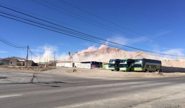
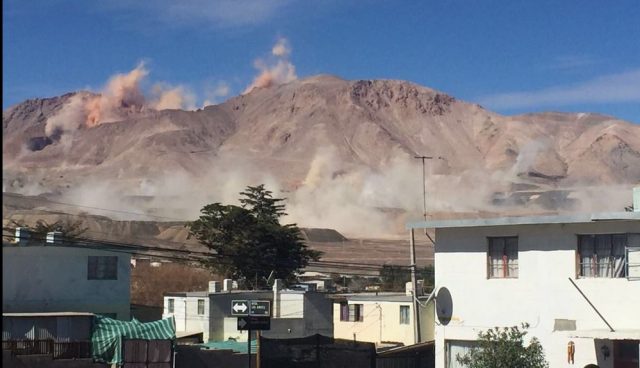
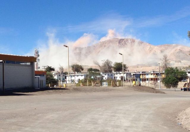
On Twitter, a series of images were posted of the impact of the earthquake in El Salvador, a mining town located in the Atacama desert about 100 km from the epicentre of the earthquake. These show large plumes of dust being generated in the mountains around the town:

Dust clouds being generated in the hills in the Atacama Desert after the M=6.1 earthquake in Chile on Monday, via Twitter
.

Dust clouds being generated in the hills in the Atacama Desert after the M=6.1 earthquake in Chile on Monday, via Twitter
.

Dust clouds being generated by landslides in the hills of the Atacama Desert after the M=6.1 earthquake in Chile on Monday, via Twitter
.
Clearly there was significant landslide activity in this earthquake, although it is likely that the slides will mostly have been small and localised. We know little about landslide activity during earthquakes in very arid conditions, so this is a technically interesting event. The images suggest that the effects might have been similar to those from the 2010 Sierra Cucapah earthquake in Baja California, Mexico, which was captured on a youtube video that I posted at the time. Working with colleagues at Durham, most notably John Barlow (who is now at the University of Sussex), we used satellite imagery to investigate at these landslides. This work was published about 18 months ago (Barlow et al. 2014), and I posted a commentary about the paper at the time. In that case we found that large numbers of comparatively small landslides were able to generate a large amount of dust.
Reference
Barlow, J., Barisin, I., Rosser, N., Petley, D., Densmore, A. and Wright, T. 2014. Seismically-induced mass movements and volumetric fluxes resulting from the 2010 Mw = 7.2 earthquake in the Sierra Cucapah, Mexico, Geomorphology, 230, 138-145, http://dx.doi.org/10.1016/j.geomorph.2014.11.012.


 Dave Petley is the Vice-Chancellor of the University of Hull in the United Kingdom. His blog provides commentary and analysis of landslide events occurring worldwide, including the landslides themselves, latest research, and conferences and meetings.