
13 March 2014
The Mount La Perouse landslide: new images
Posted by Dave Petley
The Mount La Perouse landslide: a Pleaides image
Last week Marten Geertsema flew up to the Mount La Perouse landslide in Alaska. He has very kindly made a set of images that he took from the air and on the ground available. Marten and Colin Stark also arranged the acquisition of a Pleaides high resolution satellite image. Colin has kindly generated this image of the landslide, which gives a fantastic overview of the slide:
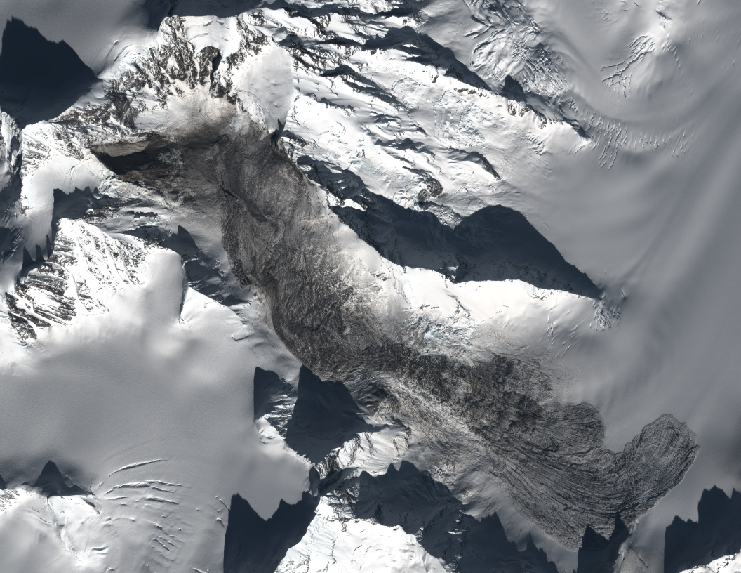
Pleaides image courtesy of Colin Stark
..
The source area of the Mount La Perouse landslide
This image shows the source area of the Mount La Perouse landslide. Note the structure in the rocks behind the failure scar. The general geological structure here is an anticline, the core of which has been eroded out by the glacier to form the valley. Thus, the basal shear surface of the landslide is the natural structure in the rocks, with the form of the anticline allowing the plane of weakness to daylight. The rear scar appears to have been defined by a sub-vertical joint. Thus, the landslide itself is a giant wedge; it is perhaps inevitable that this slope was showing some signs of distress prior to failure:
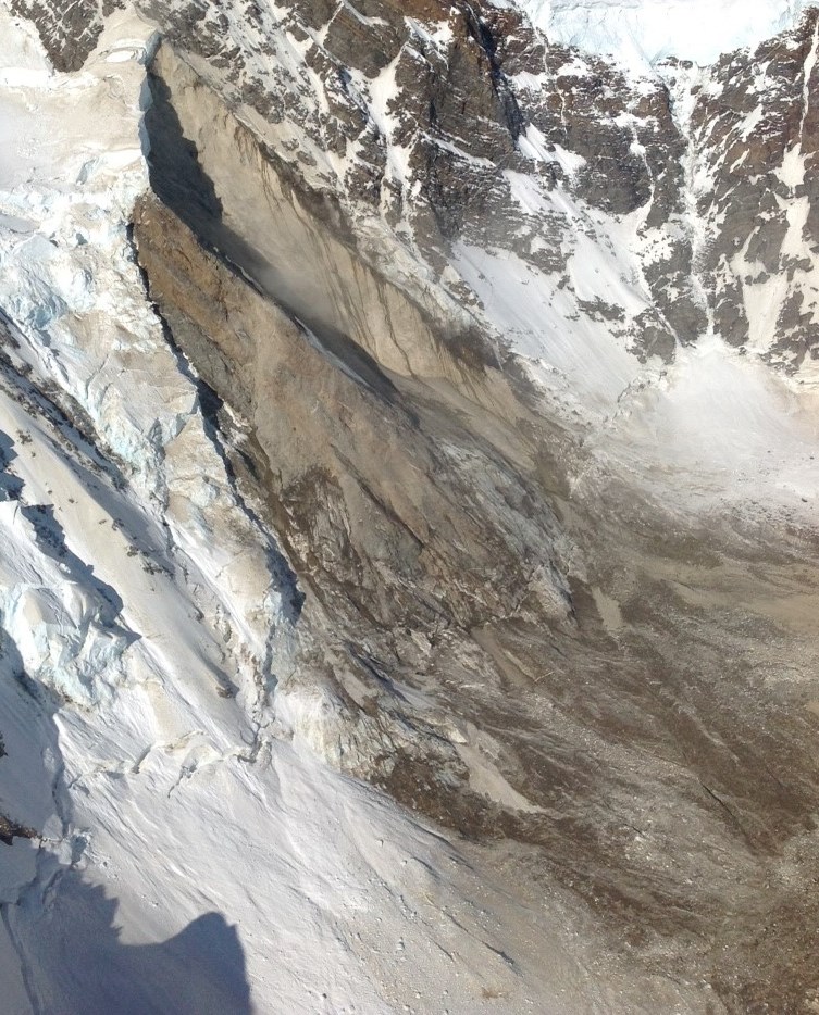
Image courtesy of Marten Geertsema
..
The material that formed the Mount La Perouse landslide
The rock material that formed the initial failure of the landslide was gabbro according to the geological maps (hat-tip to Colin for digging that information out). However, upon impact at the foot of the slope this is likely to have shattered and then to have entrained snow and ice. The resulting deposit at the foot of the slide is thus a complex mixture, which appears to consist of a matrix of dirty ice (possibly slush during the movement?) with clasts of intact ice and gabbro (note the handle of an ice axe for scale):
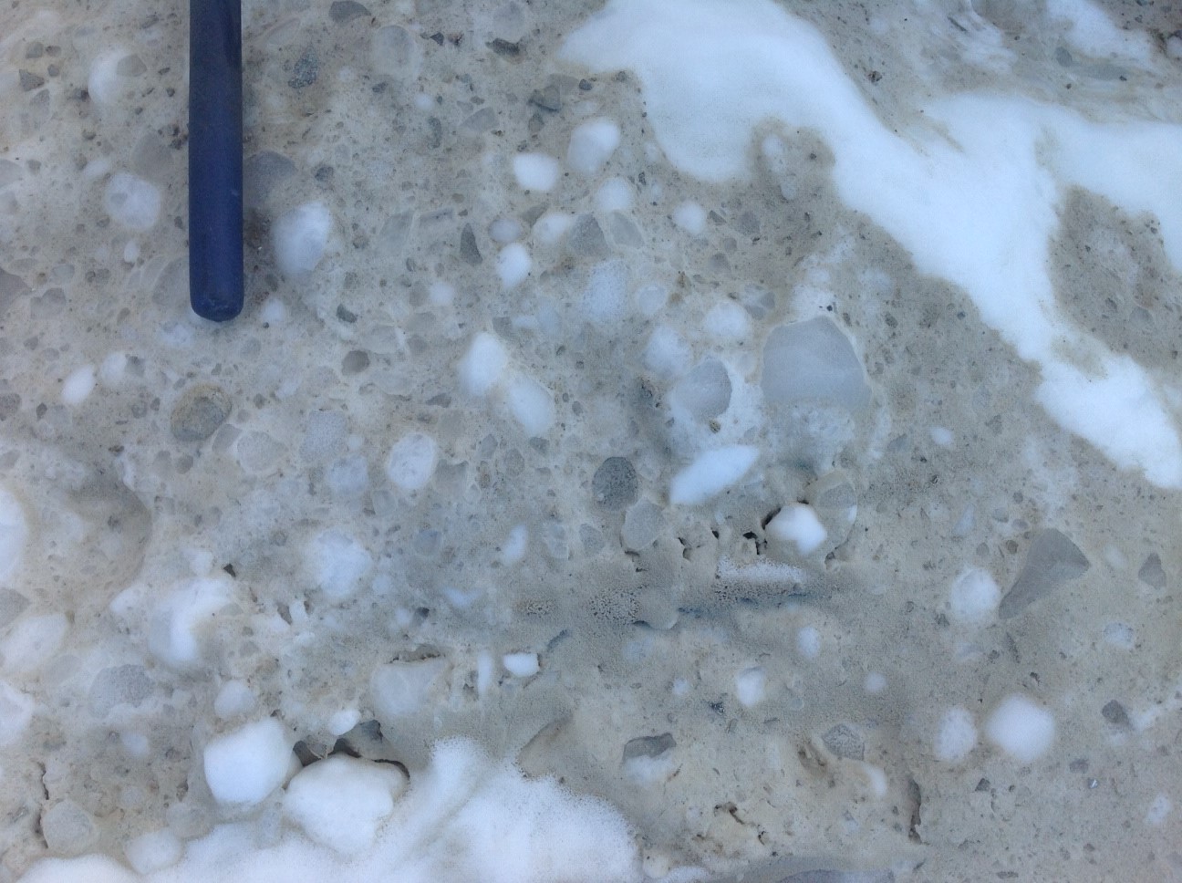
Image courtesy of Marten Geertsema
..
The Mount La Perouse landslide track
An interesting aspect of the Mount La Perouse landslide is its behaviour upon impacting the valley floor. The satellite images show considerable super-elevation – i.e. it ran up the far side of the valley before turning to flow downhill. This image shows the run up on the opposite valley side:
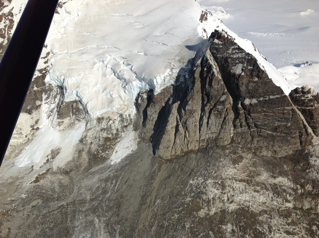
Image courtesy of Marten Geertsema
..
The slide then travelled down the valley, but with a rather complex flow pattern en route:
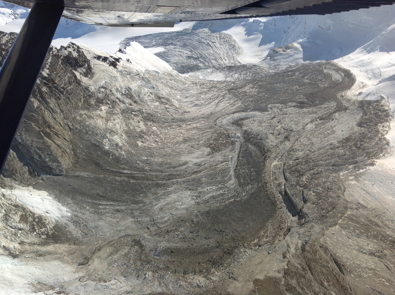
Image courtesy of Marten Geerstema
..
There is a great deal of work to do to understand this landslide properly, and it does deserve a detailed investigation. Unfortunately, snowfall is likely to mean that it will soon be difficult to work on it.
 Dave Petley is the Vice-Chancellor of the University of Hull in the United Kingdom. His blog provides commentary and analysis of landslide events occurring worldwide, including the landslides themselves, latest research, and conferences and meetings.
Any indication if slide debris made it through the saddle in the far wall? Site is always in shadow and difficult to determine. I also note that much of the far wall was also stripped of its cover as the debris slid back down into the valley.