26 February 2014
Mount La Perouse landslide: a Landsat 8 satellite image
Posted by Dave Petley
The Mount La Perouse landslide in the news
The Mount La Perouse landslide is now attracting interest from the media, which is rather cool. This has been driven at least in part by the publication yesterday of images of the landslide collected by Landsat 8 and published by NASA yesterday. The best thing about this is that we now have a before and after view of the landslide.
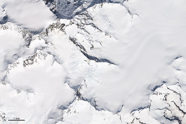
Mount La Perouse before the landslide
This is an image of the location of the landslide, collected on 27 May 2013:

Image from the NASA Earth Observatory: http://earthobservatory.nasa.gov/IOTD/view.php?id=83195&src=eoa-iotd
..
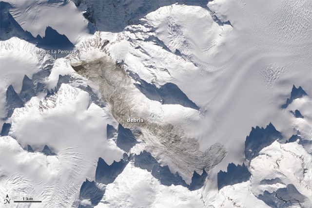
Mount La Perouse after the landslide
This is the Landsat 8 image of the landslide, collected on 23 February 2014:

Image from the NASA Earth Observatory: http://earthobservatory.nasa.gov/IOTD/view.php?id=83195&src=eoa-iotd
..
The mobility of the Mount La Perouse landslide
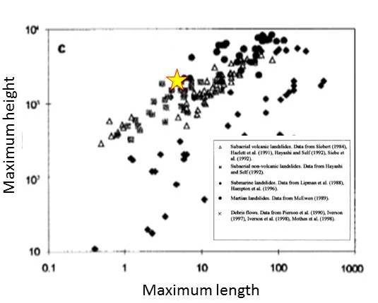
It has been suggested by some that flowing across ice and snow might be a factor in determining the mobility of very large landslides. Back in 2002 Francois Legros wrote a very nice paper in which he collated a dataset on very large landslides, and then compared their mobility (for example the maximum distance that they traveled in relation to the maximum height difference from the landslide crown to the landslide toe). I have plotted the approximate position of the Mount La Perouse landslide on his graph below (apologies for the poor quality scan!):
..
The data suggests that this landslide was at the higher end of the mobility scale on this criteria. Interestingly, the morphology of the toe of the landslide is very similar to that of the Mount Dixon rock avalanche in New Zealand. The final movement phase for that event consisted of sliding across the snow and ice base at a low rate, as the video below shows:
..
Thus, it may be that this type of movement contributes significantly to the mobility of large landslides moving across ice
Reference
..


 Dave Petley is the Vice-Chancellor of the University of Hull in the United Kingdom. His blog provides commentary and analysis of landslide events occurring worldwide, including the landslides themselves, latest research, and conferences and meetings.