20 June 2010
Attabad – a decision has been taken to blast
Posted by Dave Petley
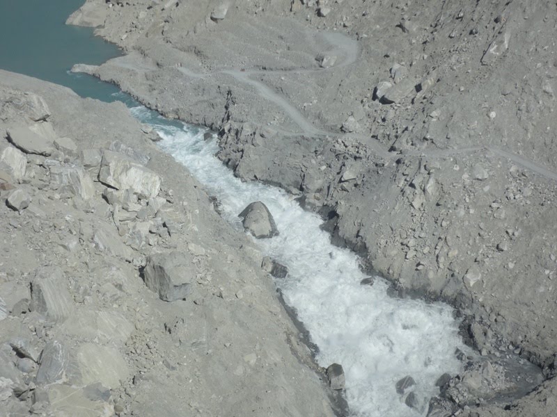
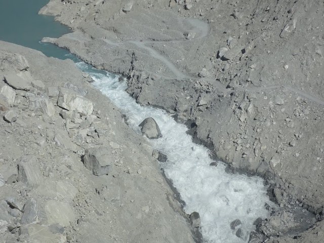
It appears that a decision has now been taken to attempt to blast the key boulders controlling the flow at Attabad, with suggestions now being made that blasts will begin tomorrow (Monday). This is a brave decision by NDMA – and I wish them luck. The context appears to be a combination of the continued exasperation of the local people about the lack or resolution of the situation, and the ongoing slow evolution of the spillway. However, it should also be noted that there has been some change in the spillway over the last couple of days, as this Focus image (taken today) shows:
The Pamir Times published an alternative view taken on 18th June from the other side of the river, showing at the key boulder:
It is clear that the water has started to erode around the restriction. By today the water had created a channel around the back of the block (image from Focus):
The importance of this boulder in controlling the flow remains very high, as this Focus overview image shows clearly:
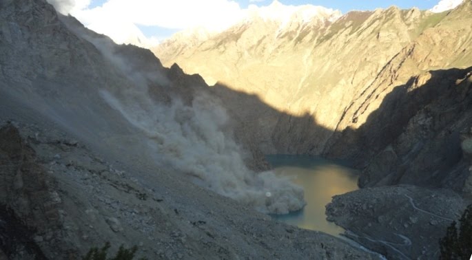
Meanwhile, the level of landslide activity immediately upstream remains high (Focus image):


 Dave Petley is the Vice-Chancellor of the University of Hull in the United Kingdom. His blog provides commentary and analysis of landslide events occurring worldwide, including the landslides themselves, latest research, and conferences and meetings.
thanks David for the information and observations on the lake situation. its good decision to blast the big stones inside the river but there could be Hundreds of more then that inside the debris. the actual outflow will start in the month of August when Hunza river will be in it peak but for now there is no sign of outburst of the lake. Best of luck for the NDMA decision to blast the boulder. they'll need more to do that.
I'm not to optimistic that this can be undertaken with any degree of safety. The controlling boulder has much debris on top of it, and to reach it people will not only have to cross water, but also very unstable ground. Then the debris will have to be cleared. And how will one dill? You can't simply lay dynamite on top of the boulder and expect results. One method may be to try and place charges under the boulder from upstream, but then you risk moving it and blocking the channel.I understand that the people who are displaced are impatient, however; the water level is certainly not going to go much higher because it cannot. My personal opinion is that patience should be observed until the high July / August flows from snow-melt can be analyzed. But then, I'm sitting half the world away in my house.
I disagree that the boulder now standing by the right bank at the bottom of the blue chute is the key boulder. I would agree if this boulder is at lake level but the current velocity at that point in one of the videos indicates that it's quite a few feet below. A water level height measurement relative to the lake would settle the argument, but I don't see any way to get that measurement from the available photos and videos. I nominate as prime suspects for key boulders the streambed slabs above and below that boulder.There is very little gradient over these slabs; in fact, the low gradient and lack of retrogressive erosion are strongly suggestive of streambed slabs.Above the "key" boulder, a streambed slab tilted slightly upstream is plainly visible as the water flows over the lip. The wave pattern immediately below it is typical. I strongly suspect another streambed slab tilted a bit downstream just upstream of the visible slab. I suspect these two slabs were a single slab that fractured in the middle approximately normal to the spillway direction when it stopped there. Here also the flow pattern above the "key" boulder is strongly typical of flow over slabs.If/when the "key" boulder is gotten out of the way — and that may be by natural forces, as photos show considerable movement and fracturing of that boulder over the last several days — increased scouring on the right bank may find a path around the slabs below and allow retrogressive erosion around them.George
Although not an expert, I got the same feeling as George: the major flow control now is upstream from this now isolated rock (although if it is removed, that might help erosion cut back up the channel).And I'm not sure that water cannons and other efforts directed at "widening" the channel above this rock (like the volunteers did the other day) will have the desired effect. The small stuff will get washed away, but where the water velocity is relatively low, larger boulders and rock might just end up filling in the channel depth, retarding flow.It seems to me that at this point, cutting down, not outward, is what you want. And so activity directed at the banks is probably a waste, except where there is a specific purpose in mind (such as providing a path for water to get around an obstruction in the channel)I have no idea how you go about blasting a boulder that is submerged in the middle of the channel.Apparently the lake rose another ft or so yesterday (just during the day time), so outflow volume is probably going to go up a lot.
The second photo shows a considerable slab boulder resting mostly on the right bank with a finger protruding into the current. The third photo shows just the finger; so, where did that major section of boulder end up? Examination of the third photo shows upstream of the finger some white water parallel to the finger and upstream of that a roughly rectangular area of flat blue water. Beneath that flat water is a portion of the slab previously leaning against the right bank that slid in front of the finger likely after a fracture.Easy to see if you know how to read water.Note also that the underwater slab lip apparent in the second photo is now harder to discern as the new slab has increased the depth of water in the vicinity and may even have changed the tilt of the slab it is now resting upon. Blasting the finger will do little to change the flow unless that allows the slab above it to slide downstream.George
Could the spillway be blasted wider? Drill down along the bank and place the charges such that the rate of erosion is increased.As far as "slab" of rock, is the "slab" one contiguous piece, or a series of smaller pieces? Given the nature of the deposit, I have always thought that the "slab" was comprised of smaller pieces interlocked together to form the "slab," but based on George's latest message, it seems he is actually referring to single pieces of rock that are largely flat.
"o Demolition Demolition experts visited the spillway site on Saturday (19 June) and formulated a comprehensive plan to carryout demolition at the site. Preparatory work for the demolition is under way. Demolition is tentatively scheduled to be carriedout tomorrow (22 June). "http://ndma.gov.pk/Documents/Hunza_Landslide_2010/One%20Pager%2021%20June.doc
I think demoltion is not a fantastic idea in the first place. It might trigger a flood wave of high magnitude. The strategies should focus on 'gradual drainage' of the lake rather than creating an abrubt and destructive burst of the dam.Also, I suspect the domoltion may not be very effective. I share Mr. Khan's view that there may be more big boulders and slabs buried in the slide matrix. The presence of big boulders within the slide is an opportunity. An expert evalutation of slide matrix may help devise such a strategy. Geophicial investigations and statistical analyses for characterizing the sizes and distribution of 'big' boulders within the slide matrix may be helpful before attempting the domolition.H.A.
I still feel that the saddle (connecting the lake with the channel)that is obstructing flow.Is it possible to blast the two sides of the channel at the mouth of the lake to widen it?
Below a link (from youtube) from China were the military is blasting against landslide deposits to widen the spillway happening in 2008.Impressive!http://www.youtube.com/results?search_query=China+quake+lake+gets+shelled+by+PLA+&aq;=fCheers Jonas
They could drill holes angled down from the safety of the roads above. Then load explosives at the desired depth beside or below the present overflow channel to widen and deepen it. Explosive engineers could design this to proceed in a controlled manner in increments.