
9 January 2010
Detailed information and amazing images of the catastrophic Attabad (Atabad or Atta Abad) landslide in Hunza, Pakistan
Posted by Dave Petley
A few days I ago I posted on reports of the Attabad landslide (which is variously described as the Atabad landslide or the Atta Abad landslide) in Hunza, Pakistan. There has been very little information about this bar various reports that it was not as bad as had been feared. However, Reliefweb has today published a report from the Pakistan Red Crescent that paints a rather different picture.
The essence of the report is as follows:
- The slide occurred in two parts, the first at 13:00 (local time) on Monday 4th January, the second two hours later. The second slide was the larger of the two;
- To date 15 fatalities have been recorded; an unknown number of people are missing;
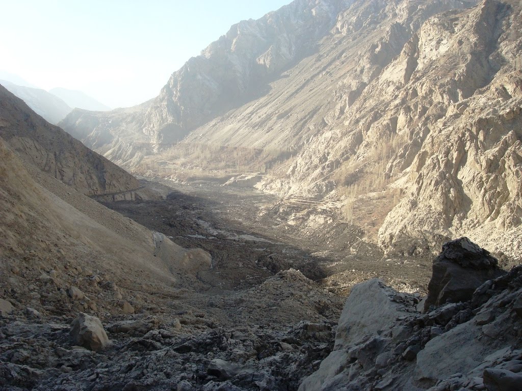
- Debris has covered a 4 km stretch of the Karakoram Highway, to a maximum height of 263 feet (80 metres) (!!!). The road is still closed;
- 1763 people have been displaced.
However, perhaps the most important part of the report states that:
“On 6th January Pakistan Red Crescent Society (PRCS) Gilgit-Baltistan branch reported that the Hunza River is still blocked and its level
had risen to 350 feet and still rising. The situation raises fears that low-lying areas across the
river would be inundated. The population of these red-zone areas is estimated to be around
20,000 people.”
350 feet = 107 metres.
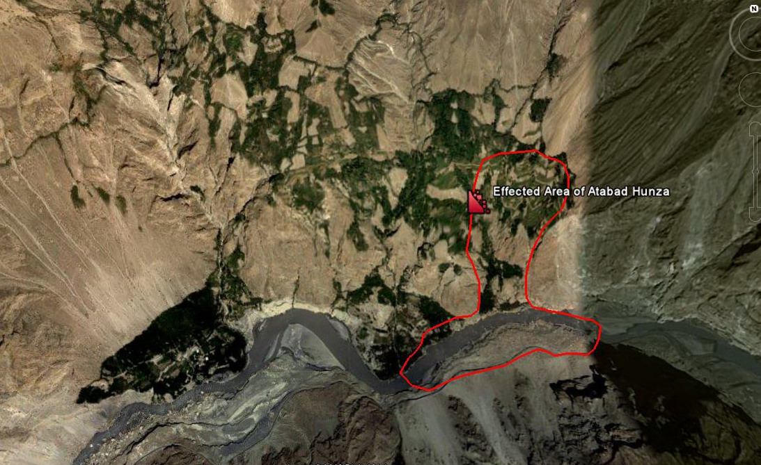
The Pamir Times has published a very high quality set of images of the landslide here. Two images are particularly useful – first, this one shows on an aerial image the area affected by the landslide:
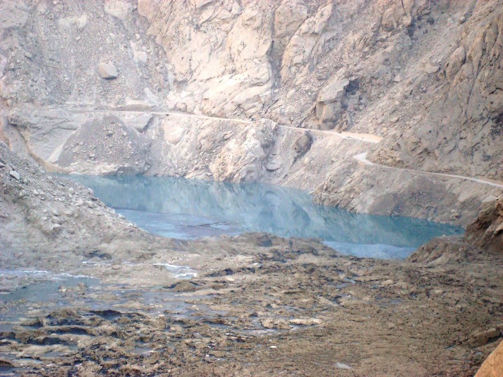
Second, this image shows the slide debris and the lake, taken I assume from the top of the landslide debris pile:
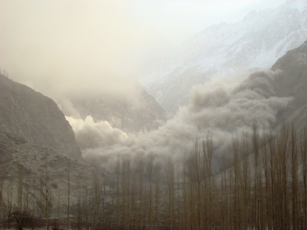
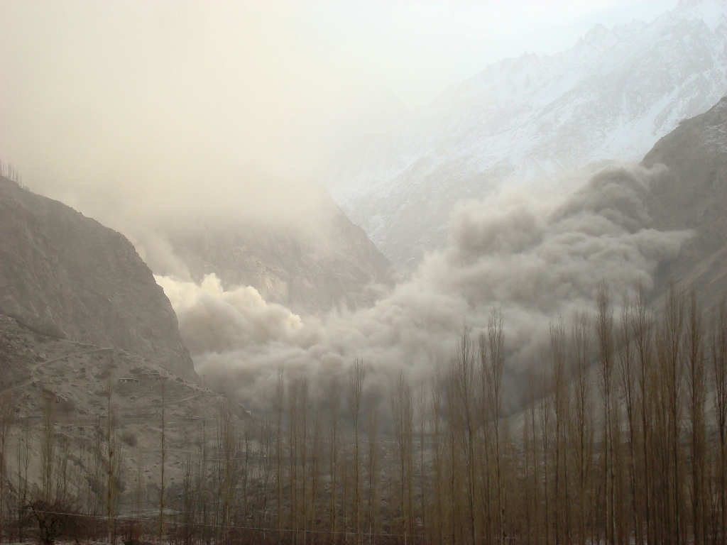
 The most extraordinary image though is this one, captioned “Huge clouds of dust arise as land sliding continued on second day of the Attabad disaster”:
 Dawn.com reports that towns up the valley from the blockage, especially Gojal, are facing real hardship due shortages of food and medicine caused by the road blockage. This is of course mid-winter in a high mountain location. They suggest that it may take a month to reopen the road. Meanwhile they also expressed concerns about the potential for failure of the dam, causing a catastrophe downstream, which judging by the images above must be a real concern.
Finally, an EEFIT report on the landslide site, dated 2003, is available online here:
http://www.istructe.org/EEFIT/files/Atabad%20Landslide.pdf
The report describes the existence of a very large tension crack, in places 1.5 metres wide, across the slope and through the village. This crack appeared in 2003.
The reports states, with an impressive level of prescience:
A sudden catastrophic failure of the size, and which not uncommon elsewhere in the Northern Areas, could have the following effects:
• Removal of fields over perhaps half the village area and also removing nearly 30% of the
farming properties.
• Destruction of the rough mountain road probably with no alternative route that could be
established at any time in the near future.
• A blockage of the Hunza River – of a temporary or permanent form. Dam breakage could
cause disastrous water wave effects down stream. The dam hypothesis should be compared
with the estimated 2Mm³ of scree soil that in 1980 formed a permanent dam across the
Ghizar River just up stream of Gupis, west of Gilgit.
• Creation of an adjacent unstable landform and which contains other houses and associated
fields.
• Knock-on effects of loss of tree stands in minor descending lateral Hunza Valley gorges.
• Destruction of buildings, farmed lands and water supply to Sarat village.
Comments and thoughts welcome. See update from 11th January 2010 here
 Dave Petley is the Vice-Chancellor of the University of Hull in the United Kingdom. His blog provides commentary and analysis of landslide events occurring worldwide, including the landslides themselves, latest research, and conferences and meetings.
Sir the great,first time i visited your blog, very interesting and infomative for me and others too,regardsAli Rehmat MusoferGeographerhttp://gulbtur.wordpress.com/