
24 November 2009
Satellite imagery of the El Salvador lahars
Posted by Dave Petley
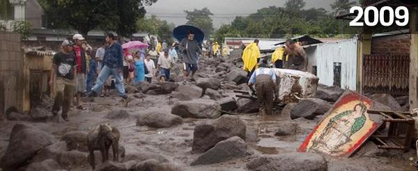
NASA has released before and after satellite images of the lahars (volcanic debris flows) triggered by Hurricane Ida in El Salvador earlier this month. The final toll of the landslides remains unclear, over 60 is the widely reported statistic.
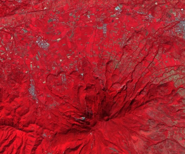
The images are false colour composites collected by the ASTER instrument. These images differentiate between vegetation, which appears as red colours, and bare ground, which appear as a blue-grey colour. Such images are ideal for delineating new landslides, which usually strip away vegetation to leave bare soil.
This is the before image of the area affected by the landslides:
 As usual, click on the image for a better view in a new window. Here is the image after the hurricanes passed through:
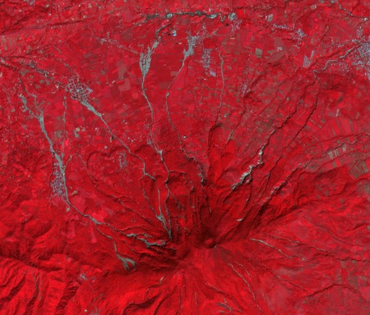
The lahar tracks are pretty clear. Note that they start high on the volcano, mostly with small, translational landslides. These slides then enter the channel, entraining (eroding and incorporating) material along the channel. The towns are quite clear on the images – the debris flows have hit the settlements in several locations, leaving this type of damage (Image from here):
When the landslides reach the plains below the volcano they spread out and stop, leaving a large area covered in debris. This is also clear on the image.
 Dave Petley is the Vice-Chancellor of the University of Hull in the United Kingdom. His blog provides commentary and analysis of landslide events occurring worldwide, including the landslides themselves, latest research, and conferences and meetings.