12 July 2012
The Mount Lituya landslide in Alaska – an update
Posted by Dave Petley
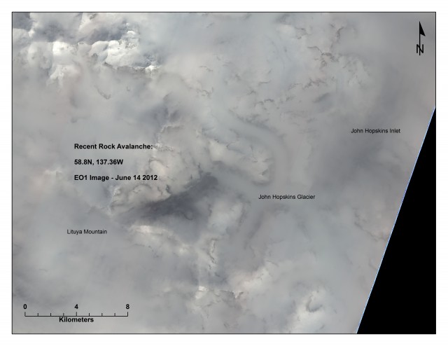
You may remember that about a month ago I posted a requested for help to identify a landslide that Colin Stark had identified from the global seismic dataset. A few days later Keith Delaney and Steve Evans from the University of Waterloo in Canada came forward having remarkably identified the landslide, which was clearly a very mobile rock avalanche, from a very cloudy NASA image collected a few days later:
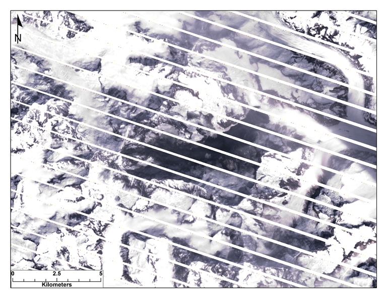
 A few days later Keith produced a better image based upon Landsat 7 data. As discussed previously, this instrument has a technical fault that produces a distorted dataset. However, the image was sufficiently good to be able to estimate that the landslide had a runout distance of about 9 km and a surface area of about 9.3 square kilometres – i.e. this is a really big landslide:
 Yesterday, National Parks Traveler in the US produced a report with images of the landslide as collected by a local pilot, Drake Olsont. The dynamics of the landslide are similar is some ways to those of the Seti River landslide in Nepal about which I posted a couple of months ago, with a large rockslope failure, a large fall height and then a long runout of the debris. The National Parks Traveler article provides an image of the landslide source:
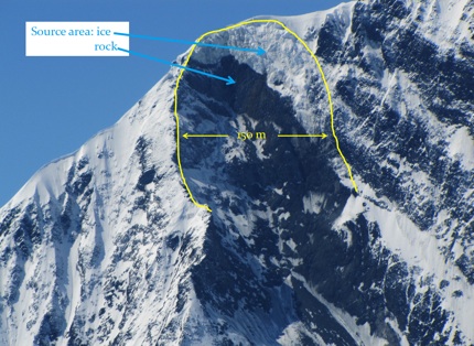 Note the scale – the scarp is 150 m wide. The total vertical extent from crown to toe is estimated to be about 2,200 metres, suggesting that the fall height was in the order of 2 km. The Drake Olson photos suggests that the landslide ran out as a highly mobile flow across the glacier surface:
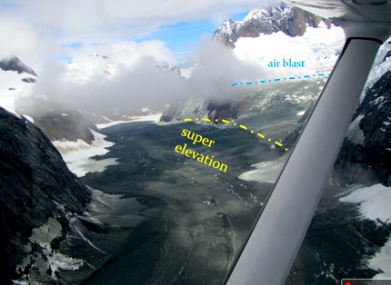 Note the area of deposited dust on the right side of the image (labelled in the article as “air blast” and the rather beautiful flow features on the landslide surface. Finally, as the satellite imagery suggested, this landslide ceased moving having run out about 9 km:
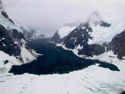 A really interesting issue now is how this will effect the dynamics of this glacier. The addition of a large volume of rock, which adds both weight and a mantle of dark material, may have some key implications for the way that the glacier moves. However, we will not know what will happen for many years, and data will be hard to obtain in such a remote location.


 Dave Petley is the Vice-Chancellor of the University of Hull in the United Kingdom. His blog provides commentary and analysis of landslide events occurring worldwide, including the landslides themselves, latest research, and conferences and meetings.
A recent AGU publication discusses the impact of three coseismic rock avalanches that covered Black Rapids glacier in the east-central Alaska Range during the 2002 Denali Fault quake.
Link:
http://www.agu.org/pubs/crossref/2012/2011JF002011.shtml