19 January 2012
The 1929 Murchison Earthquake in New Zealand
The recent earthquake sequence in Christchurch has of course heightened awareness of seismic hazard in New Zealand. One the way across South Island last weekend I stopped in the town of Murchison, after which the 1929 earthquake is named. The was a large event – the estimated magnitude is Ms=7.8, such that shaking was felt across much of New Zealand. Fortunately, at the time this central region of the South Island was very sparsely populated, so the number of casualties was limited to just 17 people.
From my perspective the interesting aspect of this is that it triggered many landslides. The distribution of these landslides is currently being analysed by a team of people from GNS Science and Durham, and in particular by my PhD student Rob Parker. These slides are interesting for a number of reasons, not least is that they were responsible for much of the loss from the event. Indeed, 14 of the 17 deaths occurred as a direct result of landslides. Furthermore, it is thought that 38 valley blocking landslides occurred, and 21 of these still retain lakes.
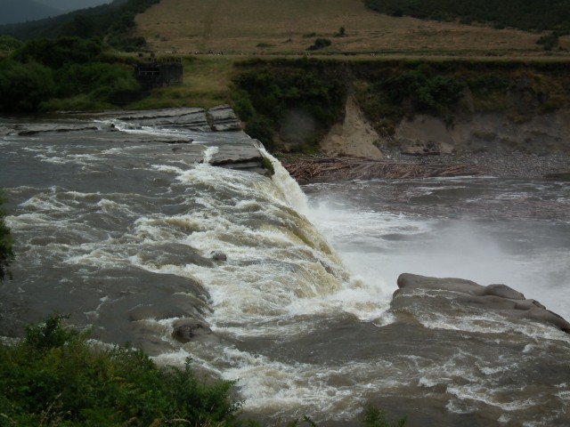
The legacy of the earthquake is still clearly evident in the landscape. Perhaps most obvious is this waterfall on the Maruia River, a tributary of the Buller River. There is a viewpoint to allow the passer-by to stop – it is a really impressive feature:
Whilst it has been widely reported that this is the fault scarp, in reality is through to be a legacy of a landslide that diverted the river across an old river channel.
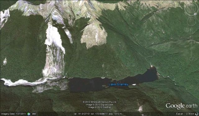
All across the area the hillsides are mantled with landforms that look like large landslides, presumably triggered by this earthquake or some previous event. These were not easy to photograph in the dreadful weather, but many are really very clear on Google Earth. This perspective view shows the landslide that created Lake Stanley. Even more than 80 years on the landslide scar and valley-blocking deposit are clearly visible:
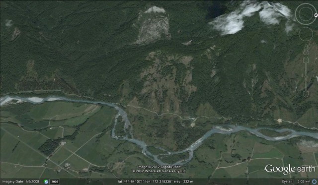
One large landslide occurred at Mātakitaki. The landslide is still very clear on the ground today (see the Google Earth image below), having clearly diverted the river away from the foot of the ridge. The characteristically uneven topography of the deposit has not been cultivated. This landslide blocked the valley, creating a lake that extended 5 km up the valley. Charles Morel, the local land owner, was killed by the landslide.
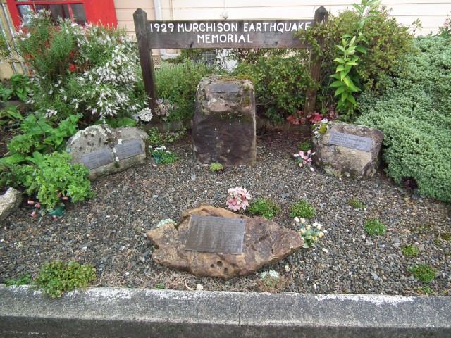
In the town of Murchison, the volunteer-led museum has an excellent collection of newspaper reports from 1929 describing the event, and some great archive photographs. There is also a small memorial to the victims of the earthquake:
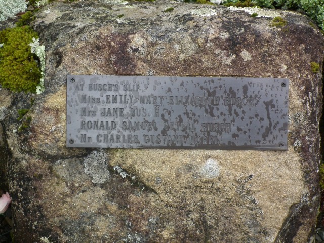
This memorial even records the landslides that were responsible for many of the deaths:
Of course the importance of this is that it highlights the role that landslides are likely to play in intensifying the impacts of a future earthquake in the mountains of New Zealand, and in hindering the response to the event. Worldwide the importance of landslides during earthquakes is under-estimated – indeed a search on the Global Earthquake Model website yields not a single hit for the word “landslide”. This would seem to be a surprising omission.
Landslides in the British Newspaper Archive
An interesting ongoing project is the creation of the British Newspaper Archive, which seeks to digitise the British Library’s back catalogue of newspapers over the next decade. This will provide searchable access to 40 million pages of historic news. The newspapers date from 1800.
The team is only part way through the project, but the scanned material to date (and it should be added that they are scanning up to 8000 pages per day) is now available as a searchable archive. There is a great deal of material there.
In terms of landslides this starts to create the opportunity to generate a dataset of past landslide events, a project that would be deeply fascinating (is anyone interested in working with me on this?). For example, a simple search for “landslide AND killed” brings up this on just the first page:
12th Feb 1929: Many Persons Killed by Landslide Lisbon. Torrential rains have caused a landslide near the village of Miraodella. Two houses have been destroyed and persons killed.
29 Dec 1930: MANY KILLED BY LANDSLIDE. ALGIERS, Sunday. Many persons are believed have been killed in a landslide which buried two native houses here yesterday evening. The dwellings were situated in Mustapha Hill.
8 Aug 1930: Sixteen natives, fifteen whom were women, were killed in consequence of a landslide while they were working a clay at Melilla, Morocco
3 Nov 1917: Working at Plaxtol Kent, a 16-year-old lad named llerliert Maynard, was killed by a 70- ton landslide of sandy soil
07 Mar 1929: LANDSLIDE MADEIRA. FIVE KILLED, AND HOUSES OVERWHELMED. A message from Funchal, Madeira, received Lisbon last night, states that a disastrous landslip, due to tho recent rainstorms, has occurred in the St. Vincent Valley. Many houses are buried.
30 Dec 1899: TREMENDOUS LANDSLIDE. ENGLISH VISITORS KILLED. Rome, December 22.—This afternoon there was a tremendous landslip at Amalfi, in the Gulf of Salerno. Part of a mountain crashed downwards towards the sea, burying the Hotel Cappuccini Convento.
06 Mar 1899: LANDSLIDE ON RAILWAY. THREE TRAINS WRECKED. New York, Monday Morning. News has reached here from low a of an extraordinary railway accident which occurred in that State yesterday near Altoona, Polk County.
03 Sep 1927: A motor car containing five persons was swept away by a landslide on the shore of Lake Geneva on Sunday. All the occupants were killed.
15 Nov 1930: It is feared that sixty people lost their lives in ‘the collapse of houses owing to a landslide at Lyons. Twenty-five would-be rescuers were killed.
11 Mar 1933: ENGINE OVERWHELMED BY LANDSLIDE. DRIVER AND STOKER KILLED. An engine driver and his stoker were killed on Saturday when their engine fell a hundred feet down a cliffside between Barmouth and Llwyngwril.
26 Sep 1924: LANDSLIDE DEATH ROLL. Locarno, Thursday.—The number of dead as a result of the landslide yesterday evening is lower than was at first supposed. Nine persons have been killed and five injured.
And there are many, many more besides. With a reasonably inexpensive subscription it is possible to then look at the original article, meaning that a great deal of material could be obtained, and of course correcting the OCR errors. Of course it would also be interesting to see how the reporting of these events has changed too, and at the understanding causes.
17 January 2012
Two interesting landslide posts on other sites
These two really interesting landslide stories have recently come to my attention. They are both worth a look:
1.The Nardi Road/Goulais River landslide
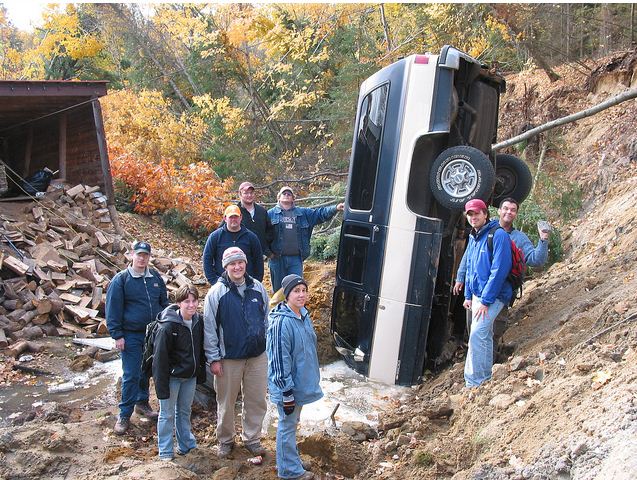
Ron Schott has a wonderful post on his blog about the Nardi Road/Goulais River landslide, which occurred on 13th October 2003 in Ontario. The post provides maps, photos and a detailed description, and all of the images (some of which, such as the one below, are remarkable) are available on Flickr:
2. Recording a huge submarine landslide
The Our Amazing Planet site has a write-up of a paper recently published in Geology in which a sea floor hydrophone recorded a submarine landslide, with an estimated volume of over 50 million cubic metres, on the seafloor to the north of Guam. This paper deserves a more detailed review, and is now on my list!
15 January 2012
Landslides and logging – an pictorial example from New Zealand
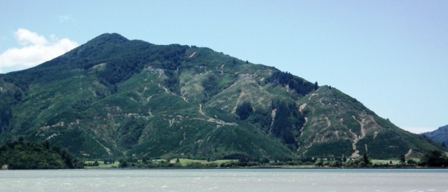
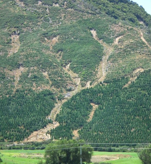
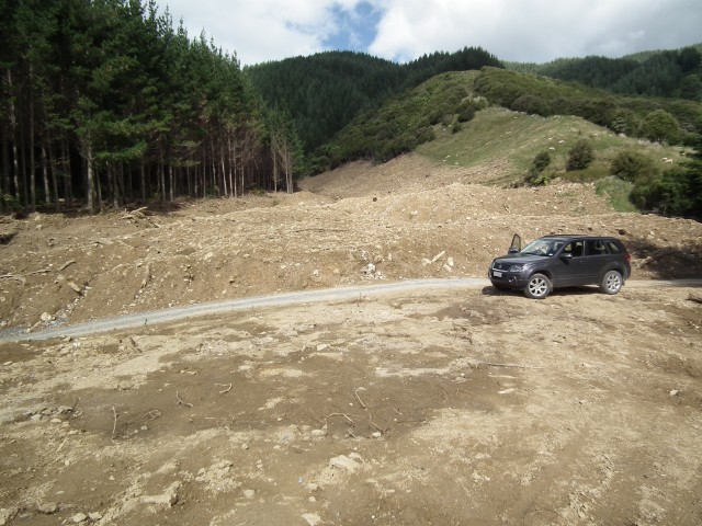
As I was driving across from Nelson to Picton in New Zealand yesterday (in quite glorious weather), I came across this recently logged and replanted slope:
This is a nice example of the way that logging causes a short-term landslide problem. It should be clear from the picture above that the logged areas have suffered significant shallow landsliding, whilst the upper, still forested, slopes are much more stable. In a couple of places the landslides are quite interesting. The largest appears to be this complex on the lower right side:
This complex is actually several (I think about ten) very small slips that have each entrained material and then entered the drainage line. As a result the amount of debris at the toe of the slope is quite large. This illustrates two major problems with deforestation. First, when trees are present these small slips are much less likely (the strength accorded by roots is enough to prevent themfrom starting, for example). Second, trees prevent small slips from entraining debris from the slopes below, and from entering the drainage line.
It is also interesting to note that several of the other small landslides in this picture started just above the tracks, where the slopes have been cut to create the road bench. This is very common, and indeed was a key factor in the devastating Sarno landslides in Italy in 1998, which killed about 150 people.
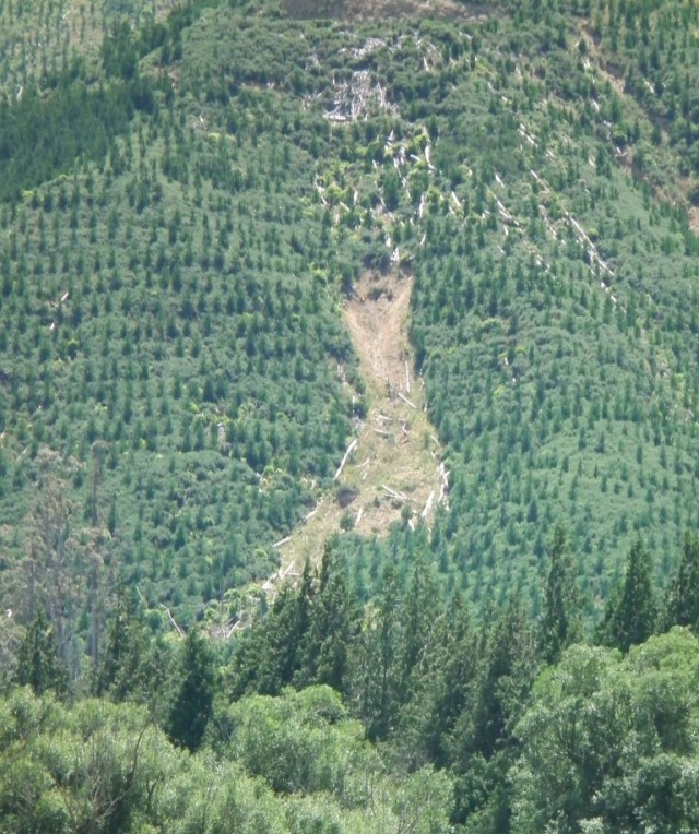
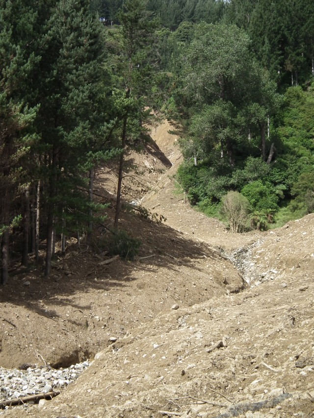
Another interesting landslide is on the left side of the slope:
This slip appears to have initiated at the bottom of a natural topographic hollow. Imagine what happens in heavy rainfall with the original trees missing – the water flowing across the surface and through the soil will be focused into this area, allowing a small landslide to start. Again a comparatively small slide has then turned into quite a large event as it has entrained material downslope. This also illustrates the difficulty of restabilising a slope that has started to slip. Planting trees is often touted as the simple solution, but stabilising the soil long enough for trees to take root and start to strengthen the soil can be a real problem. Nature gets around this problem through a vegetation succession (the slip above has started to be colonised by small plants and shrubs), but this can be a slow process. Humans often want or need to act much more quickly.
14 January 2012
A photo album of landslide damage at Golden Bay, Nelson, New Zealand
I have spent the last week collecting samples from the rock slopes affected by the Christchurch earthquake sequence, and am now travelling back up to Wellington, were I will spend the coming week. En route I have stopped off for the weekend in Nelson so as to be able to take a look at the landslides at Golden Bay. These landslides were triggered in an exceptional rainstorm in mid December – I covered it briefly at the time – and have been quite devastating for the local people.
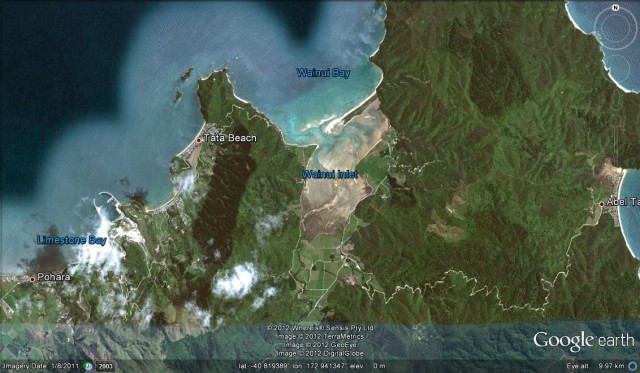
In Golden Bay the most seriously affected area that I saw was the margin of the Abel-Tasman National Park, as shown in the Google Earth image below, especially between Pohara and Tata Beach, although there is almost certainly further problems to the east that I could not access. The road shown on the map across the area was closed at Tata Beach.
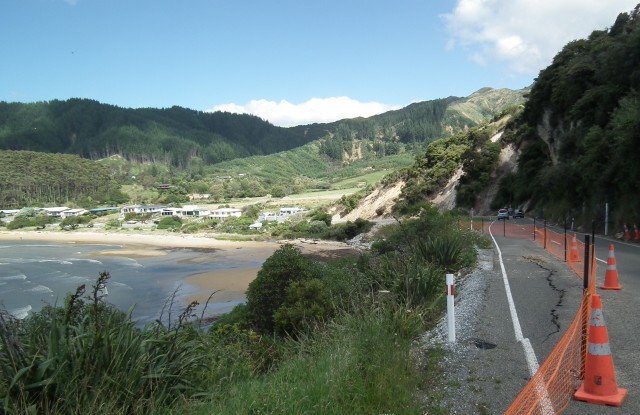
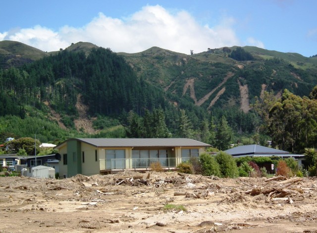
A good overview of the main impacts of this storm is shown below – this is the small community of Ligar Bay, which has been an area of beachside houses, with new subdivisions on the slopes behind. If you look carefully you will see:
- Slips below the road affecting the carriageway;
- Slips on the slopes above the road, which deposited debris that blocked the highway;
- Multiple slips in the slopes behind the village; and
- Debris released from those landslides that has then damaged the houses.
The landslides themselves are quite interesting – and are not just simple shallow, translational failures. This is one of the areas of slips in the hills behind the village:
There are multiple anastomosing slips in regolith materials, but some are several metres or more deep. These then appear to have entrained material downslope to form debris flows that have damaged the communities below. Note also the amount of wood in the debris. As an aside, the slips above are in an area that was for sale for residential development:
“Location, location, location” indeed!
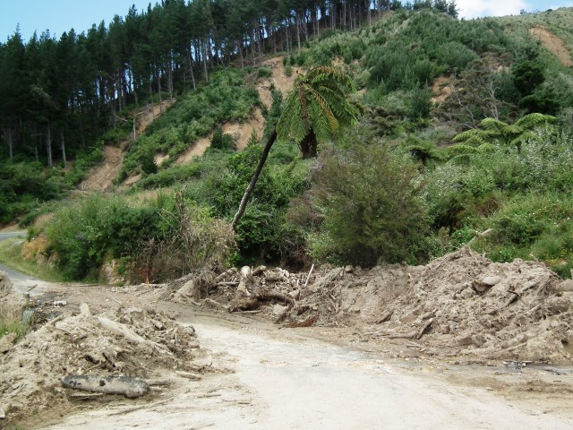
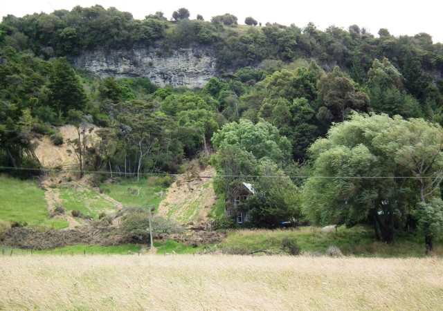
In some places the landslides have directly affected properties; in others it came perilously close, as in this case:
As described above, the debris from the landslides travelled downhill, following but often overtopping the channels. The houses lower on the slope are quite vulnerable:
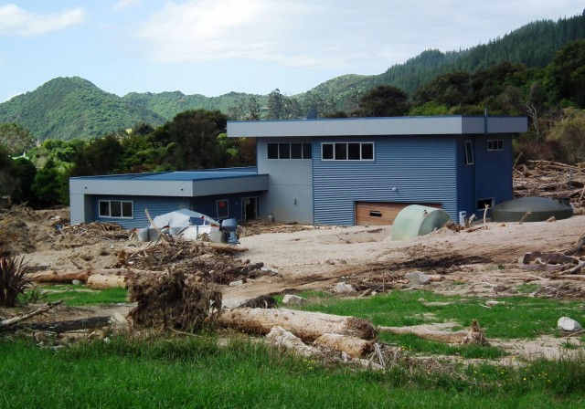
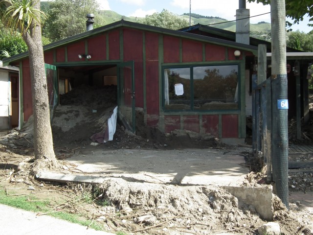
In some places across the affected area the houses were too close to the drainage lines, and were thus in the path of the flows as they travelled downslope. It must have been truly terrifying to have been in one of the houses affected in this way:
Note the depth to which the garage has been buried, and the way that the debris has forced its way in through the front door. Note also the amount of timber, and that the wood is stripped and shattered, which indicates fast, turbulent flow. This house clearly had debris flows straight through the living room:
This is shown after the flood in the video here.
There is one intriguing, very large landslide. This is at Bird Road in Clifton. I managed to get some of the way up the landslide, but not to the source area. The landslide appears to have travelled down a very steep section of channel, entraining debris en route:
Further down the slope it had become a very energetic debris flow. Note on the right side the way that the debris has travelled up the side slope as it came around the bend. This is known as super-elevation, and is an indication of high speed flow.
This landslide is also shown in three Youtube videos by Mike Howe. This is the first of them:
He also has a video of the flow in a small ravine during this rainstorm:
11 January 2012
A wonderful iceberg arch collapse video
Thanks to the Zetica twitter feed for the heads up on this one.
This video shows the collapse of an iceberg arch in Antarctica. It is beautifully filmed as well as being technically very interesting:
Particularly interesting here is the increasing event rate for material dropping from the arch before collapse (we see the same thing for rockfalls) and the way that the pillars performed after the arch collapsed. Note also the development of the waves as the iceberg collapses and fragments.
9 January 2012
So what would you do…
…if you were standing on a beach buying ice creams for your kids. Suddenly an earthquake occurs, and across the bay clouds of dust are thrown up by rockfalls. Behind you is a set of cliffs that have collapsed in previous (very recent) earthquakes, such that the road is now being protected only by a double height of shipping containers?
The answer is here:
http://www.youtube.com/watch?v=Awz8ALUqeqc
Thanks to Jill for highlighting this video.
7 January 2012
An update on recent landslides
I am slowly catching up on the backlog after the festive break, so here is a round-up of interesting landslides that have occurred over the last fortnight or so.
1. The Pantukan landslide in the Philippines
It now appears that the losses associated with this event may not be as great as initially feared. According to the latest NDRRMC report, 25 people have been killed and a further five are known to be missing. However, this total is not quite in agreement with more recent media reports, which suggest 27 fatalities to date. This should be clearer as the day wears on. Interestingly, several reports indicate that there was a gap between the most intense rainfall and the occurrence of the landslide. For example:
“Renato Solidum, head of the Philippine Institute of Volcanology and Seismology (Phivolcs), said the area struck by the landslide had been battered by “bulldozing and other activities.”…The landslide struck on a clear day which was deceptive, he said. People should be taught that landslides could happen even days after the rains had stopped, he added. “If the weather is clear, they should not assume that there’s no danger,” said Solidum in a phone interview.In the case of Pantukan, he said, “there was a lag time between rain and landslide.”
This is a very important point. In the case of a progressive slide such as this, a time gap is to be expected, but this is indeed rarely appreciated. Meanwhile, the authorities now plan to shut down the illegal mines and to relocate up to 20,000 people from the most hazardous areas. Implementing such an aspiration is likely to be very difficult though.
2. Another remarkable quick clay landslide in Norway
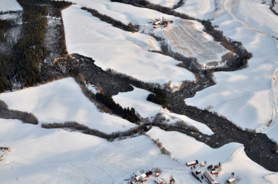
Thanks to several people for pointing out this landslide to me. On the first day of the year a landslide occurred at Byneset in Trøndelag near to Trondheim. This report includes some good images of the landslide, although it does take a little time to get one’s eye into what has happened:
http://www.monstersandcritics.com/news/europe/features/article_1683598.php/Norway-Landslide-Pictures?page=1

http://www.monstersandcritics.com/news/europe/features/article_1683598.php/Norway-Landslide-Pictures?page=2
Although not of the best quality, this Youtube video provides a good overview of the nature of the landslide:
http://www.youtube.com/watch?v=OEAhSNj1DUA
Although the trigger for this landslide appears to be a spell of heavy rainfall, the underlying cause is not clear. Fortunately it caused no damage or injuries. The way in which the debris has flowed down the valley system illustrates the extreme mobility of quick slay landslides, as the Rissa landslide video illustrates.
3. A fatal rockfall in Germany
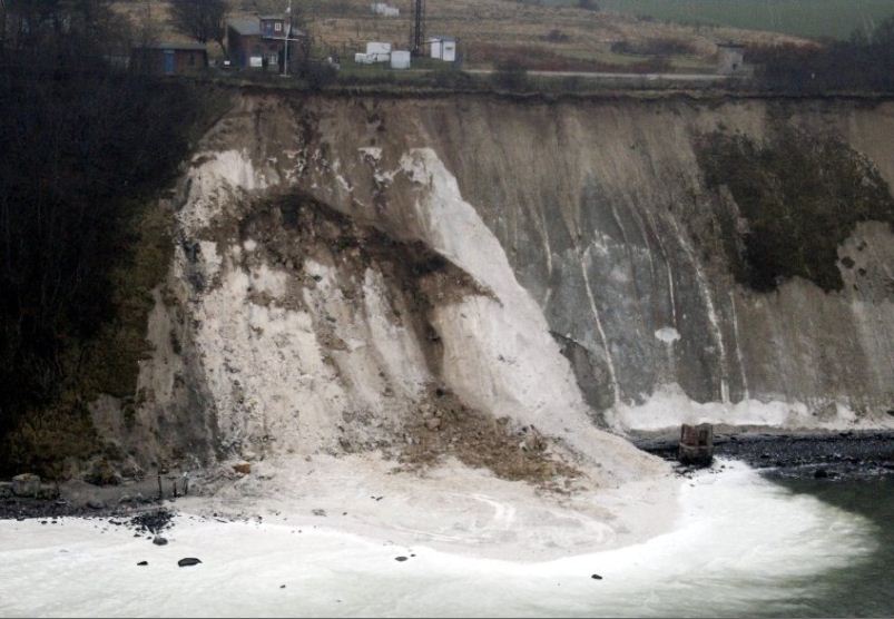
Again, thanks to several people for pointing this one out. On 27th December 2011 a 10-year old girl was killed on the island of Ruegen in northern Germany when a cliff collapsed onto her. There is a gallery of images online here, which includes the rescue operations and some panaromic views of the collapse:
4. Landslide at Stromeferry in Scotland
Meanwhile, on a much smaller scale, two landslides at Stromeferry in the Scottish Highlands has blocked a major road, the A890, since 22nd December. This is resulting in a very long diversion and quite serious disruption for this part of Wester Ross.
5. Potential landslides in Brazil
Finally, the continuation of the La Nina conditions is once again causing concern about the potential for serious landslides in Brazil, which a year ago caused such remarkably high losses. Reports suggest that a landslide this week killed two people in Ouro Pretodue, and there is widespread flooding.
5 January 2012
Major landslide in the Philippines – at least 25 killed, many more reported missing
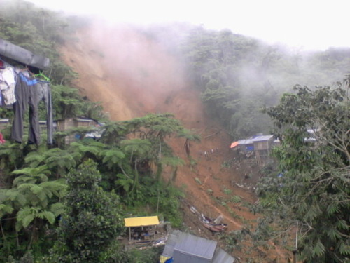
The first major landslide of 2012 has occurred just five days into the New Year. Early this morning a landslide occurred at the gold mining community of Napnapan village, which is in the area of Pantukan township in the Campostela Valley on the island of Mindanao in the Philippines. The landslide, which is reported to have happened during heavy rainfall at about 3 am struck at least 50 dwellings. To date 25 bodies have been recovered, with up to 100 more people reported missing.
The Campostela Valley is undoubtedly a global hotspot for devastating landslides. This is due to a combination of steep terrain, very heavy rainfall, poor communities and unregulated gold mining. Indeed, the community that has been destroyed is a mining village, although at this stage it is unclear as to whether this was a factor.
News about this disaster remains sketchy, primarily because the site is very remote. The National Disaster Risk Reduction and Management Council are posting bulletins. At the time of writing, Bulletin No 2 confirms that 25 people are known to have died, 16 people have been injured, eight people are known to be missing, and up to 150 in total may be buried.
The best overview image of this landslide that I have been able to track down to date is this one, from Newsday:
This does seem to concur with the suggestion in the newspaper articles that the landslide has struck the centre of this small community. Given the steepness of the terrain the movement rate was probably very fast. The location of buildings close to both the crown of the landslide source, and to its lateral margins, does suggest that there may have been some human activity in this area. Given the steepness of the terrain and the lack of obvious agricultural activity, mining must be a strong possibility. Some newspaper reports suggest that cracks had been previously identified on this hillslope.
Meanwhile ABS-CBN have this image of the source area:
4 January 2012
Professor John Hutchinson
Yesterday, the Daily Telegraph published a notice that John Hutchinson, Emeritus Professor of Soil Mechanics at Imperial College, died peacefully on 21st December 2011. I am sure that, like me, others working on landslides around the world will be greatly saddened by this news.
John was born in 1926 and grew up in the city of Coventry before reading Civil Engineering at the University of Birmingham. Upon graduating in 1947 he started his career working in engineering consultancy, initially for R. M. Douglas and then later for Rendel, Palmer and Tritton. In 1957 he left the UK to work first for the Swedish Geotechnical Institute, and the subsequently for the better-known equivalent in Norway. In 1961, John moved back to England to join the Building Research Station whilst studying for a PhD at the University of Cambridge under the supervision of Dr Bill Ward. He was awarded his doctorate in 1965, and then joined the famous Soil Mechanics Section at Imperial College,working in probably the most dynamic and influential soil mechanics research group of all time. He was promoted to a Readership in Soil Mechanics in 1970 and was made Professor of Engineering Geomorphology in 1977. In 1987 the University of London awarded him a DSc (Eng).
John will be remembered for many things. His academic contributions are many and varied, but focus mainly on the importance of understanding geomorphology, and earth surface processes, in civil engineering, with a strong emphasis on slope processes. As such he was the pioneer of a discipline that has greatly gathered traction and momentum in recent years, and he continued to participate in research and in academic discussions to the very end. His work on Quaternary history, and in particular of periglacial processes, in contemporary ground conditions, will leave an enduring legacy. In the landslide field he will perhaps be best remembered for his work on undrained loading, but this in just one of many contributions.
In 2000 his lifetime’s work was drawn together when he presented the fourth Glossop Lecture, which he titled “Reading the Ground: Morphology and Geology in Site Appraisal“. In the vote of thanks, Professor Eddie Bromhead noted that
“Many friends, colleagues and associates who have seen the lecture in gestation will be aware of the effort which has gone into it, but tonight’s audience have only seen the polished end result. It has been a tour de force.. .As one who has worked with John at various levels over 30 years, I knew what the Fourth Glossop Lecture would be like: a scholarly exposition of the subject, painstakingly researched, beautifully illustrated, and fluently delivered. I knew we would be informed and entertained at the same time.”
John has been a huge influence to many of us who have worked in landslides and in geomorphology, and he will be greatly missed. His breadth of knowledge, intellectual prowess and exquisite sense of insight were a remarkable combination, wrapped up in a personality showed both warm and humility. His remarkable attention to detail and insight was often most evident in the reviews of papers submitted for publication. Many authors have John to thank for improvements that had a profound impact on the quality of the resulting science. And very often in those comments John would politely note that a few years before he had observed a similar phenomenon or result, with a reference to the paper in which it was described. Our discipline is so much richer for his many contributions. In the words of Eddie Bromhead’s vote of thanks:
“John Hutchinson is a known throughout the world as a first-rate original thinker, a meticulous scholar and a prolific writer.”
John’s funeral will take place on 10th January 2012 at 1:15 pm in South London at St Mary the Virgin, Merton Park, SW19 3HJ, and will be followed by a private cremation ceremony. All enquiries to Cooperative Funeralcare on 0208 947 6228. He was predeceased by his wife Patricia (d. May 2009), and was father to Kristin, Julia and Thomas.
Please feel free to leave comments and tributes to John below.





 Dave Petley is the Vice-Chancellor of the University of Hull in the United Kingdom. His blog provides commentary and analysis of landslide events occurring worldwide, including the landslides themselves, latest research, and conferences and meetings.
Recent Comments