14 February 2022
Two new large landslides in the Southern Alps of New Zealand
Posted by Dave Petley
Two new large landslides in the Southern Alps of New Zealand
In recent weeks the Southern Alps of New Zealand have suffered substantial rainfall events, including 1,177 mm of precipitation in three days at Tuke Hut in Westland. In consequence two large landslides have occurred. Loyal reader and friend Simon Cox at GNS Science has kindly provided details, with additional information having been posted at the excellent Matariki Project website, which is jointly managed by Simon, Pascal Sirguey and Aubrey Miller, both of the University of Otago School of Surveying.
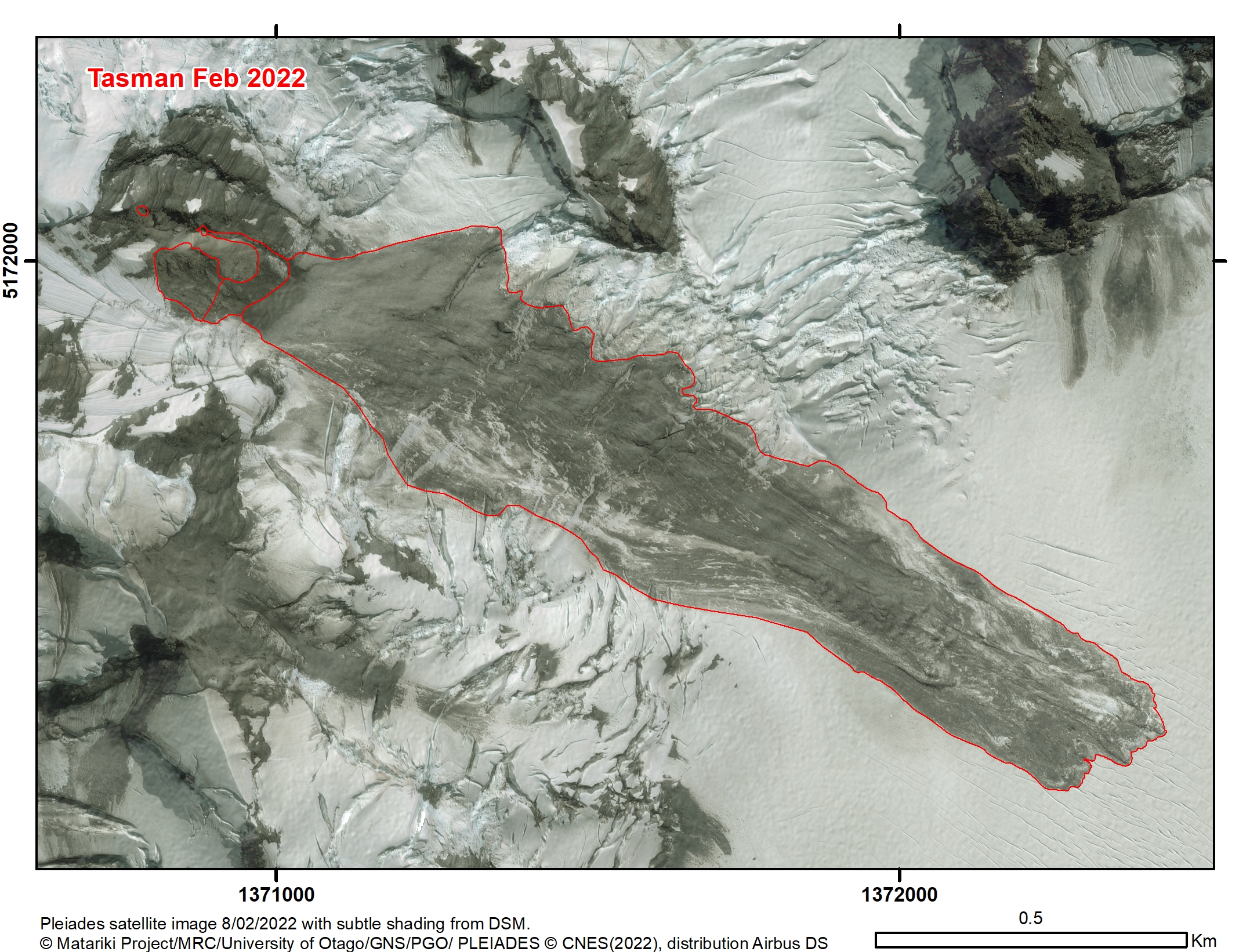
One of these events occurred on east face of Mount Tasman, which is the second highest peak in New Zealand. DOC Aoraki Mountain Rescue posted a helicopter video of the landslide to Facebook – it’s pretty good – giving a decent oversight of the event. The image below, generated by the Matariki Project team, shows the landslide:-

The February 2022 landslide on Mount Tasman in New Zealand. Image copyright of the Matariki Project, used with permission. Satellite image by PLEIADES, distribution Airbus DS.
.
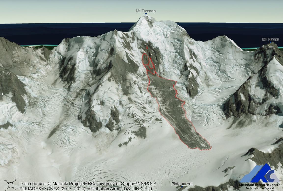
This landslide has a rock volume of about 169,000 cubic metres, with a runout distance of 1,800 m and a fall height of 750 m.
The image below provide a rather beautiful 3D view of the landslide:

3D view of the February 2022 landslide on Mount Tasman in New Zealand. Image copyright of the Matariki Project, used with permission. Satellite image by PLEIADES, distribution Airbus DS.
.
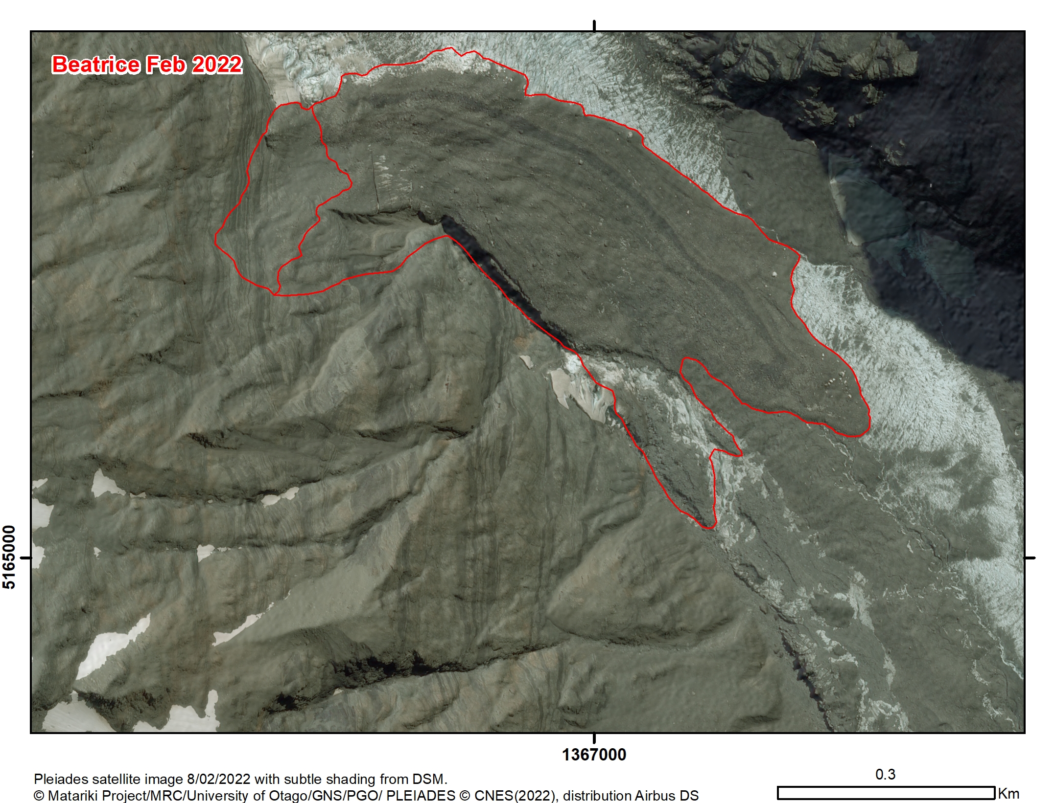
The other event occurred at Beatrice in the Hooker Valley. The Matiriki Project team had identified the source as a creeping landslide, which duly collapsed. This might be interesting to look at using InSAR. This is a rather larger failure – the estimated volume is 704,000 cubic metres, with a runout distance of 1,020 m and a vertical height change of 435 m. The image below shows the landslide:-

The February 2022 landslide at Beatrice in the Hooker Valley in New Zealand. Image copyright of the Matariki Project, used with permission. Satellite image by PLEIADES, distribution Airbus DS.
.
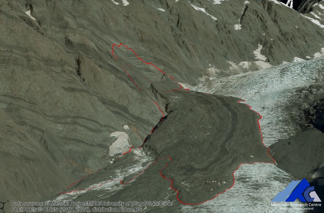
Again, this is quite spectacular when viewed in 3d:-
.

3D view of the February 2022 landslide at Beatrice in the Hooker Valley in New Zealand. Image copyright of the Matariki Project, used with permission. Satellite image by PLEIADES, distribution Airbus DS.
.
Interestingly, Simon points out that:
It looks to have dammed side streams and emergent subglacial water, which breached and eroded the deposit and remobilised material to form a braided supraglacial outwash fan stretching around 1 kilometre further down valley.
This is visible in the image above.
On the Matariki Project website there are some sliders that allow comparison of imagery before and after these landslides. It is well worth a look. Unfortunately WordPress doesn’t allow me to use them here.


 Dave Petley is the Vice-Chancellor of the University of Hull in the United Kingdom. His blog provides commentary and analysis of landslide events occurring worldwide, including the landslides themselves, latest research, and conferences and meetings.