12 September 2009
Coastal erosion – the last groyne problem
Posted by Dave Petley
One of the most emotive topics for local authorities in the UK is that of coastal erosion. Over the last few years in Britain we have increasingly taken a view that coasts should only be defended where absolutely necessary – elsewhere erosion should be allowed to occur at a “natural” rate. In most cases the view has been taken that protection of coasts in which erosion will affect domestic properties (i.e. peoples’ houses) does not qualify as necessary. This is particularly harsh for those whose properties are affected by erosion – in the UK domestic insurance does not cover erosion and there is currently no compensation scheme for people whose houses are affected by erosion. Even worse, when the house becomes dangerous the local authority will often take possession of the hose and demolish it. Guess who gets the bill for the demolition…
One of the key reasons for choosing not to protect coasts is the so-called “last groyne” problem. This occurs at the point of the last (down drift) part of the coast that is protected. Here, the coastal protection updrift typically starves the coast of sediment that would normally provide some protection against erosion, leading to greatly increased erosion rates at this point. I was playing with the historic imagery feature on Google Earth this week and came across a very clear example of this problem, from the east coast of Britain.
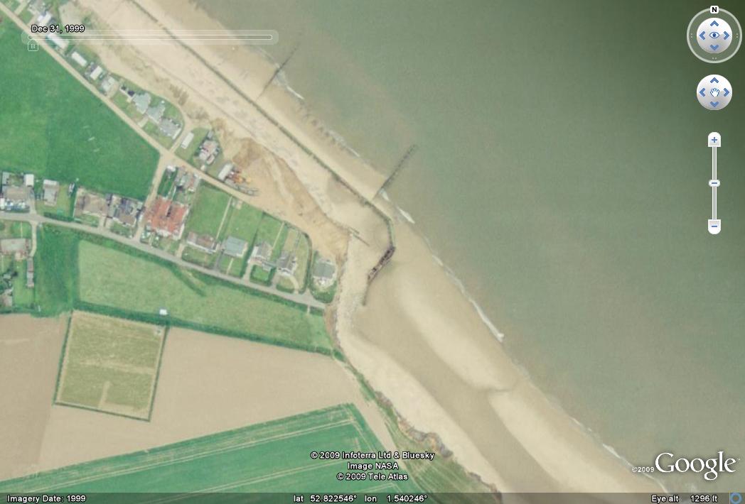
Here is an image collected in 1999 of the site in question. As ever, click on the image for a better view in a new window:

Here, longshore drift is from the northwest to the southeast, such that the groyne (sea defence) in the centre of the image is the last of the chain. Most of these sea defences have been in place for half a century. What should be immediately obvious is the way that the coast steps back at the point of the last groyne, indicating the much higher erosion rate at this point.
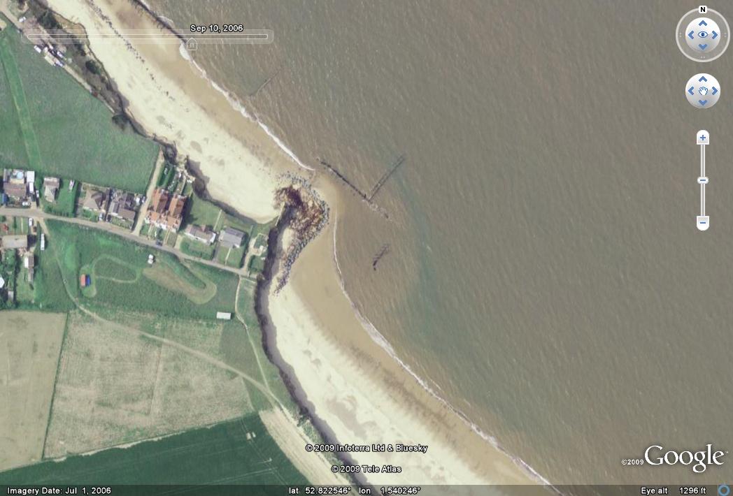
Let’s now zoom forward just seven years to an image that was taken in 2006:
 The change in this period is quite startling when you look closely. First, you will see that the area previously affected by enhanced erosion has retreated further. The sea defence has broken down and three houses have been lost. It appears that some rock armour has been dumped at this point to try to reduce erosion. The sea has also breached and destroyed the coastal defence just to the NW of this point, and as a result the coast has started to erode. In consequence a whole series of properties have been lost along this frontage.
The town in question is called Happisburgh. The residents have a campaign to try to have sea defences constructed, with an excellent website.
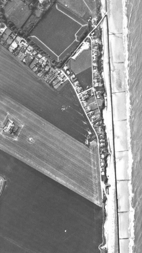
Perhaps most startling is this image, from a sequence of aerial photographs, which shows the same location in 1986:
 At this point the groynes were intact all the way down the coast, and the current step back is not present. Therefore, the big step back in the coast that is seen in the first image above occurred in just 13 years.


 Dave Petley is the Vice-Chancellor of the University of Hull in the United Kingdom. His blog provides commentary and analysis of landslide events occurring worldwide, including the landslides themselves, latest research, and conferences and meetings.
Great take on the situation,really doesn't make sense does it!Glad you like our website http://www.happisburgh.org.uk