
3 March 2023
Planet images of the Alxa League coal mine landslide
Posted by Dave Petley
Planet images of the Alxa League coal mine landslide
My friends at Planet have very kindly acquired a high resolution (SkySat) image of the 22 February 2023 landslide at a coal mine at Alxa League in China. Typically, of course, this event has effectively disappeared from the news, even in China – I can find no real updates on the recovery operations since the call for improvements in coal mine safety on 25 February.
This is the SkySat image, collected on 28 February 2023, that captures the mine site and the landslide:-
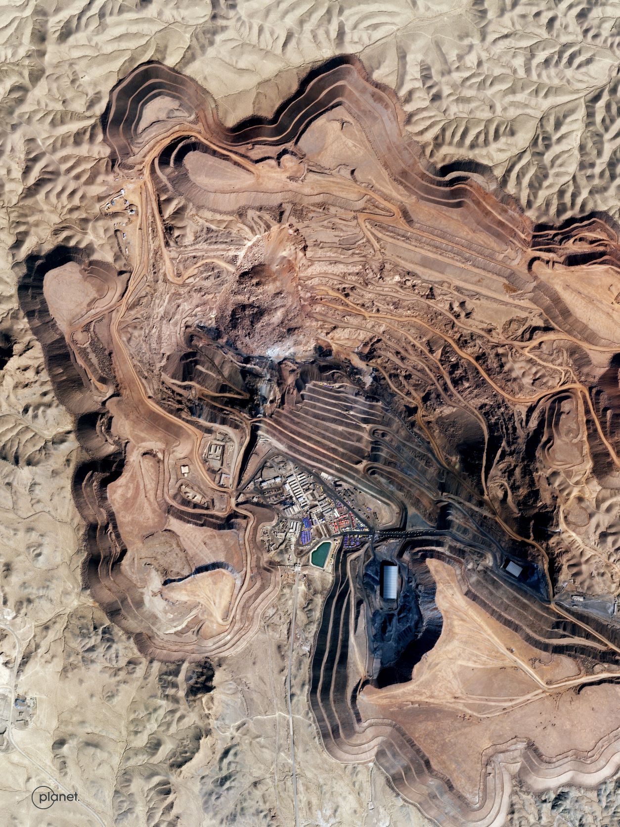
SkySat image of the 23 February 2023 coal mine landslide in Alxa League, China. Image copyright Planet, used with permission.
.
The image below provides more detail of the landslide itself:-
SkySat image of the detail of the 23 February 2023 coal mine landslide in Alxa League, China. Image copyright Planet, used with permission.
.
The crown of the landslide is to the north, so the landslide has moved towards the foot of the image. The imagery captures the scale of the landslide and the large boulders that it contains. A haul road has been built across the landslide toe, and there is some evidence of attempts to excavate the toe on the eastern side. Overall, though, the image does not indicate a huge amount of excavation, which may suggest that attempts to recover the remains of those lost have been fruitless.
For reference, this is the site of the landslide, as captured in a SkySat image on 23 November 2022:0
SkySat image of the site of the 23 February 2023 coal mine landslide in Alxa League, China. Image copyright Planet, used with permission.
.
At this point there was no obvious indication of the development of a developing slope failure. The huge amount of equipment at the toe of the slope is notable though.
I have tried to create a slider that should allow the two images to be compared:
.
This landslide highlights the continued hazards associated with poorly regulated mining activities worldwide. These types of landslides should not be causing large-scale loss of life.
.
Acknowledgement and reference
Many thanks once again to the wonderful team at Planet. Their kindness is remarkable.
Planet Team (2023). Planet Application Program Interface: In Space for Life on Earth. San Francisco, CA. https://www.planet.com/
 Dave Petley is the Vice-Chancellor of the University of Hull in the United Kingdom. His blog provides commentary and analysis of landslide events occurring worldwide, including the landslides themselves, latest research, and conferences and meetings.
I found this piece of footage taken from when the Landslide initiated
https://twitter.com/NewmanLibs/status/1629438328624799745
Quite harrowing to watch, as that was ALOT of people that were caught up in it. The vehicles getting caught in it give you an, unfortunately, better sense of scale, and you can probably see why they concentrated their attempts at the toe.
Nice share David. The issue we continue to have is …. Planet in all of their “kindness” does nothing to monitor sites like this .. there are likely 100s in China alone … even it they did, ortho imagery is not the ticket for doing so. This is helpful as an aerial review of the failure event, that would have gone unnoticed if not for the video that was shared globally. Earth Observtion offers nothing in terms of ongoing tracking and monitoring in most cases. Pixel tracking of many images of this site over weeks and months would have been required to do so…. maybe that will do that for this site for the next year … that would be really nice ….
I am not seeking to complain, any data share is welcome and has value — however tomake difference — that takes much, much more…
There are higher resolution “native” than the planet consellation in any case. If they were doing global revisit on a weekly basis and making that (base-layer) available .. that could be worth ongoing study and interest.
In the monitorng and geomatics space — we need to take a leap from the excitement of seeing aftermath, to the dogged work of lookig at the mundane and tracking real displacement dangers — that can save lives and alert on natural resources assets dangers.
there is a strong tonal feature on the right margin area, visible on both images, that suggests a significant contact/geologic structural feature along the margin of the failure.
The adage in pit slope design is “if the slopes aren’t failing, you’re not economical”. I.e., the ideal situation for a mine is to have the pit wall collapse shortly after the last truck of ore is removed. This approach certainly causes issues for things like mine closure, but can typically be handled through an observational approach of ongoing assessment, robust monitoring (such as surveying, ground-based radar, and InSAR) and mitigation (scaling, pushbacks, and the like). A good example is the Bingham Canyon landslide: one of the largest landslides in history, but it was predicted months in advance, and there was no loss of life due to proactive evacuations based on monitoring data. I don’t know the particulars of the situation in China, but the solutions to safely manage slopes (even with failures) exist.
[Interesting comments, thank you. It is perhaps worth noting that pit wall landslides often take land beyond the margin of the workings, so care is needed to ensure that there is not an unanticipated impact beyond the consent area. D.]