20 November 2022
Satellite imagery of the El Molino landslide in Norte de Santander, Colombia
Posted by Dave Petley
Satellite imagery of the El Molino landslide in Norte de Santander, Colombia
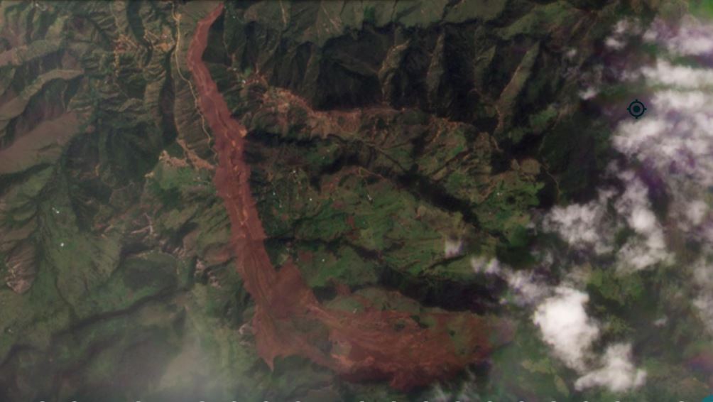
The Planet Labs PlanetScope satellite instruments have captured imagery of the 10 November 2022 El Molino landslide in Colombia. This is a cloudy area at this time of year, so obtaining images can be a challenge. This is the site as of 11 November, with the track of the landslide clearly visible:-

The 10 November 2022 El Molino landslide. Planet Labs PlanetScope image, copyright Planet Labs, used with permission. Image captured 11 November 2022.
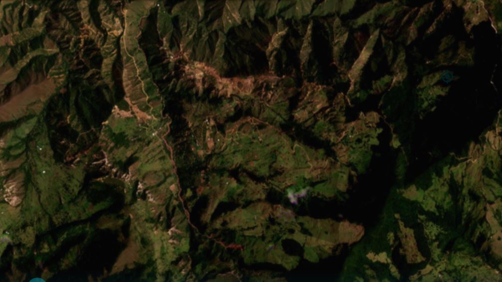
For comparison, this is an image of the same location on 3 October 2022:-

The site of the 10 November 2022 El Molino landslide. Planet Labs PlanetScope image, copyright Planet Labs, used with permission. Image captured 3 October 2022.
.
To allow comparison I have created a slider, which should allow you to see the site before and after the landslide:-


.
There are two really interesting aspects of this site. First, the landslide has picked out rather well the deforested area in the upper catchment. I am unsure as to whether this indicates that the loss of vegetation may have been a factor or that there was a strong topographic control on both the farmland and the landslide. I would tend towards the latter, but would be interested in views.
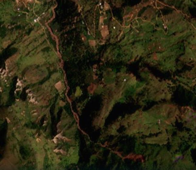
Second, it appears that there was an earlier, smaller but quite long runout landslide at this site, as shown in the October satellite image. I have enlarged this below:-

The earlier landslide at the site of the 10 November 2022 El Molino landslide. Planet Labs PlanetScope image, copyright Planet Labs, used with permission. Image captured 3 October 2022.
.
The resolution of the imagery is not good enough to understand this slide properly. It may well have played a role in the development of the main failure.
Meanwhile, as of three days ago the five victims of the landslide had not been recovered, and there is concern about the damming of the river as well as about the potential for a further landslide. A small lake has developed.
The landslide destroyed 670 hectares of land, whilst 130 people have been rendered homeless.
.
Reference and acknowledgements
The images are from the wonderful people at Planet Labs.
Planet Team (2022). Planet Application Program Interface: In Space for Life on Earth. San Francisco, CA. https://www.planet.com/


 Dave Petley is the Vice-Chancellor of the University of Hull in the United Kingdom. His blog provides commentary and analysis of landslide events occurring worldwide, including the landslides themselves, latest research, and conferences and meetings.