
1 October 2021
Using InSAR to create a landslide inventory for the Pacific Northwest
Posted by Dave Petley
Using InSAR to create a landslide inventory for the Pacific Northwest
One of the most interesting opportunities presented by the continued rapid development of InSAR as a landslide research tool has been the ability to create inventories of landslides that have not previously been identified. The principle is that InSAR can detect deformation, allowing areas of moving ground to be identified. The step beyond this would be to use it as a tool to try to identify slopes that are progressing towards failure, such as occurred in Chamoli in India earlier this year, but that is some way off as a widely-deployable tool.
A really good demonstration of the potential of InSAR for creating a landslide inventory has recently been published in the journal Landslides (Xu et al. 2021), sadly behind a paywall, with a good write up in phys.org. In this study, InSAR has been used to map slow-moving landslides in the Pacific Northwest of the USA. There are many such landslides in this area, but they can be difficult to detect using conventional tool, often because of forest cover and/or agricultural modification of the terrain.
The authors used radar images from 2007 to 2019. They found 617 active landslides that do not appear in the USGS inventory. The largest is 13 million cubic metres. The landslides were active at different times through the study – for example, 471 showed deformation in the period between 2015 and 2019.
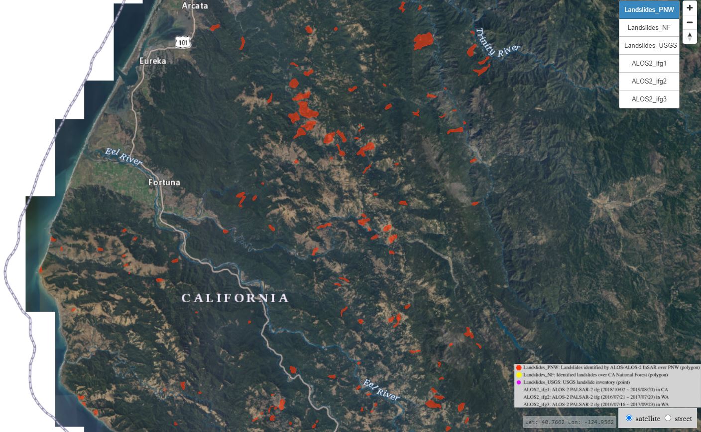
The research team, from Southern Methodist University and the USGS, have provided an online tool to visualise the landslides. The image below shows a part of the inventory using this tool:
.
The creation of the this inventory is very valuable in itself, providing the potential to determine how the landscape will evolve in the coming decades in response to seismic activity, changes in rainfall patterns and wildfires. But the study also demonstrates that InSAR is rapidly becoming an very valuable tool for wide area landslide mapping and monitoring.
.
Reference
Xu, Y., Schulz, W.H., Lu, Z. et al. 2021. Geologic controls of slow-moving landslides near the US West Coast. Landslides (2021). https://doi.org/10.1007/s10346-021-01732-3
 Dave Petley is the Vice-Chancellor of the University of Hull in the United Kingdom. His blog provides commentary and analysis of landslide events occurring worldwide, including the landslides themselves, latest research, and conferences and meetings.
I LOVE this and will look into it. I have lived in the upper left corner of the photo for 26 years and have several maps in the works for the central part of the image. These slides are most definitely active, haha!