1 September 2021
George County: a drone video of the site of a fatal landslide triggered by Hurricane Ida
Posted by Dave Petley
George County: a drone video of the site of a fatal landslide triggered by Hurricane Ida
The landfall of Hurricane Ida across the southern USA earlier this week caused high levels of rainfall, inducing flooding and landslides. In terms of mass movements, one of the most significant events occurred in the Benndale community in George County in Mississippi, where a substantial failure destroyed a section of MS26. The landslide had substantial consequences – it killed two people and injured a further 10, three of them critically.
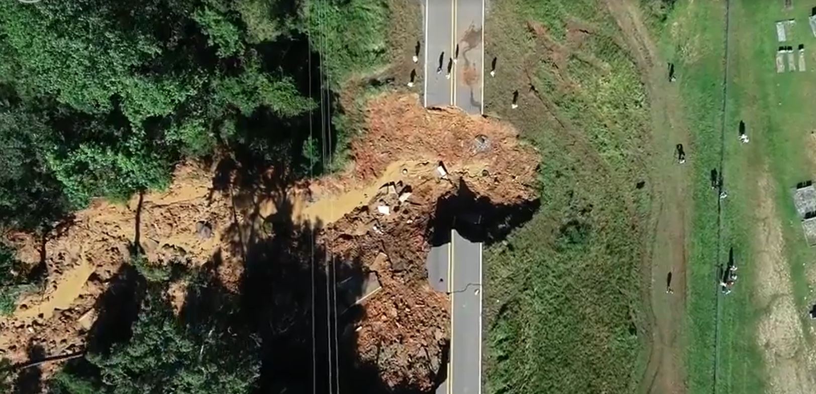
The SunHerald has a detailed article about the event, and has published a drone video of the aftermath. The site is quite interesting, as this overhead view shows:

The fatal landslide in George County, Mississippi. Image taken from a drone video posted by the SunHerald. Drone video by Travis Long.
.
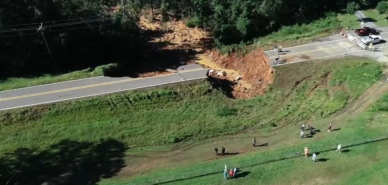
The view below, also from the drone video, provides an understanding of the form of the landslide:

An oblique view of the fatal landslide in George County, Mississippi. Image taken from a drone video posted by the SunHerald. Drone video by Travis Long.
.
The SunHerald article provides some information about the landslide:-
“It is a slide, which means the ground under the roadway and embankment was super-saturated and we can tell right now that’s what caused the slide,” said Kelly Castleberry, district engineer for the Mississippi Department of Transportation. “The ground liquified and it spread several hundred feet to the south.”
The road appears to be on embankment, which has failed.


 Dave Petley is the Vice-Chancellor of the University of Hull in the United Kingdom. His blog provides commentary and analysis of landslide events occurring worldwide, including the landslides themselves, latest research, and conferences and meetings.
I was wondering if you were going to post about this one! I saw a video clip of it last night on weather.com when I was looking up the storms path. It looks like more of the embankment is ready to go, too.
Corridor monitoring with InSAR (maybe forensic study) …… there will be reports come out about issues at this “location” that likely preceded this result after an “extreme” event. Condolences and sympathies to those lost, and injured.