12 April 2021
The interesting morphology of the Culluchaca landslide in Peru
Posted by Dave Petley
The interesting morphology of the Culluchaca landslide in Peru
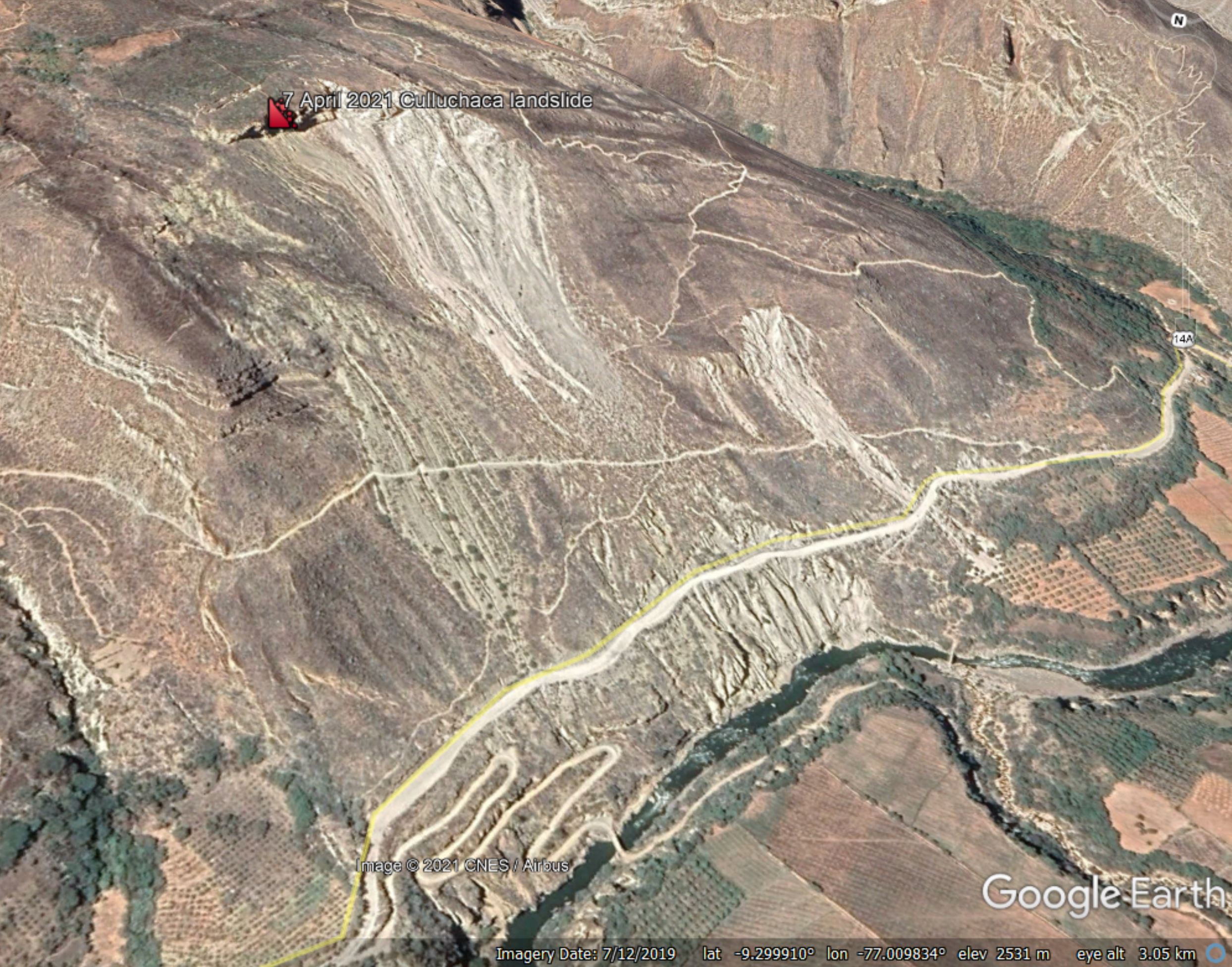
After posting yesterday about the Culluchaca landslide in Peru, I spent some time looking at the morphology of the site using the Google Earth Imagery. As a reminder, this is what the Google Earth images show. The image was collected in July 2019:-

Google Earth view of the site of the landslide close to Culluchaca in Peru.
.
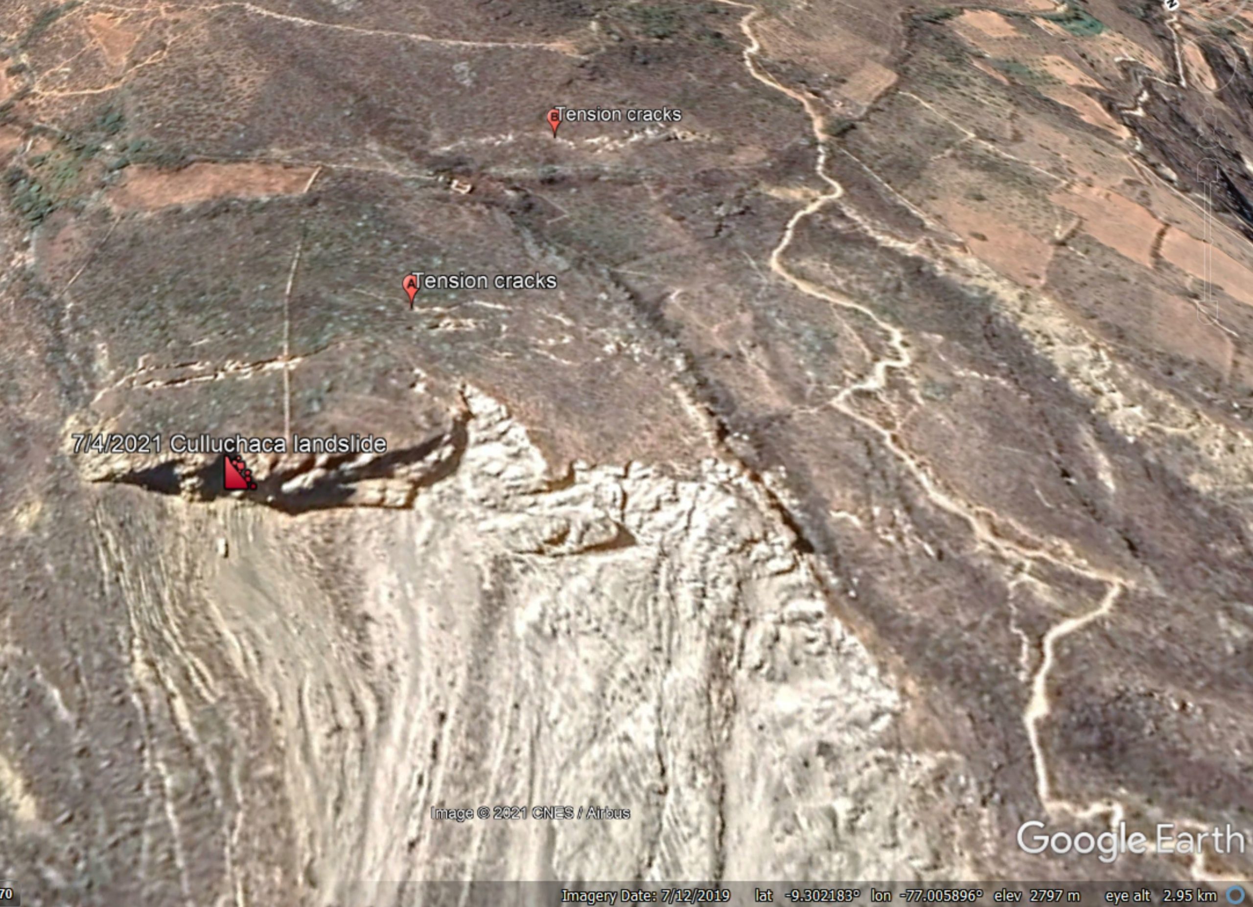
The interesting features of this landslide lie above the crest of the slide shown above. The image below shows that area, on this occasion looking square onto the landslide:-

Google Earth view of the crest of the landslide close to Culluchaca in Peru.
.
The image appears to show two arrays of tension cracks. The first set, marked with A, are about 50 metres back from the landslide crown. But there is another set, marked with B, that are probably less well developed. These are about 150 metres back from the landslide crown, indicating a very large instability.
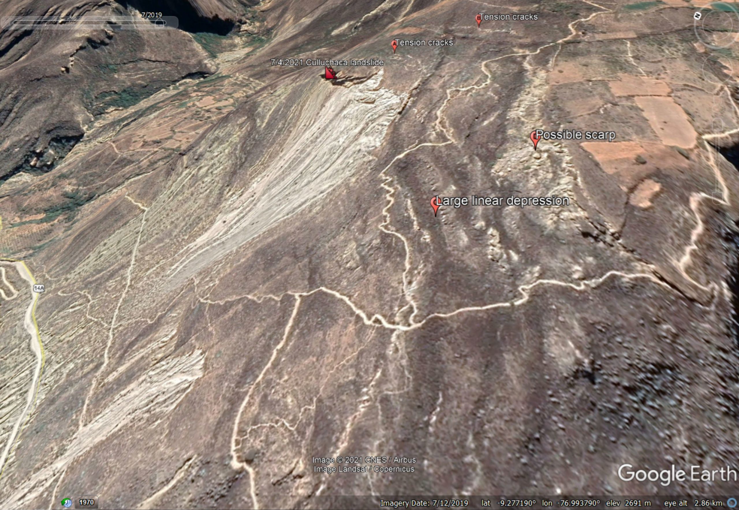
Perhaps even more interesting is the set of features further across the slope. The image below shows the morphology of this area. I’ve left the other markers in place for reference:-

Google Earth view of features at the crest of the landslide close to Culluchaca in Peru.
.
Running across the slope parallel to the crest is an array of linear depressions, some of which are large and extensive. Upslope from here is a ridge with extensive bouldery deposits, which is probably a scarp.
The most likely explanation for these features at that this is the site of a deep-seated gravitational deformation (DSGD), defined as “a gravity-induced process affecting large portions of slopes evolving over very long periods of time. A DGSD may displace rock volumes of up to hundreds of millions of cubic meters, with thicknesses of up to a few hundred meters.”
DSDGs are very large, slow creeping failures in rock masses, common in high mountain areas. I wrote about an example in Italy in 2019. They typically generate arrays of parallel scarps and troughs high up on the hillside.
Thus, the failure of the Culluchaca landslide on 7 April 2021 is probably only a small part of the unstable mass on this slope. However, that does not necessarily mean that further collapses are likely in the short term – DSGDs creep for hundreds and even thousands of years.
I should note that an alternative explanation for these features in this landscape as an active fault. This possibility cannot be precluded without further investigation.


 Dave Petley is the Vice-Chancellor of the University of Hull in the United Kingdom. His blog provides commentary and analysis of landslide events occurring worldwide, including the landslides themselves, latest research, and conferences and meetings.
Mostly, a “deep-seated gravitational deformation” is produced by viscoplastic behaviour (Bingham body) of the ground. This behaviour generates tensile stresses and subsequently tension cracks above slope edges reaching deeper and deeper into the ground. This results in a decrease of the area transferring shear stresses between the moving parts and the ground. Finally, a rotational slide occurs turning the tension cracks into normal faults.
Very interesting… How much does an arid environment play in the timeline for activation…..
Might be interesting to do some radar interferometry here.
http://www.esa.int/ESA_Multimedia/Missions/Sentinel-1/(result_type)/images
What are the rock types involved? Such curvilinear fractures are seen in Kerala uplands, south India over the granite gneiss as large exfoliation features – a natural and common weathering phenomena in such rocks.
Dr Sudesh Wadhawan, Amrita University, Kerala India