
15 February 2021
New perspectives on the Chamoli debris flow disaster
Posted by Dave Petley
New perspectives on the Chamoli debris flow disaster
The grim search for the victims of the Chamoli debris flow disaster in Uttarakhand in India is continuing, with much of the effort being focused on the tunnels associated with the Tapovan Vishnugad hydroelectric scheme. As of this morning (15 February 2021), 54 people are known to have lost their lives and 179 people are reported to be missing. The Tapovan tunnel operation is extremely challenging as it is filled with sediment, including large boulders.
The Planet Labs high resolution images are incredible – it is almost impossible to do them justice. I have imported them into Google Earth and draped them onto the landscape, which helps to provide a perspective on the events. The image below shows the slope that failed, taken a few days before the landslide:
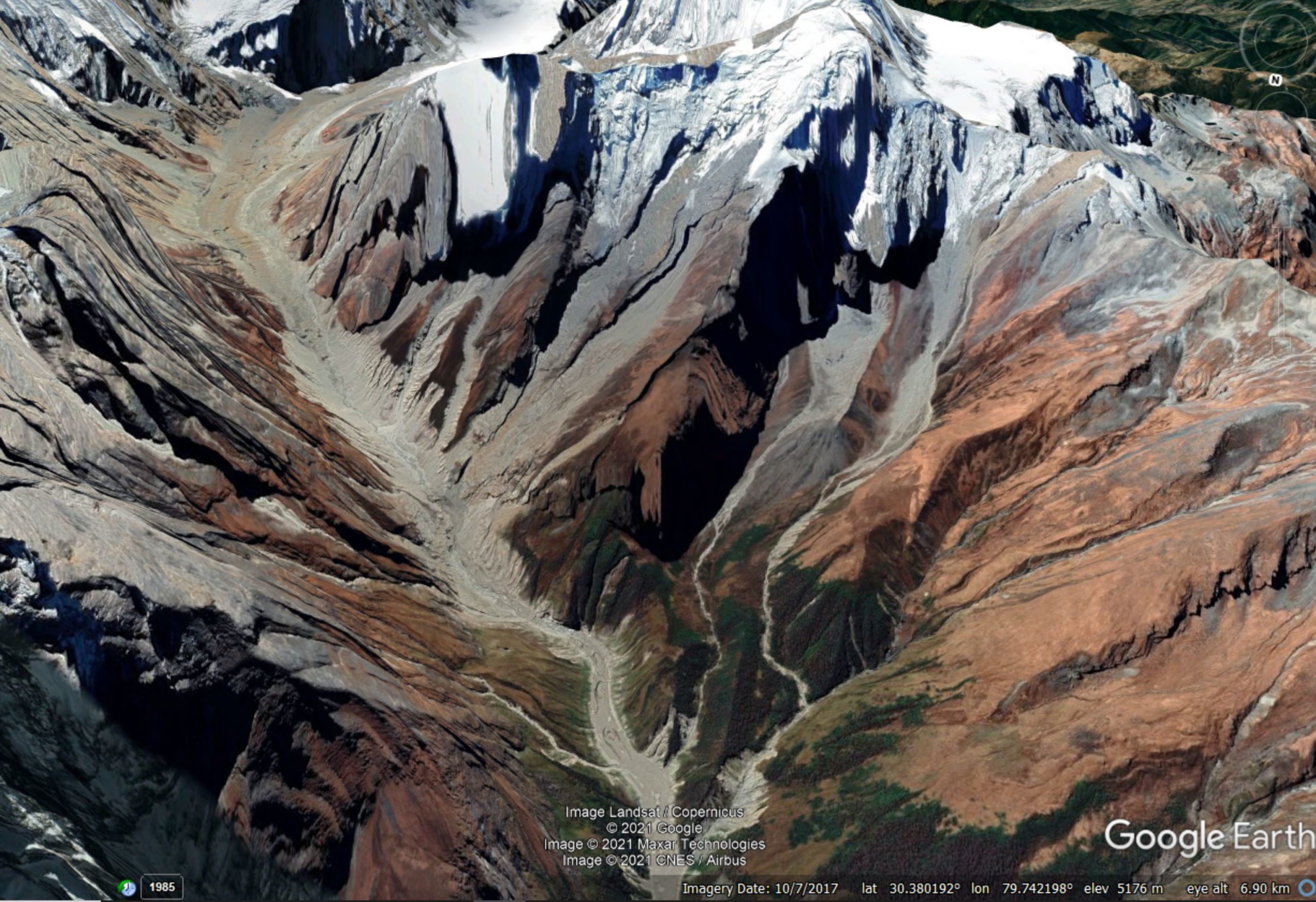
Google Earth perspective view of the slope that failed in the Chamoli landslide
.
The terrain was steep and barren, with some woodland in the lower parts of the valley. The image below shows the same view, but with the Planet Labs SkySat image draped onto the topography:-
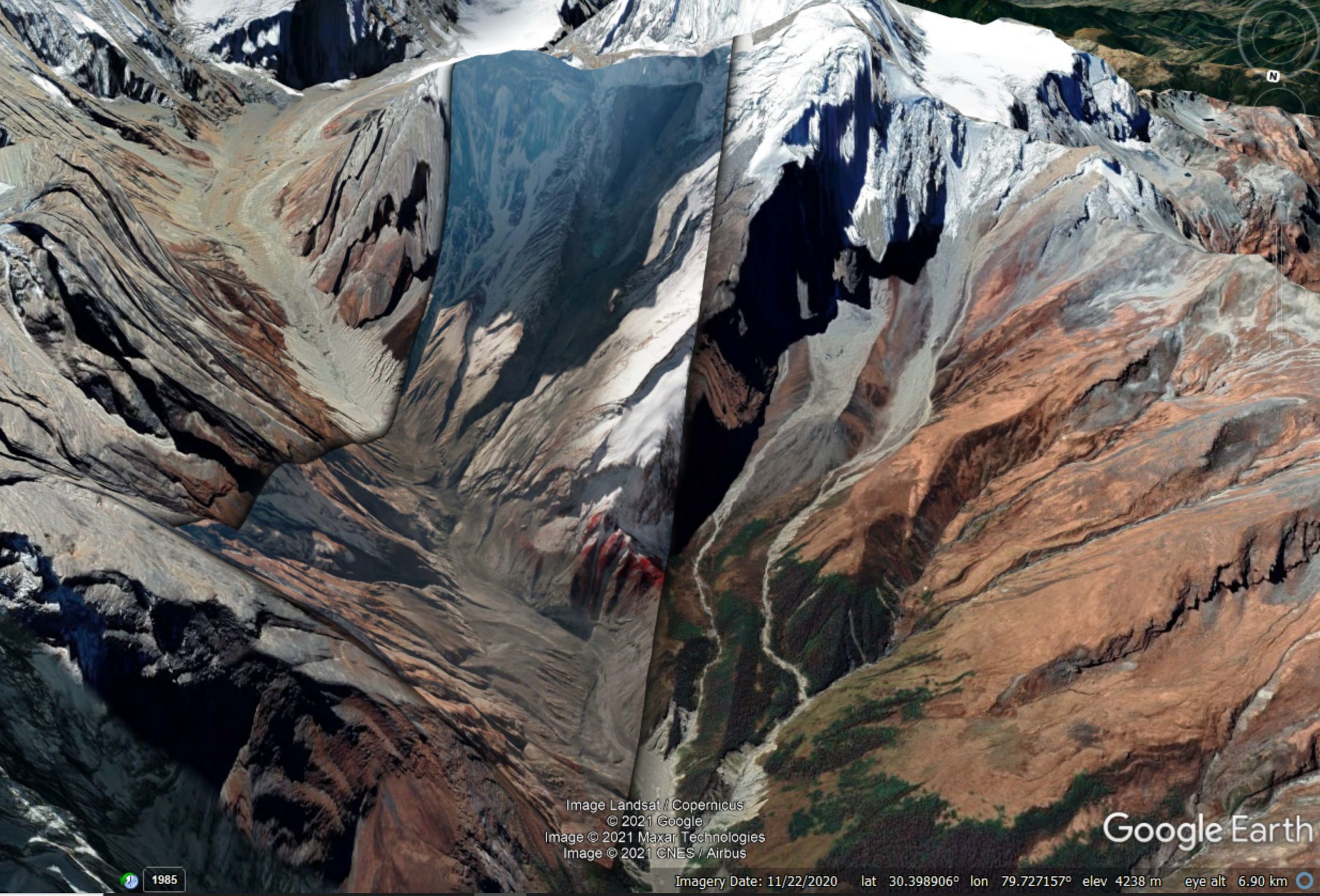
Google Earth perspective view of the slope that failed in the Chamoli landslide, with the Planet Labs SkySat imagery draped over. Imagery copyright Planet Labs, used with permission.
.
To provide a comparison, I have created a slider below that allows you to flick between the images:-
.
The large block that has failed is clearly seen in the later image, as is the very steep slope down which the debris travelled. The debris appears to have travelled some distance up the opposite slope before heading down the valley. The image below uses the lower resolution Planet Labs PlanetScope imagery to show the path of the debris:
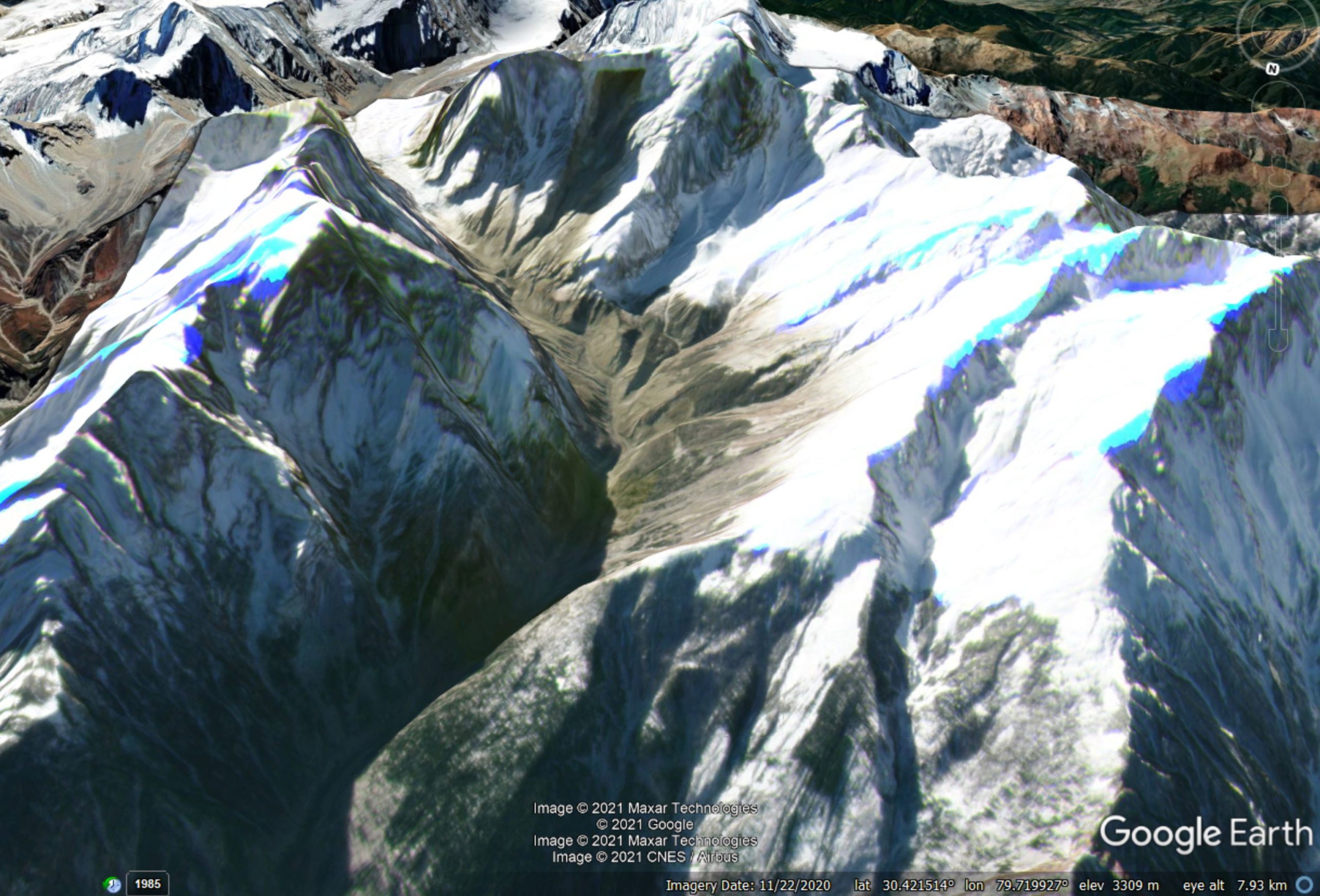
The path of the debris that formed the Chamoli debris flow. Imagery copyright Planet Labs, used with permission.
.
The area of dust deposition in the upper part of the flow path is clear. It appears that the flow became increasingly confined to the lower part of te valley, possibly as it transitioned into a debris flow.
The image below, which was prepared by my friends at Planet Labs, show the full path of the Chamoli landslide and debris flow to the Tapovan Vishnugad hydroelectric dam site:
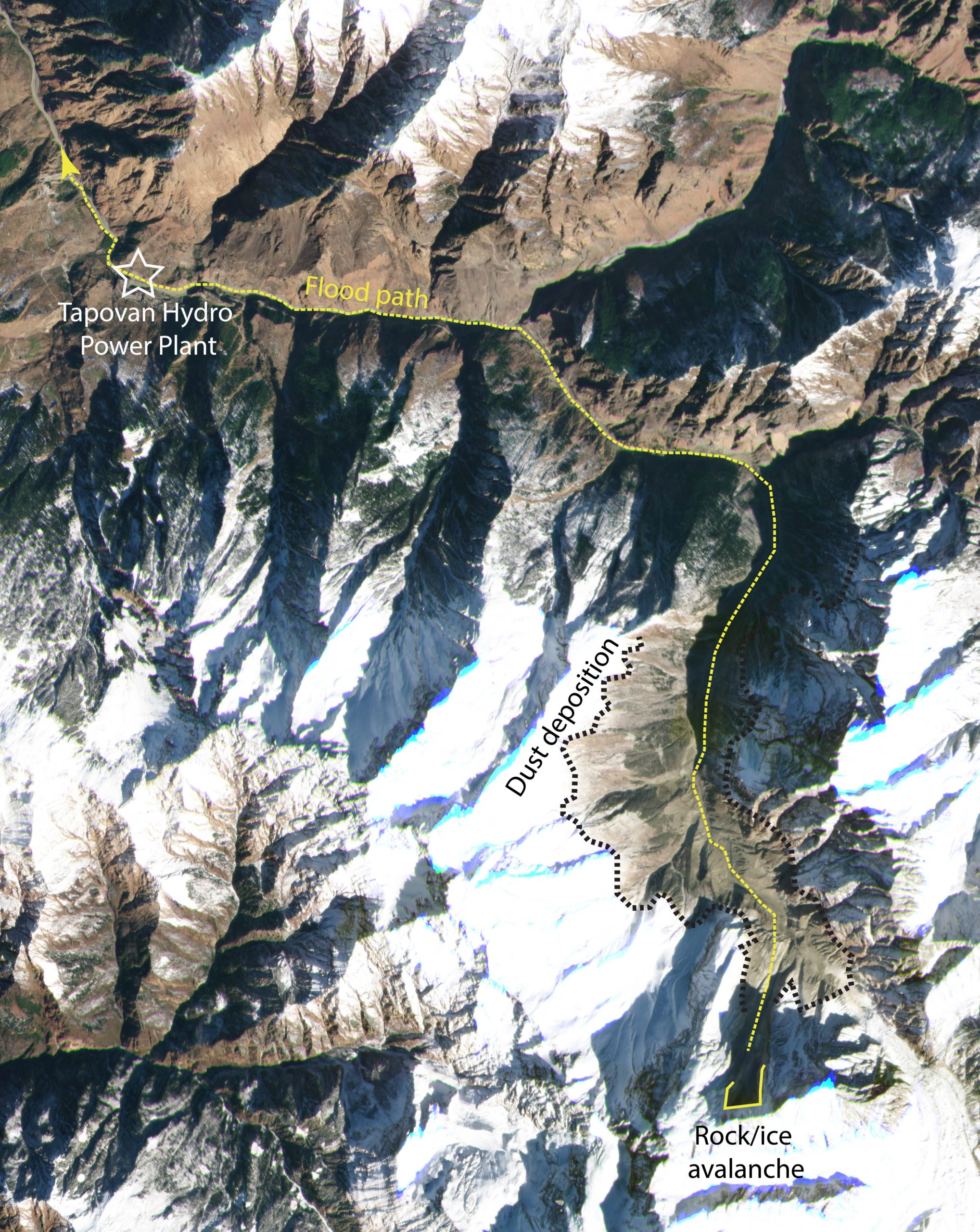
The track of the Chamoli landslide and debris flow. Image prepared by Planet Labs, used with permission.
.
Reference
Planet Team (2021). Planet Application Program Interface: In Space for Life on Earth. San Francisco, CA. https://www.planet.com/
 Dave Petley is the Vice-Chancellor of the University of Hull in the United Kingdom. His blog provides commentary and analysis of landslide events occurring worldwide, including the landslides themselves, latest research, and conferences and meetings.
Hi Dan – thank you for the excellent coverage and information. As a geotechnical engineer and dam safety engineer in the US it was a relief to hear some factual reporting on the events leading to this disaster. The news media seems content to publish nonsensical and incorrect information – this is the first real explanation as to what happened that I’ve heard.
Thank you for the impressive pictures!
I share the view that this event is primarily a rockfall event and not a glacier break.
It is reminiscent of the event on Piz Cengalo (Switzerland 2017) only in considerably larger dimension. I am very curious what the research will show.
Thanks for keeping the flow of information. This appears to be similar to the Nevados Huascaran landslide of 1970 minus the earthquake triggering.
Very impressive analysis of the suspected slope failure concept leading to the Rishi Ganga flash floods. A stand alone glacial lake outburst in the frozen catchment has never been a possibility. But, considering that the source of floods could only be from a glacial lake, the search for a complete mechanism of lake breach continues. In that sense, the triggering mechanism is very efficiently explained in this blog but what remains is the spotting of the glacial lake that breached.
It may be mentioned that the quantity of flood water based on flood levels in downstream reaches has been estimated by some experts. This could come in handy in the search of the location of the breached glacial leak.
I finally saw an article online regarding this event and they are still referring to as a glacier collapse linked to claimate change. I have a feeling that the media will continue to do so as it is easier for readers to understand how climate change affects glaciers, but trying to explain the magnitude of the rock slope collapse that then transitioned into a debris flow. I really cannot find fault with the media in this case, as they are trying to do there best at reporting on this incdent and the magnitude of loss of life, loss and damage to infrastructure, and the impact on the environment.
I will definitely be looking forward to when a paper or papers are published descibing and analyzing this incident. Understanding this incident will be critical in other parts of the world where the same scenario has and will continue to play out as the climate changes for all of us.
Thanks again for the great work you put into this blog Dave! Very much appreciated!!!
The root cause of these disasters is World Dam Dynamics.
[Redacted]
[It really isn’t. I don’t publish conspiracy theories. D.]
This is not a conspiracy theory. It is the truth and public interest science. Prove that it is a conspiracy theory.
[Publish this in a mainstream, reputable, peer reviewed journal and I’ll consider its relevance. D.]