3 November 2020
Williams Lake: 1 million cubic metre, damaging landslide in Canada
Posted by Dave Petley
Williams Lake: 1 million cubic metre, damaging landslide in Canada
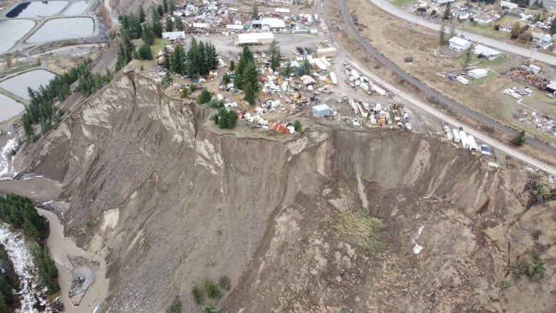
With thanks to loyal readers Charles by email and Dr Drew Brayshaw (@DrewBrayshaw) via Twitter: a large landslide occurred on 31 October 2020 in an industrial area on the outskirts of Williams Lake in British Columbia in Canada in the last few days. There are few decent pictures that capture the whole of the landslide; the best one I can find is this one, taken by Scott Nelson and published by CBC:-

A drone image of the landslide at Williams Lake in British Columbia, Canada. Image collected by Scott Nelson and published by CBC.
.
Meanwhile, the Williams Lake Tribune has a short video of operations at the foot of the slope to keep the channel open. The area has been suffering from heavy rainfall, and thus presumably elevated river levels, in recent days, and indeed there are reports of other (smaller) landslides in the area.
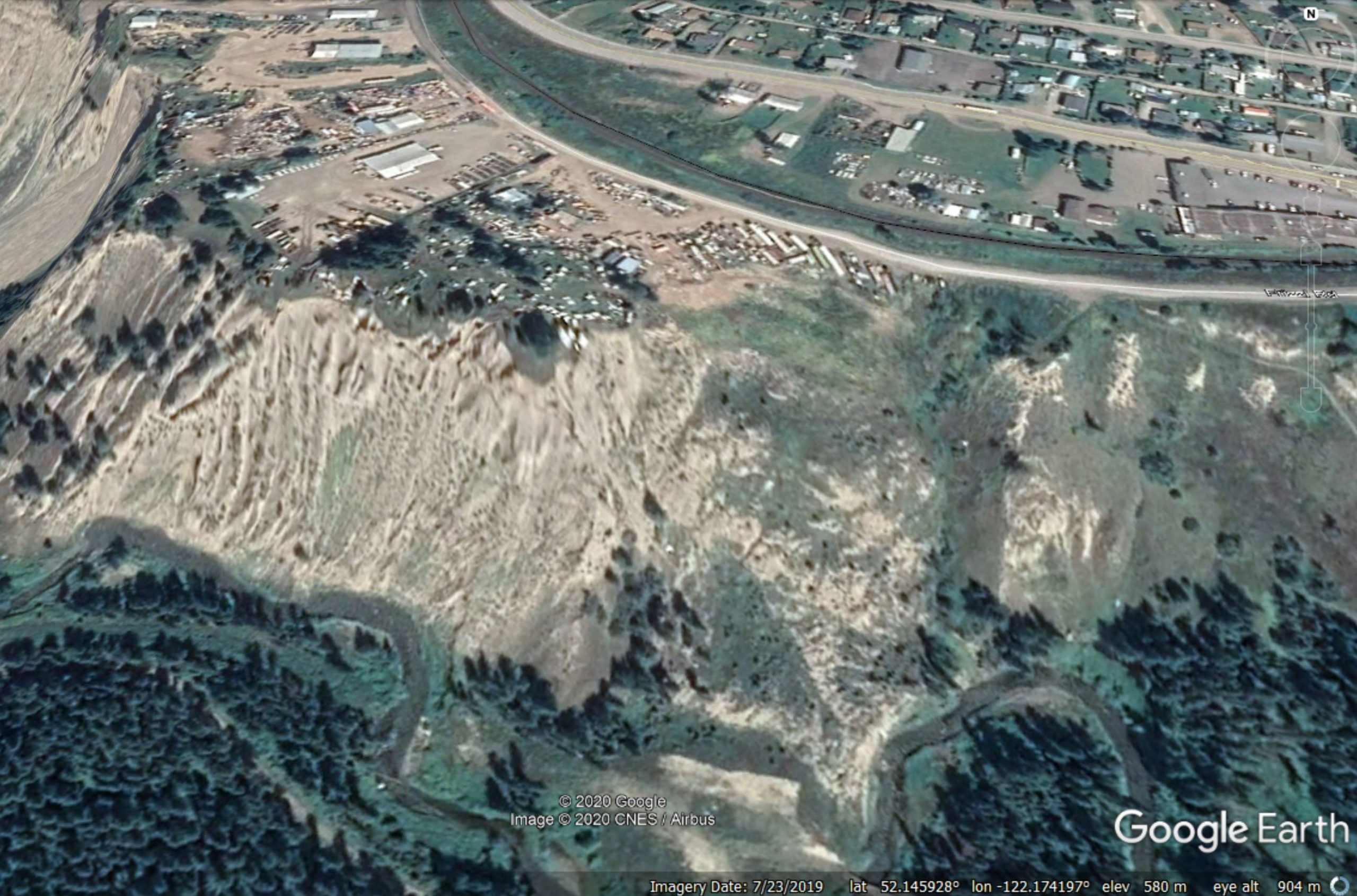
The Google Earth imagery of this area suggests that this is not the first landslide on this slope – and of course the image above suggests that future failures may occur too (but with no certainty on timing):-

Google Earth image of the site of the landslide at Williams Lake in British Columbia, Canada.
.
There is a very nice geological map of the area on the BC Ministry of the Environment website, which suggests that this landslide has occurred in glacial deposits. That looks right to me.
.
Quickslide 1: Deforestation, construction to blame for central Vietnam landslides
VNExpress has a nice article about the underlying causes of the recent landslides in Vietnam. It concludes that deforestation and construction may be important factors:
Trinh Xuan Hoa, deputy head of the Vietnam Institute of Geosciences and Mineral Resources under the Ministry of Natural Resources and the Environment, said deforestation and construction, among other factors, were to blame for triggering landslides in central Vietnam.
“Human activities including deforestation and road construction, etc. have hastened geological changes in the area. Leveling mountains and destroying taluses for construction destabilize the terrain, create steeper slopes and sacrifice local vegetation. This fuels the risk of erosion and landslides,” he said, adding erosion occurred mainly on mountain slopes, in residential areas or along roads and other man-made structures.
.
Quickslide 2: The reopening of the Aberdeen to Dundee railway line
Three months after the fatal, landslip induced crash at Stonehaven on the Aberdeen to Dundee railway line, the track reopens today. The amount of work needed to recover the train and repair the line has been very extensive.


 Dave Petley is the Vice-Chancellor of the University of Hull in the United Kingdom. His blog provides commentary and analysis of landslide events occurring worldwide, including the landslides themselves, latest research, and conferences and meetings.
psst, it’s “Brayshaw” not “Brayshore”
[Apologies, now corrected. D.]
I used to live in Williams Lake while working at a nearby mine, and would go running on the beautiful set of trails down to the Fraser River below that landslide. It’s also the only area I’ve ever seen where there was a “Caution: Falling Rocks, No Stopping” sign on a walking trail. But sure enough, if you did stop, every 30-90 seconds another cobble would roll down the slope above and cross the trail with a fair bit of force.
If I remember my glacial history correctly at one point in deglaciation that valley had the entire flow of the Fraser through it. the slopes are massive erosional banks of fluvial sands and gravels, some approaching 100 m in height.