27 April 2020
Planet Labs high resolution imagery of the Tendepo landslide
Posted by Dave Petley
Planet Labs high resolution imagery of the Tendepo landslide
Last month I noted that on Saturday 21 March 2020 the significant Tendepo landslide occurred in Tambul-Nebilyer district in Papua New Guinea, resulting in 12 fatalities. This landslide was triggered by heavy rainfall.
Planet Labs have, once again, very kindly collected high resolution imagery of this landslide (and indeed the one at Kegesuglo, which I will post this week) – thanks once again to all at Planet Labs, especially Robert Simmon, for obtaining the amazing images.
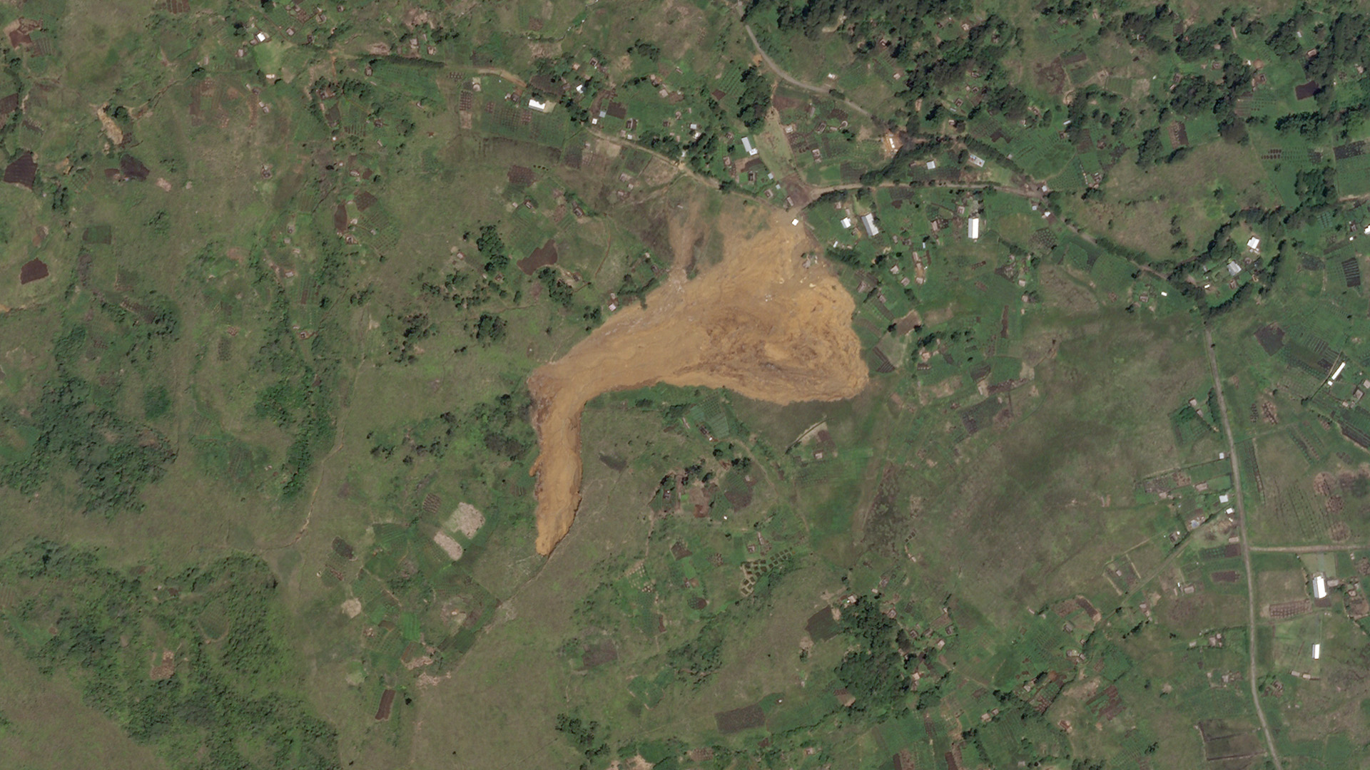
This is the SkySat image, collected on 18 April 2020:-

Planet Labs SkySat image of the Tendepo landslide, collected on 18 April 2020. Copyright Planet Labs, used with permission.
.
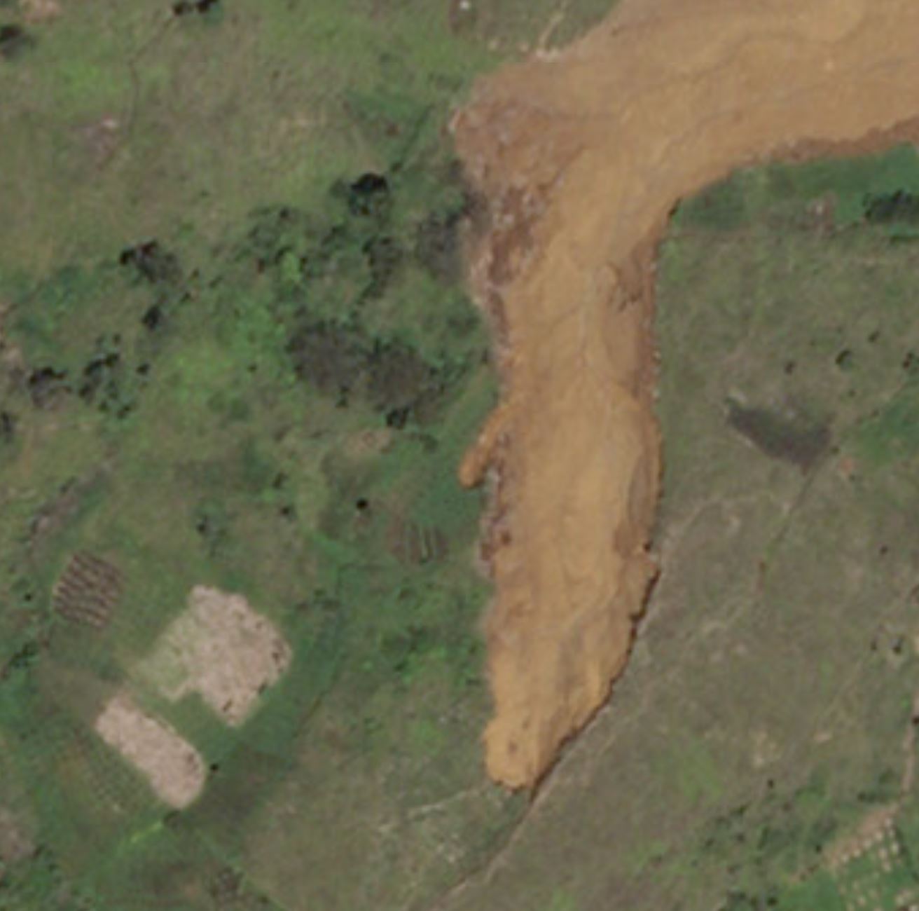
The source of the landslide is to the southwest, with the landslide initially moving towards the north, before following the topography to flow in a generally eastward direction. It is clear that the landslide has spread considerably. This is a more detailed view of the source:-

Planet Labs SkySat image of the source area of the Tendepo landslide, collected on 18 April 2020. Copyright Planet Labs, used with permission.
.
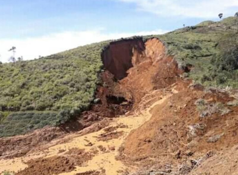
This is clearly a quite deep-seated landslide in residual soil. Note the very linear feature on the southeast portion of the scar, which appears to extend beyond the boundary of the landslide to the south. This would seem to indicate that the landslide has exploited an existing weakness. This can be seen in the image below from my original post:-

Tendepo landslide: the scar of the major landslide in Tambul-Nebilyer district in Papua New Guinea on 21 March 2020. Image by Caligen Giluwe Ice via The Watchers.
.
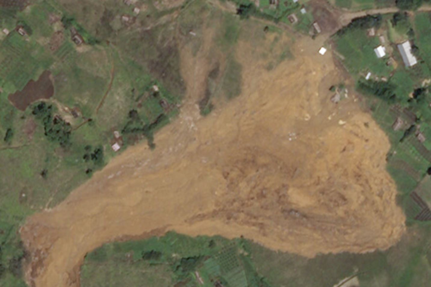
After failure the landslide has changed direction and spread across the lower angled slope:-

Planet Labs SkySat image of the deposit of the Tendepo landslide, collected on 18 April 2020.
.
I suspect that there is some entrainment of soil in the upper portion of this part of the landslide, with deposition starting at about the half way point, probably controlled by slope gradient. The greatest volume of material appears to have been deposited in the south-east part of the slide. I suspect that there is some evidence of excavation to recover victims towards the toe.
It is very rare to get decent information about landslides in Papua New Guinea, even though they are a substantial hazard. Thus, this Planet Labs imagery has provided rare and invaluable insight into the problems there.
Reference
Planet Team (2020). Planet Application Program Interface: In Space for Life on Earth. San Francisco, CA. https://www.planet.com/


 Dave Petley is the Vice-Chancellor of the University of Hull in the United Kingdom. His blog provides commentary and analysis of landslide events occurring worldwide, including the landslides themselves, latest research, and conferences and meetings.