4 February 2020
Mina Pecket: a dramatic landslide in an open cast coal mine in 2014
Posted by Dave Petley
Mina Pecket: a dramatic landslide in an open cast coal mine in 2014
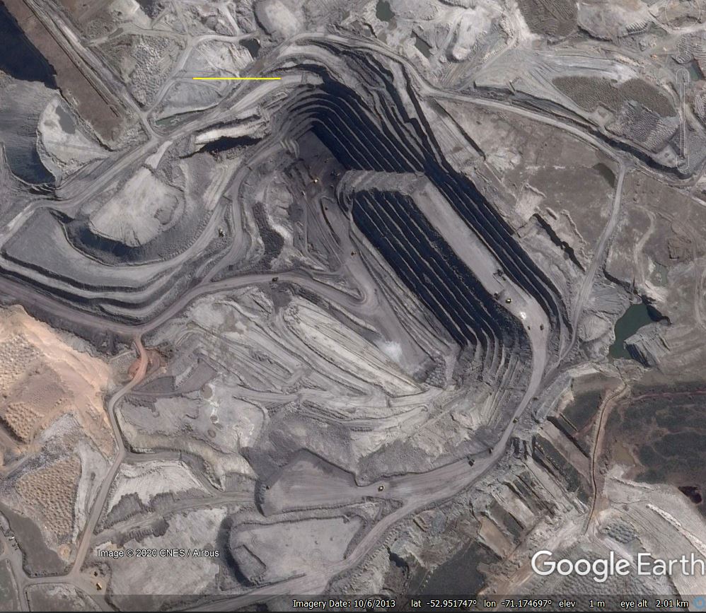
In recent years I have repeatedly highlighted the high rate of landslides associated with mining operations. Regular reader Hig kindly highlighted an interesting example to me in Patagonia, which is well-imaged on Google Earth. This is at Mina Pecket in the very south of Chile, location -52.96, -71.16. At this location there is a large open cast coal mine close to a fjord in Punta Arenas. This Google Earth image, collected in October 2013, shows the site. The yellow bar is 200 metres long, showing that this is a large mine:-

Google Earth image of Mina Pecket in October 2013. The yellow bar is 200 m in length.
.
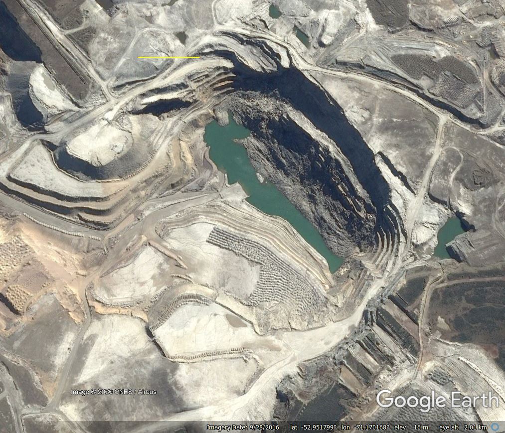
The Google Earth image below was taken in September 2016. The northeast face of the mine has collapsed completely.

Google Earth image of Mina Pecket in September 2016. Note the large collapse of the northeast face of the mine. The yellow bar is 200 m in length.
.
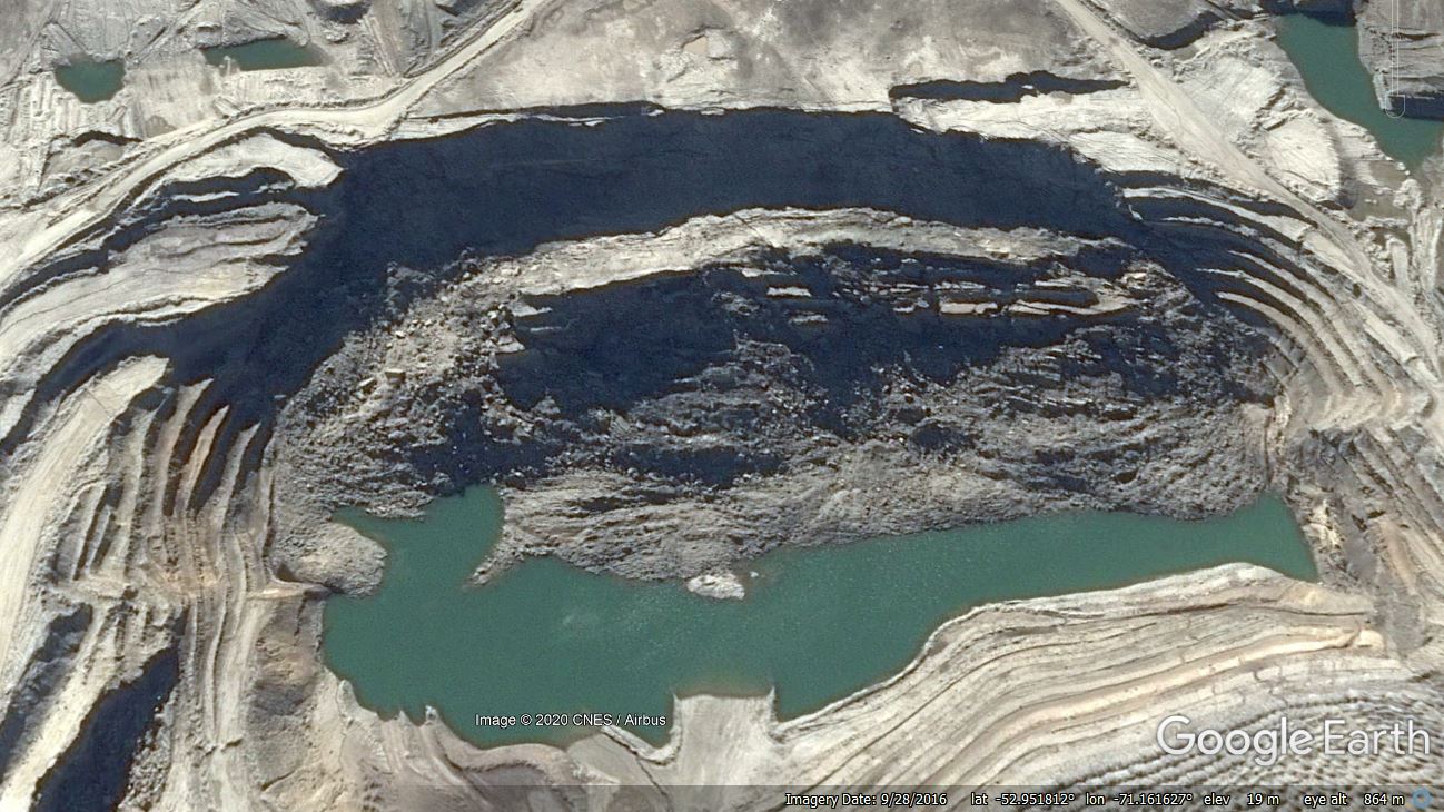
The image below provides a better perspective of the collapse itself:-

Google Earth image of the collapse at Mina Pecket, taken in September 2016. The yellow bar is 200 m in length.
.
The collapse appear to be a very large slump that has involved a block approximately 650 metres long and 300 metres wide. According to news reports, the landslide occurred on 1 April 2014. In the aftermath of the landslide, Sernageomin, the National Geology and Mining Service, presented the operator with a 120 day deadline to outline how operations would be reactivated at the mine. However, in August 2014 operations were suspended for a minimum of two years. Satellite images suggest that operations at this part of the mine at least have not restarted.
This appears to be another case of a large landslide disrupting mining operations. It would be interesting to know more about the failure, and in particular whether the collapse had been anticipated.


 Dave Petley is the Vice-Chancellor of the University of Hull in the United Kingdom. His blog provides commentary and analysis of landslide events occurring worldwide, including the landslides themselves, latest research, and conferences and meetings.
I think the coordinates are off. -59 puts you in the drake passage. From what I found on google it looks mor like -52.9
bruh the coordinates are not even right my guy,
I worked there at the Pecket Mine after the surface mining operation ceased and underground mining commenced. The highwall failures were due to greedy and incompetent Chilean ownership and management ordering the extraction and recovery of too much coal from the underground mine. In other words, they mined and removed coal from the stable coal pillars which were developed while the mine was advancing, then while retreating, they greedily cut and removed coal from the pillars which left the pillars too small and weakened, and they could not sustain the weight of the rock about them from the highwall area. Subsequently, the coal pillars collapsed and the rock above them fractured vertically all the way to the surface, and this is what lead to the massive failure of the highwall, which is the landslide you are talking about. Besides that disastrous decision to mine the coal pillars, the underground mine suffered from large natural horizontal ground stresses which were created due to the ground still rebounding from ancient glacial compression.