
18 December 2019
Larvik: a classic wedge failure on a Norwegian road last week
Posted by Dave Petley
Larvik: a classic wedge failure on a Norwegian road last week
On Friday 13 December 2019 a large wedge failure developed on the E18 motorway at Larvik in Norway. Norway Today has a good report about the aftermath of the landslide, which appears to have occurred in a steep cut slope (I have lightly edited the English for clarity):
The E18 is closed in a southbound direction – probably out of the week – after the rockslide close to the Larvik tunnel entrance on Friday…The Roads Administration fears that it will mean traffic chaos and long queues when people get to and from work…On Monday morning, the Road Traffic Center reported long queues and heavy traffic in the area, but no major traffic problems. The process of clearing the E18 may take several days. The Roads Administration must, among other things, blow up a large boulder.
Dagsavisen has a good article about the failure (in Norwegian), which includes this image of the aftermath:-
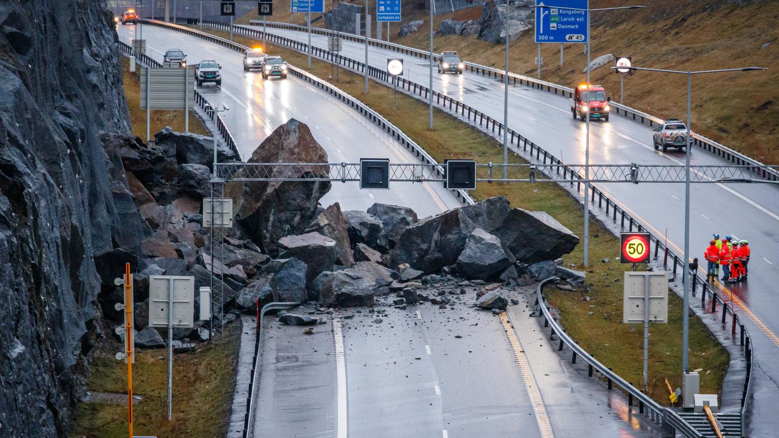
The aftermath of the wedge failure at Larvik in Norway on 13 December 2019. Image via Dagsvisen and NTB Scanpix.
.
This article makes a couple of interesting points. The first is that the road is comparatively new, and ponders why such a failure would occur. This is a legitimate question. The second is that the failure occurred at 10:45 pm local time, which meant that the road had few users. Clearly the outcome could have been much worse if the failure had occurred in, for example, the rush hour.
Some insight into the failure is provided by this image from SB:
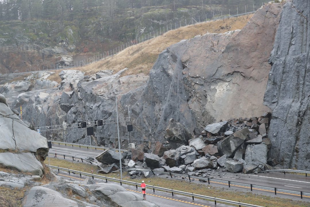
The aftermath of the Larvik wedge failure on 13 December 2019. Image from SB and Geir Eriksen.
.
The image shows that this is a classic wedge failure – note the clear detachment surface facing the camera – this is undoubtedly an existing discontinuity. The other detachment surface appears to be defined by one a series of near vertical joints cutting into the slope – the traces of similar discontinuities can be seen on the right side of the image.
The slope appears to have been protected by mesh pinned into the face, but this would serve only to contain minor rockfalls.
I wonder how the potential for this wedge failure was not picked up in the planning and construction of the road (to be fair the mapping of discontinuities can be difficult). The immediate challenge, once the road is clear, will be to determine whether there is the potential for other wedge failures of this type in this large slope.
 Dave Petley is the Vice-Chancellor of the University of Hull in the United Kingdom. His blog provides commentary and analysis of landslide events occurring worldwide, including the landslides themselves, latest research, and conferences and meetings.
From the changes in colour on the face, looks like water has penetrated an existing weakness, assisted the ‘slough’.
I’m reminded of the way a deep cutting and other works on the A82 route along part of Loch Lomond were ‘taken back’ by a remarkable distance, and to a much shallower angle than expected. IIRC, there was quite an out-cry at their vast scar upon the landscape…
“Unstable Geology…” came the reply. Even with ‘plantings’, mesh, rock-bolts, a broad ‘catcher’ ditch and w-i-d-e verges, some falls still come real-close to the road.
Wouldn’t this be classified as a planar failure rather than wedge failure?
[No, it’s a wedge. D.]
After reading this blog the last 5 days, 5 blog years, I asked myself the same question.
To Dave, what a fascinating read this has been. I live on Kodiak Island, a very geologically active area. You have created a source of information that has always piqued my interest.
Thank you, now I have another 15 months of blogs to read.
Cheers