
1 December 2018
First images of slope failures triggered by the M=7.0 Alaska earthquake
Posted by Dave Petley
First images of slope failures triggered by the M=7.0 Alaska earthquake
The M=7.0 Alaska earthquake on 30th November 2018 was sufficiently large to trigger some slope failures, even though it was comparatively deep (41 km). Such an earthquake would be expected to generate shaking over a large area, but probably with reasonably modest peak ground accelerations. The USGS ground failure model suggests that only a small area might have been subjected to slope failures, but much of the area affected had limited potential for large-scale landslides due to the low relief topography:-
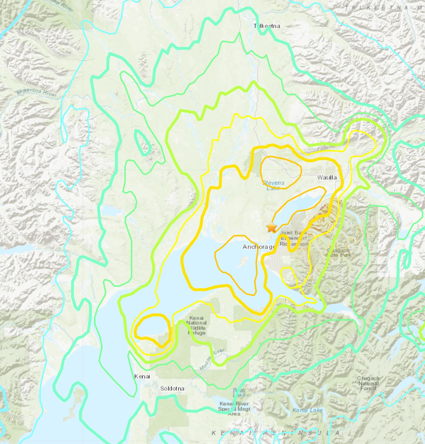
USGS map of landslide potential from the M=7.0 Alaska earthquake
.
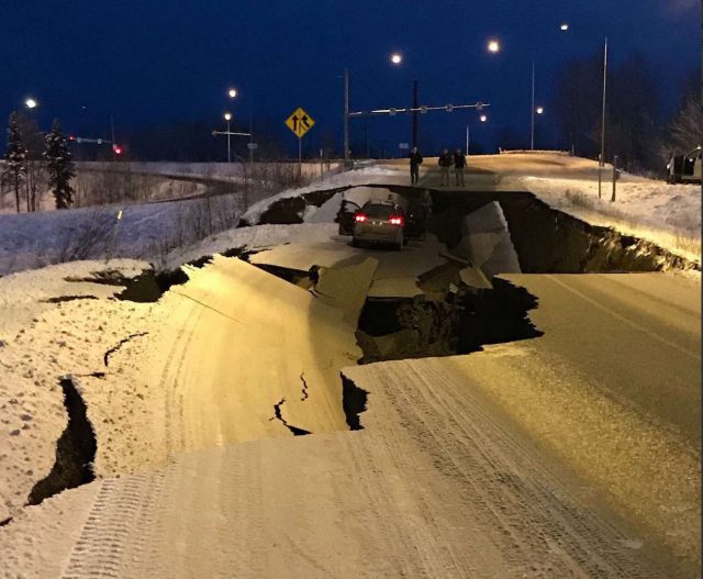
There may be some landslides to the east of the epicentre in the rugged terrain there. Some images of slope failures have started to emerge though. @AOC-Security has tweeted this image of a lateral spread affecting a road embankment on Vine Road in Wasilla:-
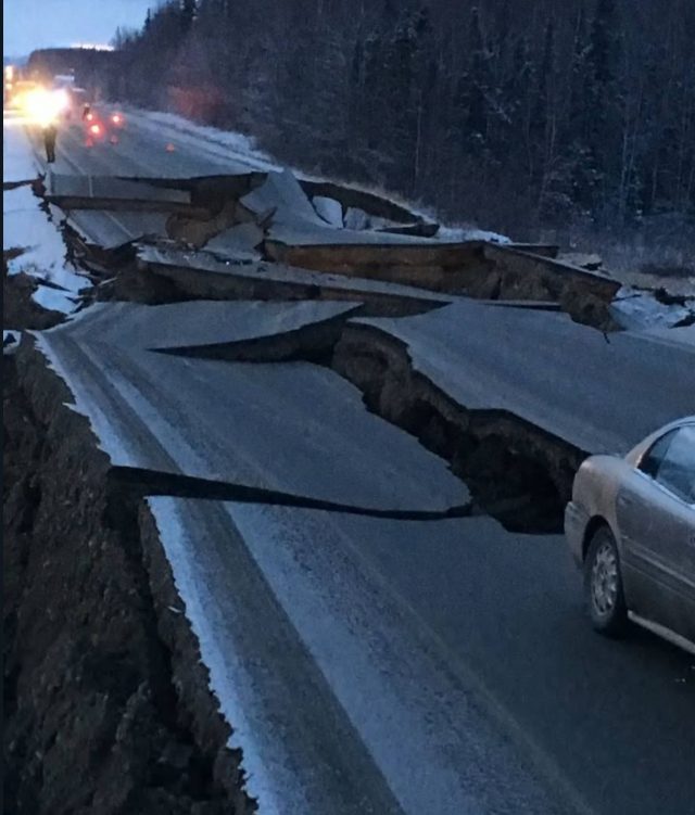
An apparent lateral spread, triggered by the Alaska Earthquake affecting Vine Road in Wasilla . Image tweeted by @AOC-Security
.
Meanwhile David Ruffini has tweeted an image of the same feature in daylight:-
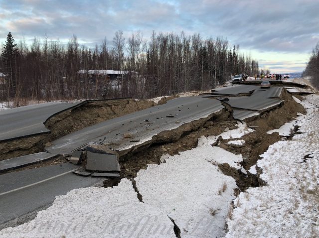
An apparent lateral spread, triggered by the Alaska Earthquake affecting Vine Road in Wasilla . Image tweeted by David Ruffini.
.
This lateral spread has been caught in a spectacular airborne image by Marc Lester:-
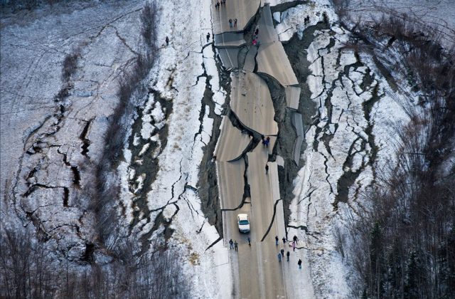
A sensational image by Marc Lester showing a lateral spread triggered by the Alaska Earthquake.
.
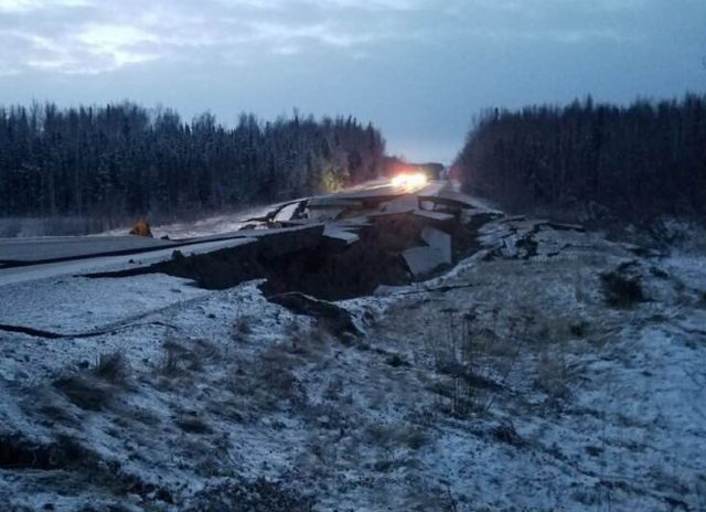
Josh Bierma tweeted an image of another apparent lateral spread affecting a road:-
A lateral spread, triggered by the Alaska earthquake, affecting a highway. Image tweeted by Josh Bierma
.
That event could have been far worse for the occupants of the car. And Ryan Hobbs tweeted an image of yet another such lateral spread affecting a highway:-
A lateral spead triggered by the Alaska earthquake. Image tweeted by Ryan Hobbs.
.
Ryan Hobbs has also tweeted an image of rockfalls affecting a road in the earthquake affected area:-
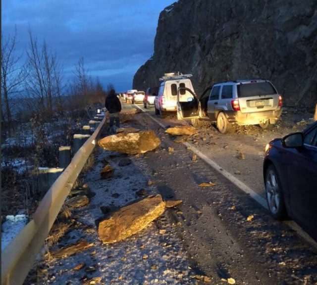
Rockfalls triggered by the Alaska earthquake. Image tweeted by Ryan Hobbs.
.
 Dave Petley is the Vice-Chancellor of the University of Hull in the United Kingdom. His blog provides commentary and analysis of landslide events occurring worldwide, including the landslides themselves, latest research, and conferences and meetings.
Holy Shit
Incredibly!
https://twitter.com/twitter/statuses/1068772123127222272
This is probably the wrong place to drop this short video, but I think you might be interested in a random rockfall.
Thank you for these images. The lateral spread in Wine road seems to have also a rotational component that probably gave rise to its circular shape, well caught by airborne image. Lat spread should have rotated from the right of the airborne image, causing compression on the left. Have you the same impression?
Do you have any info about the nature of the terrain?
Can permafrost play a role in such kind of phenomena?
The USGS has an excellent summary page for the seismic data from the event here:
https://earthquake.usgs.gov/earthquakes/eventpage/us1000hyfh/executive
Because it happened so close to a large population centre, many seismometers picked up the event. Most registered in the 0.3g to 0.4g range, though one outlier recorded almost 2g.
Of particular interest is that the USGS, in addition to their fatalities and damage estimating tools, now also has tools to estimate landslide and liquefaction occurrence for a given earthquake as well. These seem like very useful tools for emergency response planning.
This is so scary for the people in Alaska. I hope everyone is going to be ok.
How do you begin to fix the roads?
It’s mostly marsh. No permafrost thos far south .