23 May 2018
News and satellite imagery of the Hidroituango dam site
Posted by Dave Petley
Satellite imagery of the Hidroituango dam site
Today’s news from the Hidroituango dam site is that the crest of the dam has now reached the spillway level, meaning that the water level can be controlled from this point onward. That greatly reduces the risk, such that the crisis should now start to abate. Of course the problems will leave a legacy of severe damage, but hopefully that can be repaired. At the moment 26,000 people remain displaced by the emergency.
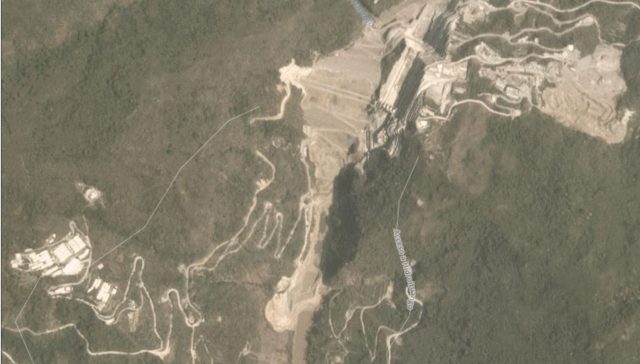
Meanwhile, Planet Labs has collected imagery of the site throughout, which provides significant insight into the problems. So lets start with an image collected on 26th March:-

Planet Labs image dated 26th March 2018 showing the Hidroituango dam site
.
The dam can be seen at the top of the image. At the bottom the river can be seen. The location at which it has been blocked, and this is flowing into the tunnels, is clear. Now lets hop forward to 8th April 2018:-

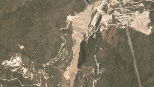
Planet Labs image dated 8th April 2018 of the Didroituango dam site.
.
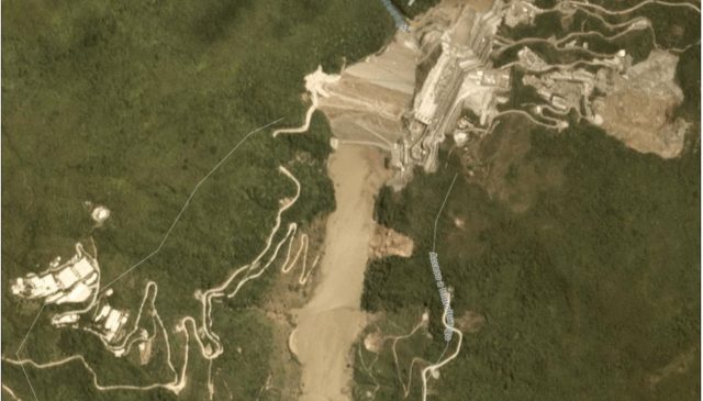
The major change is that impoundment has commenced, and the water level behind the dam is clearly rising. The first sign of a problem appears on 2nd May 2018, but is better captured in this image dated 7th May 2018:-

Planet Labs image dated 7th May 2018 of the Hidroituango dam site.
.
The major issue is the crater that has formed above the tunnel that was being used to control the water flow. This crater can be clearly seen just to the right of the lake at the bottom of the image, partially destroying a track with switchbacks. It appears that the tunnel collapsed, creating the blockage and this surface feature. Note also the significant landslide on the same side of the lake, presumably caused by the rising water level.
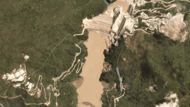
By 17th May the water level has risen so much that the crater has been drowned.

Planet Labs image dated 17th May 2018 of the Hidroituango dam site.
.
It is also possible to see the water being discharged at the foot of the dam.
Reference
Planet Team (2018). Planet Application Program Interface: In Space for Life on Earth. San Francisco, CA. https://api.planet.com


 Dave Petley is the Vice-Chancellor of the University of Hull in the United Kingdom. His blog provides commentary and analysis of landslide events occurring worldwide, including the landslides themselves, latest research, and conferences and meetings.
Dave, could it be posible to have access to the images in high resolution?
[Please contact me directly. D.]
I now have my account in Planet Labs!
We are really interested in this kind of information, could you be send us, thanks a lot for your support dave
Are there any current lake statistics as are available at DWR California for Oroville Dam? There are live cams of Oroville Dam and the reconstruction of the damaged spillways. The people insisted on it I assume.