1 March 2018
Planet Labs imagery of the Pasir Panjang landslide in Indonesia
Posted by Dave Petley
Planet Labs imagery of the Pasir Panjang landslide in Indonesia
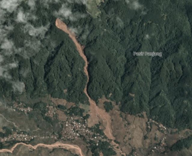
Planet Labs have now managed to capture good quality satellite imagery of the Pasir Panjang landslide in Brebes, Indonesia, which killed 18 people last week. Drone footage had indicated that the landslide had a channelised component, but the source was unclear. This Planet Labs image was captured at 02:29 UTC on 27th February. It includes the entirety of the landslide:

Planet Labs imagery of the Pasir Panjang landslide in Indonesia. Image used with permission of Planet Labs
.
The source of the landslide appear to be quite a large slide – the length is about 200 m and the width about 100 m. There is a long channelised component – well over 1 km – before the landslide emerged into open topography and spread across the fields. There is perhaps a hint of bedrock in the north west corner of the source area, perhaps suggesting a dipslope failure or one that has occurred on the bedrock regolith interface.
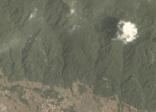
For comparison, this is a Planet Labs image of the same area before the landslide:-

Planet Labs image of the area of the Pasir Panjang landslide in Indonesia. Image used with permission of Planet Labs.
.
These images serve to illustrate how difficult it is to determine the likely impact of landslides in upland, forested areas. Note that in this case the landslide was not associated with deforestation or a change in land use, as was noted by the local authorities. Landslides are the dominant erosive process in this type of landscape, and they occur naturally. In this case the town was located away from the path of the flow, which reduced the losses. The images suggest that there are other communities that are located in the path of potential flows down other gullies.
Reference
Planet Team (2017). Planet Application Program Interface: In Space for Life on Earth. San Francisco, CA. https://api.planet.com


 Dave Petley is the Vice-Chancellor of the University of Hull in the United Kingdom. His blog provides commentary and analysis of landslide events occurring worldwide, including the landslides themselves, latest research, and conferences and meetings.