23 December 2017
Villa Santa Lucia rock avalanche – images of the source zone
Posted by Dave Petley
Villa Santa Lucia rock avalanche – images of the source zone
Over the last few days images have become available of the source zone of the Villa Santa Lucia rock avalanche, which struck southern Chile last Saturday. These include several images of the hillside prior to failure, most notably eight images tweeted by @OldClimber2 that provide views of the scarp area taken in April 2017. This image shows the crown of the scarp, which displays large tension cracks and a fractured rock mass:-
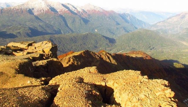
The crown of the source artea of the Villa Santa Lucia rock avalanche. Image via @OldClimber2 on Twitter.
.
Whilst this image shows the deposit in the valley below, which was probably a mixture of colluvium and moraine (others will be able to judge this better than can I).
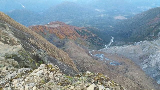
The deposit below the scarp of the site of the Cilla Santa Lucia rock avalanche in Chile. Image via @OldClimber2 on Twitter
.
Meanwhile, @Sub_Interior have tweeted images of the site after the landslide. This image shows the landslide scarp:-
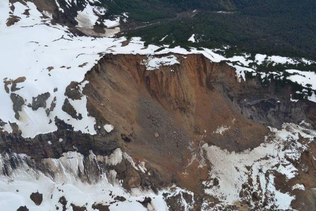
The landslide scarp for the Villa Santa Lucia rock avalanche. Image via @Sub_Interior on Twitter
.
Whilst this image shows the scarp and the start of the debris trail:-
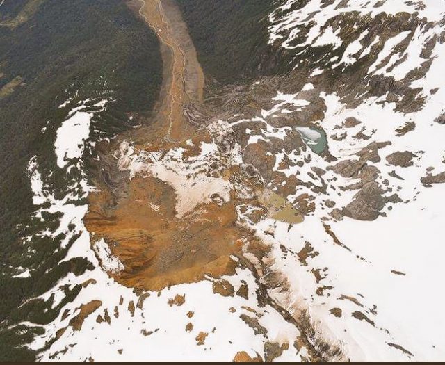
The scarp and debris train from the Villa Santa Lucia rock avalanche. Image via @Sub_Interior on Twitter.
.
Based on this it appears that the landslide consisted of a large volume rock slope failure that collapsed onto the colluvium and moraine at the based at the slope. The images suggest that this the debris at least partially saturated (note the spring within the deposit nprior to failure) and it may also have contained substantial amounts of ice. This deposit has mobilised to form a complex, high velocity rock avalanche / debris flow. This image shows the track of the landslide:-
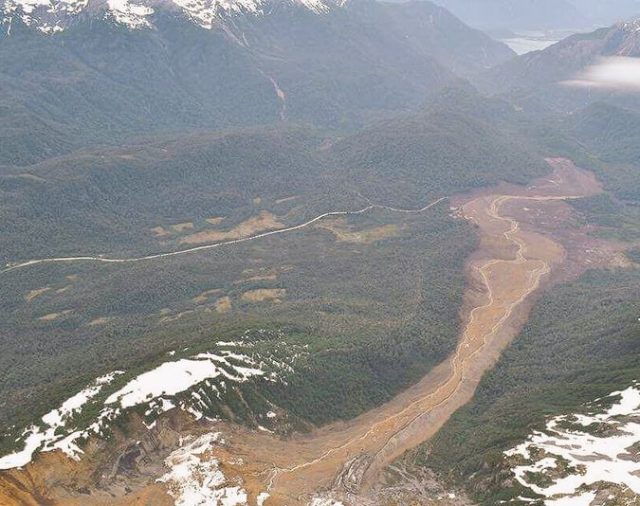
The debris trail from the Villa Santa Lucia rock avalanche. Image via @Sub_Interior on Twitter.
.
The trail suggest a high energy flow. It is a part of this landslide that struck the town of Villa Santa Lucia, with tragic consequences.


 Dave Petley is the Vice-Chancellor of the University of Hull in the United Kingdom. His blog provides commentary and analysis of landslide events occurring worldwide, including the landslides themselves, latest research, and conferences and meetings.
Hi Dave:
There is a 2008 paper, that suggest that Santa Lucia Village was built in an unsafe area:.
Moreno R., Hugo ; Lara P., Luis ; Arenas A., Manuel ; SERNAGEOMIN. Evaluación preliminar de los peligros geológicos en la localidad de Villa Santa Lucía, Provincia de Palena, región de Los Lagos [informe inédito]. [s.l.] : SERNAGEOMIN, 2008. 8 h.: 3 mapas pleg. en bolsillo
http://biblioteca.sernageomin.cl/opac/index.asp?param=o%AD%88%92bh%93%8Cub&Op=3
I haven’t been able to access a copy of the paper.
Further info on the village site:
http://www.latercera.com/noticia/desastre-evitable-estudio-2008-advirtio-del-peligro-la-villa-santa-lucia/
Cheers,
lynn
I’ve wrote a bit about my interpretation (glacial geomorphologist) of some of the aspects of the event on my personal blog: https://www.scottareynhout.com/blog/2017/12/26/aluvion-yelcho
There appears to be intact snowfield between the two slides. Unless the upper slide debris vaulted over the intervening snow, maybe only the front was involved in the disaster. Earlier Google photos suggest pre-existing benchy topography/slide scarps in this lower area. Maybe these are two close, but unrelated slides?
[No I don’t think so. My interpretation is the snow is an indication of a slumped / rotated block, which has brought the snow down with it. This might be a retrogressive phase of the failure (i.e. another block same off first) or it might be that this block generated the liquefaction in the sediments that then formed the flow. I don’t think two separate landslides meets Occam’s Razor. D]