
27 September 2017
Heifangtai terrace: spectacular loess flowslides in Gansu Province, China
Posted by Dave Petley
Heifangtai terrace: a location of spectacular loess flowslides
Loess, a windblown silt deposit, mantles about 6% of the land area of China. As I have noted previously, these thick loess deposits generate some of the most spectacular landslides on earth because of their potential to undergo fluidisation, allowing landslides to transition into highly destructive, long runout flowslides. In a recent paper published in the journal Engineering Geology, Qi et al. (2017) describe loess landslides on the Heifangtai terrace, which is located at the confluence of the Yellow River and the Huangshi River in Gansu Province, northwestern China. This terrace, which is located at 36.0916, 103.3089 if you want to take a look, has a cap of about 26-48 metres of loess. It is both populated (primarily by people relocated from the site of a hydroelectric plant) and irrigated. Qi et al. (2017) describe 17 loess landslides on the margins of the terrace – you can see many of these in the Google Earth image below:-
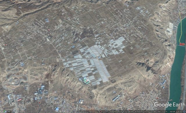
Google Earth image of the Heifangtai Terrace in Gansu, China
.
Qi et al. (2017) highlight in particular a pair of landslides that have developed in the Moshi Gully on the flanks of the terrace between 2004 and 2013. This image shows the site of these two landslides, on the southern edge of the terrace, in December 2004:-
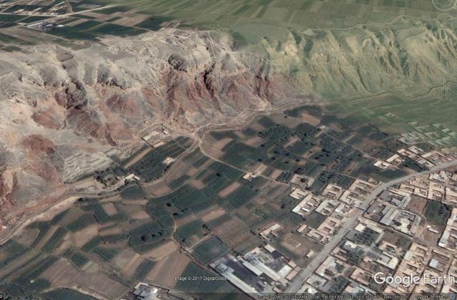
Google Earth image of the site of the landslides on the edge of the Heifangtai Terrace in 2004
.
By November 2012 notable instability had started to develop at two sites on the terrace edge. I have marked the headscarps of the two landslides. At this stage the landslides appear to have low levels of mobility:-
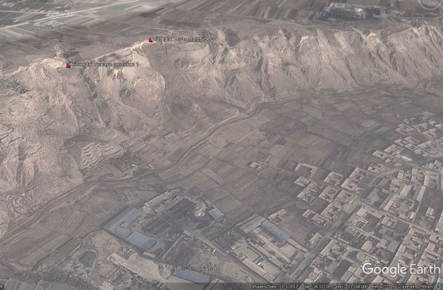
Google Earth image from November 2012 showing the two landslides on the Heifangtai Terrace.
.
By February 2015 one of the two landslides, the one further from the camera, had developed significantly. As Qi et al. (2017) note, this slide had shows retrogression of the headscarp and had started to develop a clear flow-type structure. Note though that the mobility is still low:-
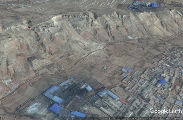
Google Earth image from February 2015 showing the two landslides on the Heifangtai Terrace.
.
But by September 2015 the landslides have changed dramatically:-
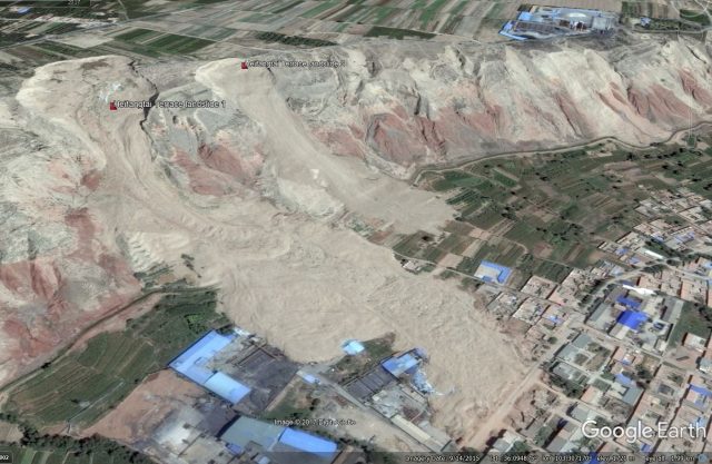
Google Earth image from September 2015 showing the landslides on the Heifangtai Terrace.
.
Both slides have failed spectacularly, with the one in the foreground in particular showing very high mobility and extreme retrogression. Qi et al. (2017) report that this landslide occurred in a two stage process in April 2015. The first failure, involving 80,000 m3, occurred on 29th April 2015 at 7:50 am. The second happened about three hours later in three distinct phases. The landslide travelled almost 800 metres.
The most recent image, from May 2017, shows that this landslide has undergone little change, but the other has suffered a further failure event:-
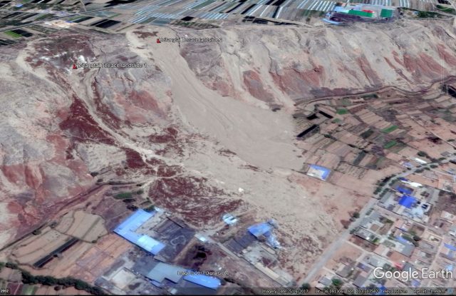
Google Earth image from May 2017 showing further landslide activity on the Heifangtei Terrace
.
Worryingly, landslide activity is clearly developing on other sections of the terrace edge.
Reference
Xing Qi, Qiang Xu and Fangzhou Liu 2017 Analysis of retrogressive loess flowslides in Heifangtai, China. Engineering Geology.
 Dave Petley is the Vice-Chancellor of the University of Hull in the United Kingdom. His blog provides commentary and analysis of landslide events occurring worldwide, including the landslides themselves, latest research, and conferences and meetings.
The major change visible on Google Earth, that may be related to the sudden increase in activity, is the construction of a road along the scarp prior to 2014; the subsequent headscarp retreat has rendered it unusable.