2 May 2016
The location of the Kyrgyzstan loess landslide, as caught on that amazing video
Posted by Dave Petley
The location of the Kyrgyzstan loess landslide
The mainstream media has not really caught up with the Kyrgyzstan loess landslide as yet (it is only a matter of time I suspect – it has to be worth a shock-horror headlline in the Daily Mail, surely?), although a news report is now available on the Cihan website. Sadly it provides no additional information. As a reminder this is the video:
.
The original text on Youtube described the location as follows:
“Uch-Chat Pasture located nearby the village of Almaluu-Bulak in Jalal-Abad region”
Google Maps locates Almaluu-Bulak at 41.144 N, 73.022 W. On that basis I think the most likely location is shown in the Google Earth image below:
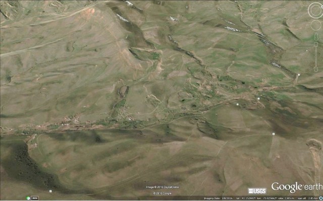
Kyrgyzstan loess landslide location, via Google Earth
.
The valley that best seems to fit the video is this one, also from Google Earth:
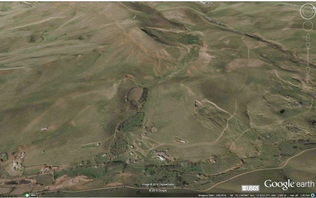
The valley that possibly generated the Kyrgyzstan loess landslide, via Google Earth
.
If so I believe that this would be the slope that generated the landslide. Note the small slip in the lower part of the slope, and the other adjacent landslides (of which more below):
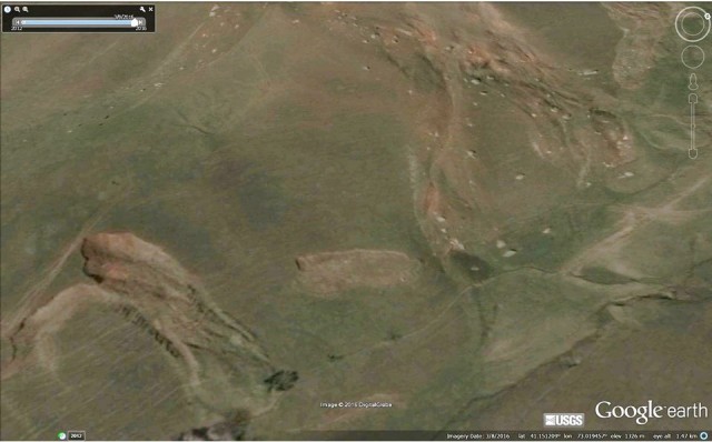
The slope that may have generated the Kyrgyzstan loess landslide, via Google Earth
.
This little corner of Kyrgyzstan has an extraordinary range of landslides. This is a Google Earth image of the wider area. The valley containing the most recent landslide is in the upper left corner of the image:
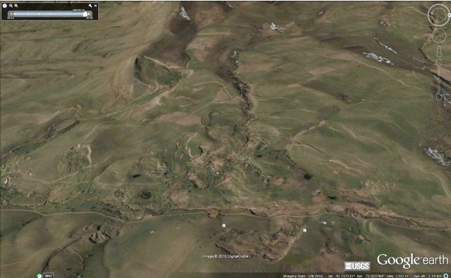
The area around the Kyrgyzstan loess landslide, via Google Earth. Note the extraordinary range of landslides in this area
.
Whilst some of these landslides seem to have had a high level of mobility, they do not appear to have been as mobile as the one last week. In the next valley over lies the set of landslides shown below. The one in the centre of the image has also shown a very high level of mobility. Note the house built right in the middle of the landslide deposit, which goes beyond the road. The smaller landslide on the left has also moved a significant distance:
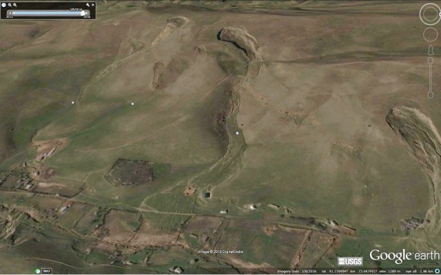
High levels of mobility demonstrated by other landslides close to the Kyrgyzstan loess landslide, via Google Earth


 Dave Petley is the Vice-Chancellor of the University of Hull in the United Kingdom. His blog provides commentary and analysis of landslide events occurring worldwide, including the landslides themselves, latest research, and conferences and meetings.
More videos, if you don’t already have them:
http://www.youtube.com/watch?v=3y3dAu6ogmY
http://www.youtube.com/watch?v=7IEJNUGF6tU
http://www.youtube.com/watch?v=J7jWmdN9vkc – a panorama from atop part of the slide itself.