
4 March 2016
Kalimpong Day 2: landslides on the eastern face
Posted by Dave Petley
Kalimpong Day 2: landslides on the eastern face
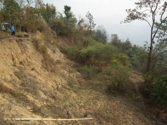
Day 2 of the SHAMROCC field visit (day 1 is here) involved a tour, ably guided by Wing Commander Praful Rao, of landslides on the eastern face of Kalimpong. It soon became apparent that this is a very landslide-prone area, and that many of the slides are large and active. For example, this road crosses a big creeping landslide complex, as the image below shows:
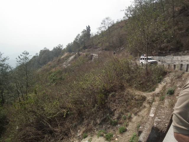
Kalimpong Day 2: An example of a landslide on the eastern face
.
I took the image above from a bridge over a culvert that marks the lateral slip plane of the landslide, which extends right across the image above. This culvert showed some interesting signs of mass movement problems, with evidence of both movement across the structure and the impact of debris flows that have come down the channel. For example, one of the steel joists supporting the bridge deck has been broken and displaced by an impact event. Note also the large cracks in the abutment – this is the landslide side of the culvert. Finally, note the pile of construction waste dumped under the bridge. This is simply bad practice that can only lead to further issues downstream:
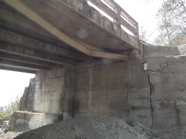
Kalimpong Day 2: damage to a culvert by mass movement events
.
Parts of this landslide are moving quite rapidly. This section of road has both dropped and displaced as a result of movement of the landslide. The deformation in the retaining wall, which has dropped and bulged, is stark:-
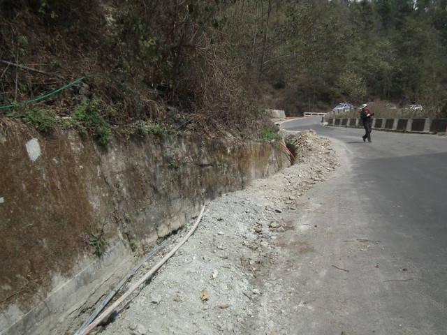
Kalimpong Day 2: deformation in a retaining wall caused by movement of a landslide
.
Further along the road, and down the hill, we came across another large, very active landslide complex. On the face of it this is an idyllic location for a small community:
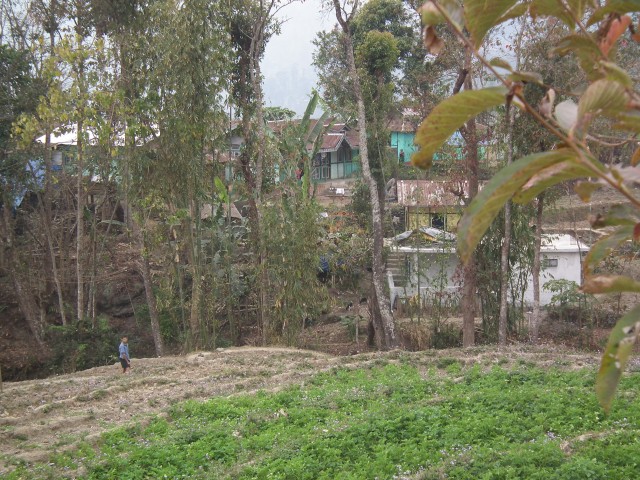
Kalimpong Day 2: An idyllic rural community?
.
However, immediately down slope from the hamlet is the back scarp of a large, expending and dramatic landslide complex. This is a retrogressive block slide – the current block at the crown has displaced about three metres. It cannot be long before the next block slips, at which point parts of the village will be lost. The displaced block is on the right, note how close the house is to the current crown of the landslide:
Kalimpong Day 2: a large displaced block and a threatened house on the eastern face
.
The material that is forming this landslide is interesting – it is clearly not bedrock, but is instead a thick layer of bouldery material that I would probably class as colluvium. My suspicion is that these middle slopes in the Kalimpong area are frequently formed of ancient, dormant landslides. In many places these landslides have been reactivated, and these movements are now threatening the communities that live upon them. In my next post I will show some more, very dramatic, examples. In the meantime of course the situation for this community is desperate. They know that their way of life is endangered by this landslide, but they are powerless to intervene and no-one in government has provided help. Meanwhile, Save the Hills continues to campaign to raise awareness of these hazards and to try to mobilise some action.
 Dave Petley is the Vice-Chancellor of the University of Hull in the United Kingdom. His blog provides commentary and analysis of landslide events occurring worldwide, including the landslides themselves, latest research, and conferences and meetings.