23 December 2015
Videos of the Shenzhen landslide
Posted by Dave Petley

Shenzhen landslide via Xinhua
Videos of the Shenzhen landslide
As questions continue to be asked as to how the Shenzhen landslide, which is now thought to have killed 76 people, can have been allowed to happen, I thought it would be interesting to post a collection of videos of the landslide. Remarkably, one survivor was recovered today, and is expected to survive. Another man was recovered shortly afterwards, but died after being rescued. It is rare for people to be recovered from a landslide so long after the event.
Some of the most dramatic footage is of buildings being impacted by the Shenzhen landslide and then collapsing. The relentless power of the landslide is quite notable:
.
A different view captures both the advance of the landslide and the explosion of the major gas pipeline that was ruptured by the landslide:
.
This video captures additional footage of the exploding gas main and the landslide impacting the various buildings:
.
I have seen some discussion as to what this represents. I suspect it is simply that the pipeline had ruptured and a large volumes of gas was escaping. However, the landslide continued to move, so debris continually covered the ruptured pipe, causing the gas to burst through the sediment, creating this remarkable fountaining effect.
And this drone footage shows the aftermath of the landslide. The only mercy here is that the slide occurred on a Sunday, when the buildings were probably less densely occupied. If it had occurred on a work day then the losses could have been much worse:-
.
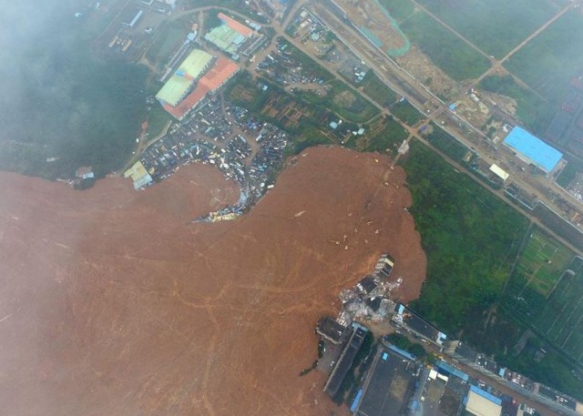
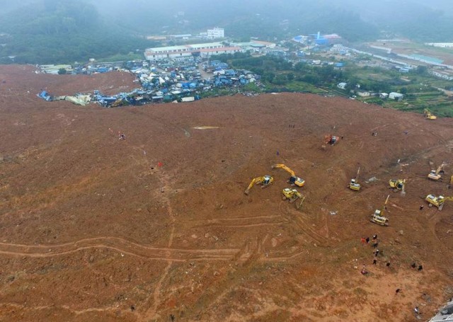
I remain intrigued by the material that forms this landslide. It has been repeatedly described as construction waste, but it is clearly not formed from demolished buildings. Indeed to me this looks to be excavated soil and weathered rock – take a look at the image below and the one at the top of the page:

Shenzhen landslide via Xinhua
.
If I was investigating this landslide I would want to identify the very large excavations that must be ongoing in the city, or the surrounding area, to generate this amount of spoil. Interestingly, it appears that Shenzhen is extending its underground light rail system at present, with 87 km of new track. There has been some speculation that the two events might be connected, but I have no evidence at all to link them.
Finally, the very best collection of images that I have seen of the landslide are on the Getty News website, including a stunning aerial image looking along the length of the landslide. I cannot reproduce the image here, but it is worth a look on their website.


 Dave Petley is the Vice-Chancellor of the University of Hull in the United Kingdom. His blog provides commentary and analysis of landslide events occurring worldwide, including the landslides themselves, latest research, and conferences and meetings.
I have managed to locate the slide source to a old quarry (22.712073°N 113.934279°E) that appears, according to Google Earth historical photography, to have been active between about 2000 to 2008. The original quarry was about 500m long by about 280m wide with a low entry point on the north side. Between 2010 and 2012 spoil material was dumped from a stack starting from about 160m east of the edge of the quarry working back towards and into the quarry, this material looks like it is being placed much higher than the original edge of the quarry. A photo from 2013 shows the spoil dump largely revegetated and the remaining base of the quarry filled with water. Two photographs from 2015 show a wet/sloppy material dumped from the eastern margin covering most of the old quarry with a drier(??) material being placed over the top starting from the northern end. The last photo from April 2015 shows a location that a pond could form in the southern part of the partially filled quarry that is about 5 hectares in area.