
12 May 2015
Sorkjosen (Sørkjosen) in Norway – an unusual underwater landslide
Posted by Dave Petley
Sorkjosen (Sørkjosen) underwater landslide
Away from Nepal for a moment, a very interesting landslide occurred at the town of Sorkjosen (Sørkjosen) in Finnmark, Norway on Sunday. This appears to be the location as shown on Bing Maps:
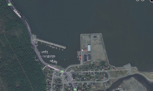
Sorkjosen (Sørkjosen) – Bing Maps
.
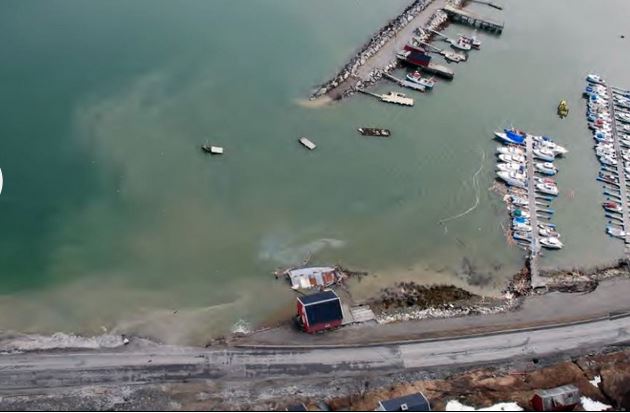
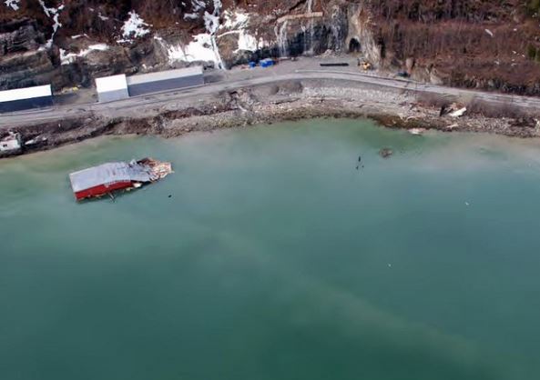
There is a good archive of images of the aftermath of the landslide on the NRK.no website (the article is in Norwegian):-
NRK.no
.
NRK.no
.
The landslide appears to have taken out an area of fill on the edge of the fjord and a large part of the jetty, plus some buildings, though fortunately no houses. If you compare the photographs with the Big Maps image the size of the Sorkjosen landslide becomes apparent. The timing of the landslide, in the early hours, meant that none of the buildings were occupied. The landslide has also effectively cut Norway in half as the highway through the town – the E6 road – has been closed. The diversion route is 700 km long via Finland (see this translation of the Norwegian article).
Interestingly, the images suggest that close to the crown of the landslide there was a large ongoing construction project on the highway, including the construction of a new tunnel (as seen in the image above). There is some speculation in the various articles that the landslide might have been associated in some ways with these works. Indeed, this article suggests that local fishermen have been concerned about this site for some time because of the dumping of spoil from the tunnel. The concern now will be to ensure that the landslide is not likely to retrogress and remove the road itself. In the longer term, it will be interesting to find out the causes of the landslide, and the mobility of the slipped mass.
This landslide is quite reminiscent of the Nord-Statland landslide, also on Norway in January of last year.
 Dave Petley is the Vice-Chancellor of the University of Hull in the United Kingdom. His blog provides commentary and analysis of landslide events occurring worldwide, including the landslides themselves, latest research, and conferences and meetings.