
23 February 2015
Fauquier Golf Course – the evolution of a landslide
Posted by Dave Petley
Fauquier Golf Course
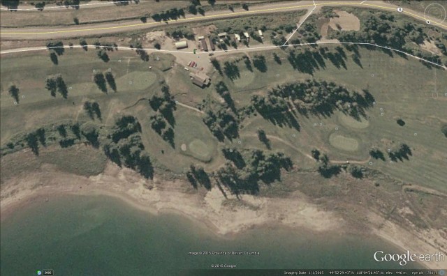
The interesting Fauquier Golf Course landslide, about which I wrote over the weekend, does not appear to be a one-off event, although the most recent movement may well be far more damaging and significant than early events. This Google Earth image is dated January 2005:
Google Earth
.
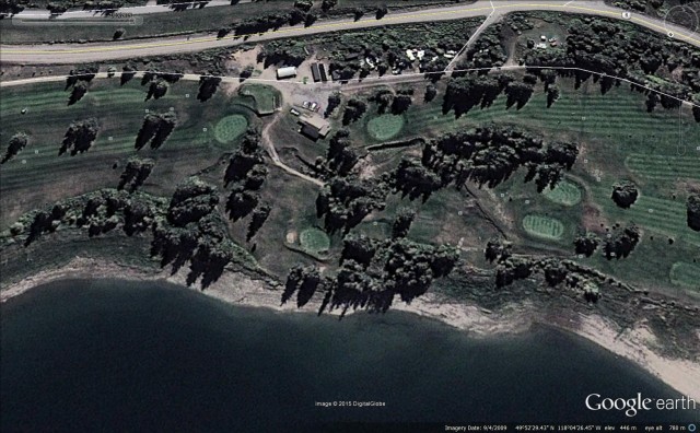
Note the linear features running sub-parallel to the shoreline just below the clubhouse. These appear to me to be tension cracks and rear scarps. The other (less good) Google Earth image is from April 2009. Take a look at these features in this image:
Google Earth
.
The low sun angle does exaggerate the effect, but it is clear that four years on the landslide had developed substantially. The tension cracks and rear scarps below the clubhouse had become larger and more pronounced, and they had extended down towards the shoreline, especially on the right hand side. The landslide block is very clearly delineated.
Some of the Panoromio photographs give the game away. This one, by Kuschk, is entitled “Hill slumping on hole no. 4, Fauquier & District Golf Club”. It was taken in June 2010, and does very clearly show very large, fresh scarps:
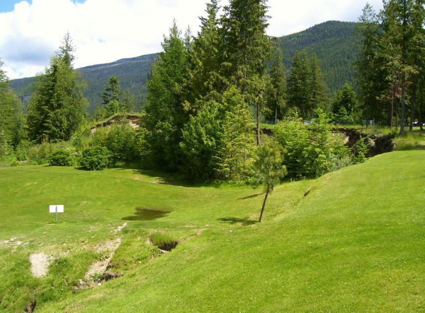
“Hill slumping on hole no. 4, Fauquier and District Golf Club” by Kuschk via Panoramio
.
Whilst this one, by the same person, shows one of the tension cracks and scarps that has extended across the fairway:
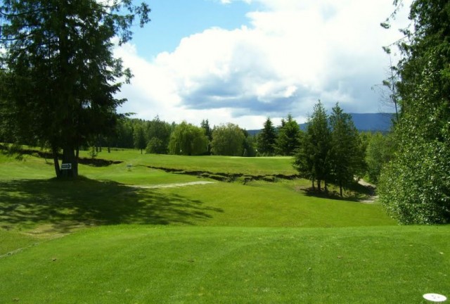
“Hole no. 4, Fauquier and District Golf Club” by kuschk via Panoramio
.
As is so often the case, this landslide event has been developing over a decade or more.
 Dave Petley is the Vice-Chancellor of the University of Hull in the United Kingdom. His blog provides commentary and analysis of landslide events occurring worldwide, including the landslides themselves, latest research, and conferences and meetings.
Around the same time, there was a significant slump of a section of highway just across the lake:
http://www.cbc.ca/news/canada/british-columbia/mudslide-closes-highway-6-in-west-kootenay-south-of-nakusp-1.2961829