
4 December 2014
The Domkar Monastery landslide: the (non-)evolution of a failure
Posted by Dave Petley
Domkar Monastery
Yesterday I highlighted the very large Domkar Monastery landslide in Tibet, which failed in a somewhat spectacular manner last month. I have managed to track down a good image of the slope that failed, from the Tibetan Trekking website:
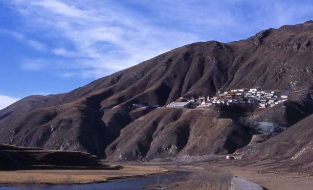
From Tibetan Trekking
.
It is not clear to me whether this mass is loess or an old landslide body – I am still tending towards the former, but it could be the latter. The failed body has deeply incised drainage lines on each side, but little sign of erosion or excavation at the toe.
It is quite interesting to look at the Google Earth archive imagery of the site, taken from a perspective view. This is November 2007:
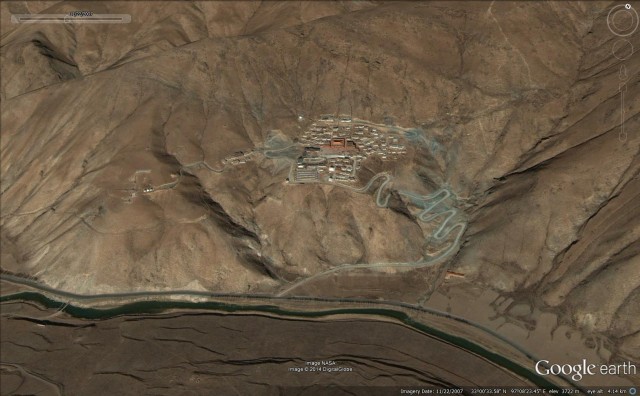
November 2007 from Google Earth
.
This is May 2009 (in black and white):
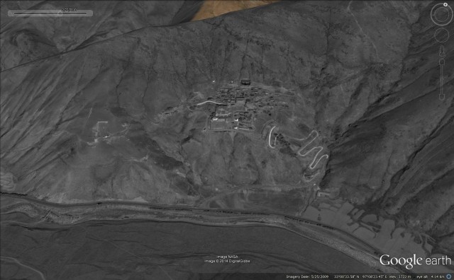
May 2009 from Google Earth
This is November 2010, which post-dates the April 2010 Yushu earthquake that affected this area and damaged the monastery:
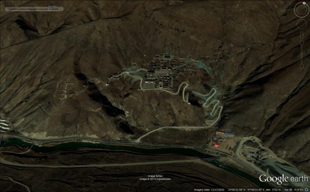
November 2010 from Google Earth
.
The most obvious change is the development of works beside the road in the bottom right hand corner of the image – I wonder what this is? But the remarkable thing is that there is really no sign in these three images of the development of the landslide except perhaps that the rear scarp formed along the line of the track at the rear of the settlement. Even after the 2010 earthquake the landslide does not seem to have progressed, although it would be interesting to see an image from earlier this year. But from these images there is little sign that an incipient collapse was developing. I suspect that this supports the notion that this is a loess failure – loess can be a collapsible material, which means that it can be subject to rather spectacular landslides.
 Dave Petley is the Vice-Chancellor of the University of Hull in the United Kingdom. His blog provides commentary and analysis of landslide events occurring worldwide, including the landslides themselves, latest research, and conferences and meetings.