18 August 2014
Sunkoshi landslide: another update
Posted by Dave Petley
Sunkoshi landslide
ICIMOD has released a report about the Sunkoshi landslide, which has been reported in The Himalayan Times. The most interesting aspect may be some statistics on the landslide, which appeared in a tweet by Kanak Mani Dixit, which said:
ICIMOD collation re Sunkosi landslide: dam length 409m, width 106m, height 55m, volume/material: 6mill m3, lake length 3km, volume 8mill m3.
— Kanak Mani Dixit (@KanakManiDixit) August 18, 2014
.
These statistics are in line with those generated elsewhere, but are the first to provide a complete set. The main thrust of the ICIMOD report (which I’ve not seen) seems to be that more investigation of the Sunkoshi landslide itself, and more detailed landslide hazard mapping in general, are required. It is hard to disagree with these suggestions.
Meanwhile, the Nepal Army continue to try to drain the lake, but the degree to which they are being successful is very unclear. There is a profound deficit of reliable information about the state of play at the dam site – over the last two weeks there has been a number of reports that the lake level was falling, all of which have proven to be incorrect. The latest reports, on Sunday, were that:
The water level in artificial lake formed after massive landslide at Jure blocked Sunkoshi River, is gradually decreasing with increase in water outflow from the reservoir after Nepal Army (NA) constructed another channel to drain out dammed water. Decline in water level could be clearly witnessed on Sunday as clouds separated revealing blue sky after three days of torrential downpour came to an end.
According to NA Brigadier General Ashwin Kumar Thapa, the water level has decreased by 75 centimeters after excavators were used to increase water outflow. “The water level in the dam is decreasing at the rate of two centimeters per hour,” he said. He further informed that water inflow in the artificial lake is 180-200 cusec, while outflow of water from the reservoir is 350 cusec. “The current water inflow rate is normal rate for Sunkoshi River during Monsoon,” he said.
During three-days of torrential downpour both water inflow and outflow were high with outflow and inflow rate standing at 330 causes and 530 causes respectively.
But what does this mean? The figures above suggest that during the heavy rainfall the inflow exceeded the outflow, which means that the lake level must have risen. Then, when the rain stopped the inflow reduced to a level below outflow, so the lake level must have fallen. This is quite normal dam hydraulics. A key question is whether the net (i.e. low flow) level of the lake has fallen. The data being provided are not adequate to judge this.
The key to reducing the level of the lake has to be to lower the bed of the channel. Widening the channel, or creating a new one, will make the discharge of storm flow more efficient – i.e. the lake level won’t rise so much in the next heavy rainfall event. But to meaningfully draw down the lake the channel bed has to be lowered. Now this is of course risky – in particular if the bed of the stream is being armoured by large boulders, then these have to be blasted. But, this could be the case that beneath the boulders lie fine-grained deposits that might erode quickly once exposed. So this sort of operation is very sensitive and challenging, and requires high levels of expertise. And this is why I still contend that the Nepal Army should be seeking assistance from groups that have managed these problems before, most notably the Chinese. They might note the speed and efficiency of the operation to drain the valley blocking landslide in Yunnan Province, despite the very challenging access problems.
If the Nepal Army wants to drain the lake then the engineers have to deepen the channel. The challenge is to do this is a safe way. Why not get assistance from the Chinese team whose raison d’etre is to manage valley blocking landslides? After all, China wants this important trade link open too.
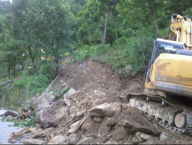
Finally, an additional dimension is the rapidly escalating pressure to reopen the road to Tibet. The Nepal Engineers Association is pressing for concerted efforts to drain the lake and construct an alternative road to bypass the Sunkoshi landslide. In a separate development, a group of local entrepreneurs have started to construct a new alignment with a bulldozer:
Whilst I can understand the frustration that is driving this, the track shown above is both environmentally catastrophic and a recipe for further landslides. It seems unlikely that it is a sustainable solution.


 Dave Petley is the Vice-Chancellor of the University of Hull in the United Kingdom. His blog provides commentary and analysis of landslide events occurring worldwide, including the landslides themselves, latest research, and conferences and meetings.