2 August 2014
Sunkoshi in Nepal: a valley blocking landslide crisis
Posted by Dave Petley
Sunkoshi landslide crisis
Now updated – see additional text at the end of this post
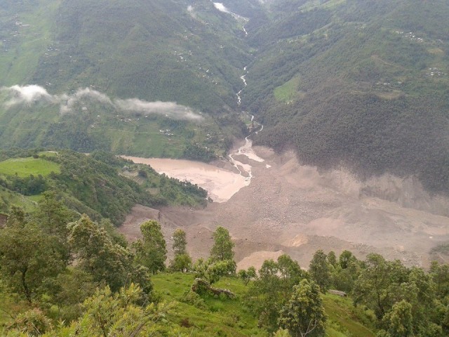
Overnight a very large landslide occurred on the banks of the Sunkoshi River in northern Nepal. This landslide has created an instant, large-scale crisis as it has blocked the river. In Nepal the English language news media is excellent, so there is very good coverage of the event, helped also by the location of the landslide on the main road to Tibet, which facilitates access. The best gallery of images that I have seen is on the Nep Hub website. This is the landslide from the slope above:
.
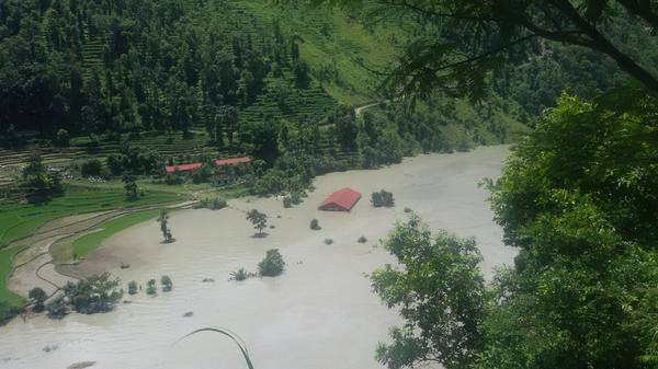
This is the lake that is building behind it:
.
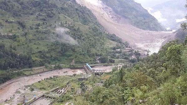
And, from the Only Nepal website, this is a view of the landslide from downstream:
.
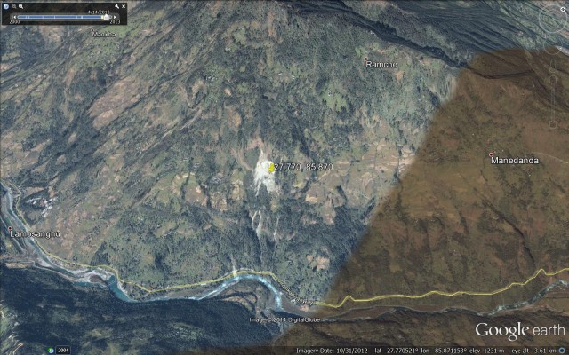
The location of the landslide is 27.770 N, 85.870 E. The Google Earth imagery of the site is excellent:
.
My colleagues and I have been working in this valley on landslides for decade or so, and Katie Oven completed her PhD on landslides in this area. On field trips up the valley we would often stop at Lamusangu to look at the debris flow deposits at this location, so a major landslide in this area is not a surprise. However, it is now a crisis. In the peak of monsoon season the river flow is high, and the images show that the lake is filling quickly. The images suggest that there is no reason to be confident that the dam will not breach rapidly when overtopped – indeed, quite the opposite I think as the length of the dam is not large and the materials appear to be fine grained. A breach now could generate a very large flood; when full the effects could be very serious.
Mitigation is of course to try to drain the lake whist evacuating everyone downstream. The valley is quite densely inhabited because of the road. A secondary hazard is that a major flood might destabilise the walls of the valley triggering further landslides downstream. Whilst the population can be protected with appropriate measures, which need to be implemented very fast, a dam breach flood has the potential to cause major damage. Given that this is the only road north out of Nepal, and the major strategic link to Tibet and China, the impacts on Nepal could be serious in the medium term.
So what to do? Well of course the first measure is to evacuate people downstream, and this has started. The second is to put a warning system in place, probably at this stage consisting of an observation team with appropriate communications. The third will be to start to excavate a channel, which will require heavy machinery.
This is a very difficult problem to manage, so Nepal should seek international help. The best qualified people are the teams that dealt with the valley blocking landslide crisis after the Wenchuan earthquake in China. Given the strategic importance of this road, the Chinese may want to help. However, time is very limited.
Update
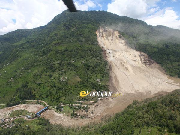
Ekantipur has tweeted the follow image of the landslide:
.
This suggests that an overtopping event is probably very close, and may even have started (see comment below). The priority must be to relocate people away from the valley floor.


 Dave Petley is the Vice-Chancellor of the University of Hull in the United Kingdom. His blog provides commentary and analysis of landslide events occurring worldwide, including the landslides themselves, latest research, and conferences and meetings.
River flow in the upstream of the landslide dam is higher than 150m3/s (http://hydrology.gov.np/new/bull3/index.php/hydrology/station/graph_view?stationId=104&deviceId=91&categoryId=6). Based on this discharge, the volume of upstream lake is about 6 million m3 in 11 hours. According to local reporter, the lake is already initiated overflow after 11 hours and there is still continuous landslide.
Oh my gosh, that’s a massive landslide. I don’t even know if a large retaining wall could’ve stopped it, but it definitely would’ve helped.