13 January 2014
The Dart Valley landslide in New Zealand
Posted by Dave Petley
Dart Valley Landslide
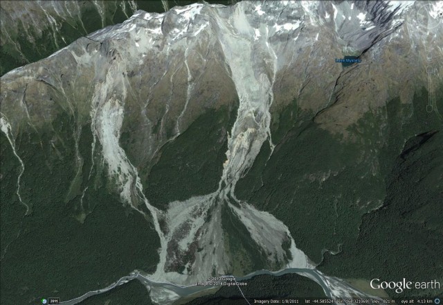
In the last two weeks there has been some interest in New Zealand in a landslide that blocked the Dart Valley on South Island on 4th January, creating a large lake. Initially there was some concern that this landslide dam might suffer a breach event, but fortunately the water overtopped the landslide deposit without a major failure. The landslide is a well-known feature (GNS have a long-standing image of it on their website), situated in the Te Koroka / slip stream area, and located at -44.587,168.332. It is easily identifiable on Google Earth from an image in August 2011:
..
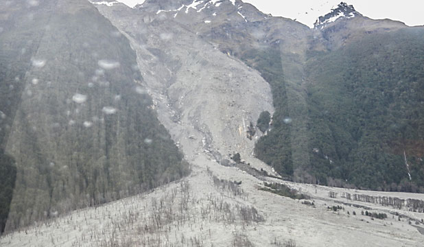
The January 2014 movement event is just the most recent of a succession of landslides at this site – it has even been written up in a GNS Science report (Thomas and Cox 2009), although sadly I cannot find this online. Several news stories have good images of the landslide during this recent event, including this one from The Press:
..
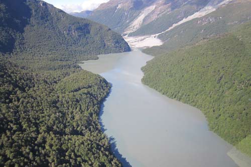
The lake that developed reached a maximum length of over 3 km and is over 20 m deep. Aerial imagery suggests that this is quite an impressive feature:
..
The major impacts of the landslide has been the inundation of a hiking track along the valley, which has now been rerouted, and temporary suspension of jet-boating downstream. The landslide dam is not considered to pose a major risk. However, the silt generated by the erosion of the landslide has also caused the colour of the water in Lake Wakatipu to change to a blue-green colour.
Finally, there is a lovely gallery of images of the landslide and the valley below from two years ago located here, and another one can be found here.
Reference
Thomas, J.S. and Cox, S,C. 2009. 42 years Evolution of Slip Stream Landslide and Fan, Dart River, New Zealand. GNS Science Report Sr 09/43, 32 pp.


 Dave Petley is the Vice-Chancellor of the University of Hull in the United Kingdom. His blog provides commentary and analysis of landslide events occurring worldwide, including the landslides themselves, latest research, and conferences and meetings.