17 December 2013
The 500 cubic kilometre landslide that we all missed – triggered by the Tohoku earthquake
Posted by Dave Petley
The Tohoku Earthquake tsunami
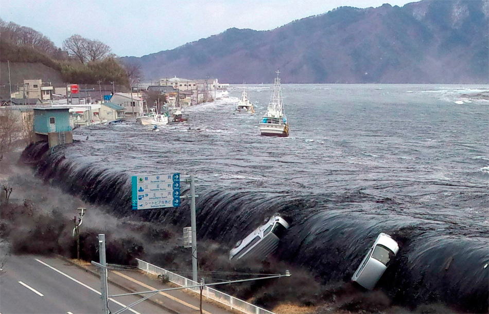
The UK environment research council NERC has a press release out today about work that was presented last week at the AGU Fall meeting in relation to the Tohoku earthquake in Japan. There has been some investigation of the terrestrial landslides triggered by the event, but of course most of the interest has been focused on the tsunami. There has always been something of a mystery about the Tohoku earthquake tsunami, in part because it was so large and in part because its behaviour is a little strange. In particular, the tsunami had two distinct peaks some 20 to 30 minutes apart.
..
A giant submarine landslide
The press release reports on as yet unpublished research that investigated the tsunami using wave buoy data and modelling, demonstrating that the wave cannot be explained by the earthquake alone. This suggests a secondary source – most likely a submarine landslide – the potential location of which they tracked down using the wave buoy data. Dave Tappin of the BGS explains:
‘Using maps of the seabed [I assume this means sonar data], we identified a landslide that was 40 kilometres wide, 20 kilometres long and 2 kilometres thick. That makes it 500 cubic kilometres, so it’s pretty big.’
‘We then used computer models to simulate the tsunami from a dual source; the earthquake and the landslide, and this gave us the high water levels along the north Honshu coast.’
‘An additional check on the landslide source was from an analysis of the wave frequency at the buoys, which showed a high-frequency component that could only be from the landslide.’
This is of course an enormous landslide – the volume is impressive in itself, but a slide with a thickness of two kilometres is genuinely amazing. I am really looking forward to seeing the submarine imagery of this event. The Tohoku earthquake and tsunami killed about 16,000 people and left about 2,700 missing.


 Dave Petley is the Vice-Chancellor of the University of Hull in the United Kingdom. His blog provides commentary and analysis of landslide events occurring worldwide, including the landslides themselves, latest research, and conferences and meetings.
Does this require rethinking of your recent post on the potential for a mega tsunami stemming from a Canary Island landslip/slide?
[No, that a landslide as huge as this generated only a locally-massive tsunami supports the view that the Canary Islands tsunami theory is hugely overblown].
Hi, Any idea how far the landslide was located from the earthquake epicenter?
[No,they haven’t said in the press release for understandable reasons – D]
Not that 500 cubic kilometers isn’t already inconceivably massive, but doesn’t 40x20x2=1600?
[almost certainly the case that 2000 m is the maximum depth, probably averages much less – D]
The 2 distinct surges are clearly evident in some of the videos taken by witnesses of the tsunami. The second surge was far more violent and abrupt than the first and comes on VERY quickly, obliterating everything in its path. The most recent Sunda Strait tsunami and the September 2018 tsunami also had 2 distinct surges and have also been determined to have been influenced by undersea landslides. The topography of the undersea landscape off Japan’s east coast is riddled with steep canyons and a stiff jolt is bound to knock it loose. Hopefully this will eventually lead to a better understanding of the dangers associated with undersea landslides and save lives in future disasters.