
19 October 2013
Aerial images of the Izu-Oshima debris flows in Japan
Posted by Dave Petley
Thanks to @levrem on Twitter (for which I use @davepetley ), my attention has been drawn to an excellent Google crisis map of the Izu-Oshima debris flows in Japan. This site provides both vertical aerial photographs and oblique images of the landslides. So let’s start with an over view of the landslide complex from the crisis map:
 ..
..
Now let’s take a closer look at the source area of the landslides:
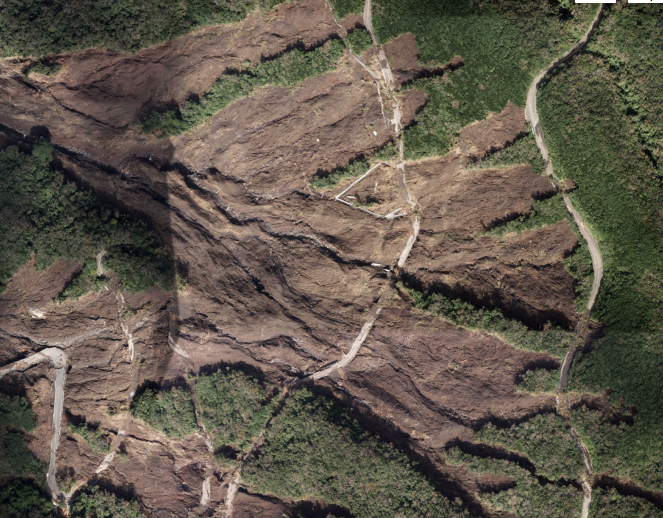 ..
..
The Google Crisis map also has an oblique aerial image of the landslides (and several others):
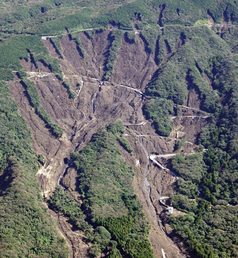 ..
..
Several people have asked why I find these landslides so surprising. It is clear from the images above that this landslide actual consisted of multiple landslide events all feeding into a two distinct major debris flows. This in itself is not unusual. What is surprising here is that these individual landslides have in effect failed the entire hillside – i.e. it is their proximity that I find surprising. There may be a number of explanations – the remarkable rainfall event (total rainfall is reported to have been 824 mm, with a peak intensity of 122.5 mm in an hour), the presence on the slopes of soils formed from volcanic ash, and the presence of the road (the close proximity of the crowns of the landslides and the road at the top of the slope is an interesting aspect of this).
The death toll from the landslides is now 27 people, with searches continuing for those who are still missing. The huge impact of these landslides can be seen by comparing these images, before and after the debris flows:
Before:
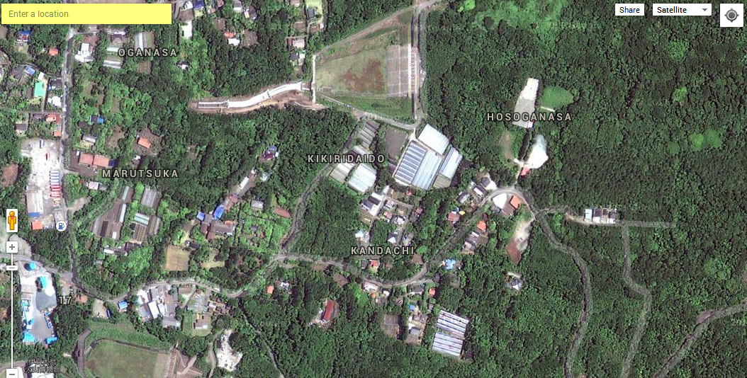 ..
..
And after:
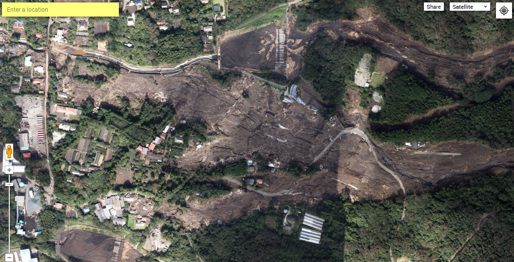
..
Unfortunately this area is likely to get more heavy rainfall in the next few days, and the track of Typhoon Francisco suggests that could also pass close to this area.
 Dave Petley is the Vice-Chancellor of the University of Hull in the United Kingdom. His blog provides commentary and analysis of landslide events occurring worldwide, including the landslides themselves, latest research, and conferences and meetings.
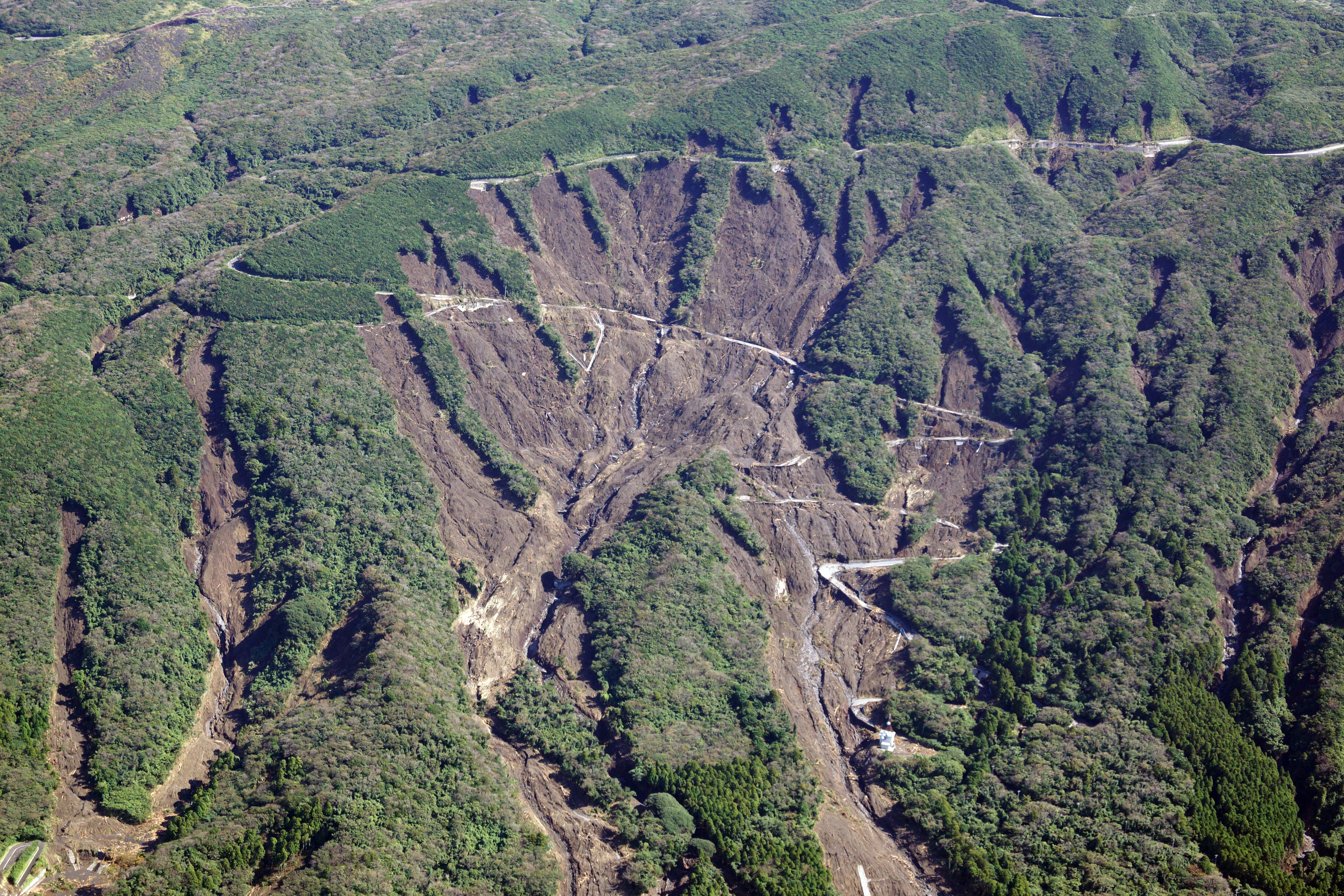