13 May 2013
A very dangerous reservoir bank landslide in China
Posted by Dave Petley
![]() In a technical note that was recently published in the journal Landslides, Zhang et al. (2013) have highlighted a very interesting landslide that is developing on the flanks of the resevoir associated with the Laxiwa Hydropower Station in China. This HEP station consists of the Laxiwa Dam, a very large concrete arch dam in Qinghai Province on the Yellow River, which was commissioned in 2009, and associated reservoir and infrastructure. Construction of the dam has not been completed, but once it is finished it will be 250 m high with a storage capacity of about one cubic kilometre of water.
In a technical note that was recently published in the journal Landslides, Zhang et al. (2013) have highlighted a very interesting landslide that is developing on the flanks of the resevoir associated with the Laxiwa Hydropower Station in China. This HEP station consists of the Laxiwa Dam, a very large concrete arch dam in Qinghai Province on the Yellow River, which was commissioned in 2009, and associated reservoir and infrastructure. Construction of the dam has not been completed, but once it is finished it will be 250 m high with a storage capacity of about one cubic kilometre of water.
Large landslides on reservoir banks are a highly sensitive issue. In 1963 a very large landslide into the Vajont reservoir in northern Italy killed about 2500 people; subsequently, dam builders have taken great measures to avoid a repeat of such a problem. Fortunately, despite very large-scale dam construction over the last 50 years, there has been no large-scale recurrence of the Vajont tragedy. This may well be a combination of good management and a certain amount of luck; many people feel that with the current boom in the construction of large dams we may be pushing this luck to the limit.
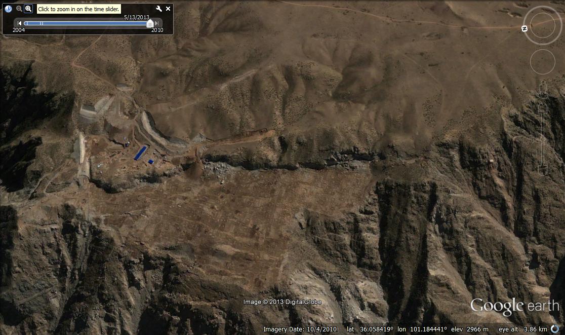
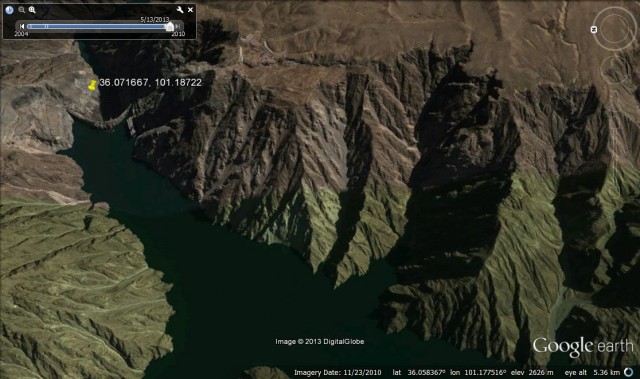
The landslide that Zhang et al. (2013) lies on the flanks of the Laxiwa reservoir, a little way upstream of the dam. The dam itself is readily visible on Google Earth – put 36.071667, 101.18722 into the search location and it will take you there. The landslide is on the south bank about 500 m upstream of the dam – go to 36.0954, 101.185. The slope started to move soon after impoundment was initiative – the Google earth image of late 2010 shows very substantial levels of movement across the newly formed rear scarp:
The sits at the top of the mass that is moving – the unstable block is shown below:
An intial visual inspection of this site rings alarm bells – the landslide is very large, the terrain is steep, and the proximity to the dam means that the wave would not attenuate substantially before reaching the dam. This becomes even more alarming when the detail from the paper is examined. In March 2010 the scarp was about 20 metres high, seven months later it had extended by a further 7 m. Detailed investigations are ongoing, but at the time of writing the slip surface had not been identified. Nonetheless, the estimated volume is about 120 -150 million cubic metres. The study used InSAR data to look at the slope – before impoundment the data suggest that the slope was not moving.
This slope is at best deeply worrying. It is hard to predict future behaviour without much more detailed analyses, but a catastrophic collapse cannot be ruled out. As the paper states:
“Although the precision in the estimation of the landslide volume and the wave height needs to be specified, the possible damage to the dam as well as to the downstream area could be devastating.”
Reference
Zhang, D., Wang, G., Yang, T., Zhang, M., Chen, S., & Zhang, F. (2012). Satellite remote sensing-based detection of the deformation of a reservoir bank slope in Laxiwa Hydropower Station, China Landslides, 10 (2), 231-238 DOI: 10.1007/s10346-012-0378-9


 Dave Petley is the Vice-Chancellor of the University of Hull in the United Kingdom. His blog provides commentary and analysis of landslide events occurring worldwide, including the landslides themselves, latest research, and conferences and meetings.
What an obviously dangerous–and curious!–landslide. Although there are plenty of big, fresh cracks visible along strike and structurally higher than the major headscarp, that big headscarp actually appears to be quite old! The top is highly rounded and there are even channels incised deeply across it! Obviously it’s active and moving now, but it appears that it’s been gradually growing for a LONG time. Or moved just a little bit a long time ago.
With respect to older (inactive) failures, it doesn’t look like the other side of the reservoir is much better. Yikes.