11 January 2013
At least 18 killed in a landslide in China
Posted by Dave Petley
Chinese News agencies are reporting that a landslide overnight buried 16 households in Gaopo Village of Zhenxiong County, in Yunnan Province, China. Whilst estimates vary as to the number of known fatalities, CRIEnglish reports 18 confirmed deaths from a total of 40 people buried in the landslide. On the other hand, China Daily is reporting 16 deaths and 37 people unaccounted for, so it seems inevitable that the fatality count will rise further.
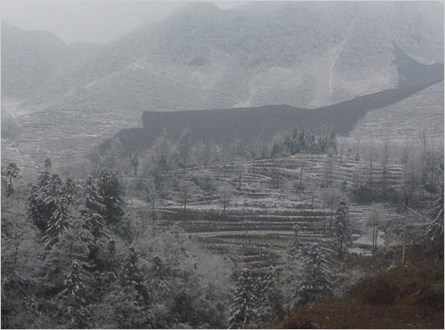
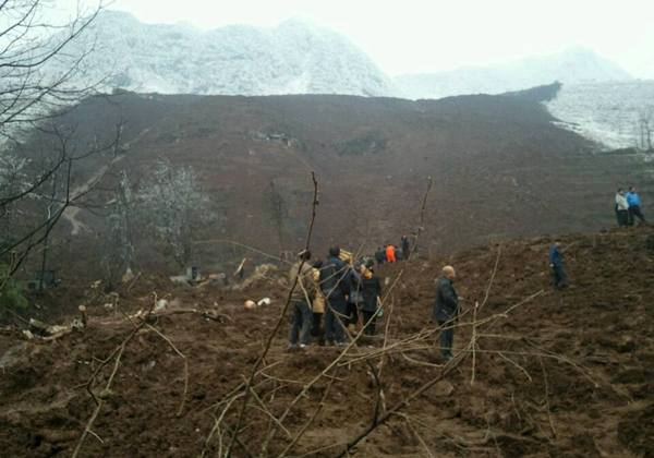
The timing of this event looks interesting and perhaps surprising. The images of the landslide seem to show a thin covering of quite fresh snow, which is not an obvious condition for landslide triggering. The overview image, shown below, is also interesting:
Judging by this image, the landslide was a reasonably rapid flow consisting mainly of mud and soil rather than bedrock:
Whilst it is too early to know for certain, I wonder if even the overview image above might be just the lower portion of a rather larger landslide somewhere in the hills upstream of the village, although I remain confused by the apparent small failure in a bluff on the far right of the first image. This does not on first inspection seem large enough to be the source of this landslide, unless there was a huge amount of entrainment (picking up of debris) along the way. It is all quite strange – an aerial image would be very interesting.


 Dave Petley is the Vice-Chancellor of the University of Hull in the United Kingdom. His blog provides commentary and analysis of landslide events occurring worldwide, including the landslides themselves, latest research, and conferences and meetings.
There is possibility effectively to watch and forecast the different stages of landslide processes by means of geophysical radio wave methods.
The automated system of monitoring, fixing the continuous evolutions of petrophysics parameters of geological environment, up to exceeding of threshold of stability, helps to define character of development and in good time to notify engineering controller’s services about activation of dangerous geological processes for prevention of possible accidents.
They are based on the study (authentications) of dangerous area not on happening deformations and accidents, and on quickly received geodynamic signs.
The monitoring system can give a probabilistic prognosis to the danger of activation of landslide processes from a few days to 1-2 months.
It is qualitatively new approach to identification and the forecast of zones of risk.