2 December 2012
Typhoon Bopha – a very real landslide threat for the Philippines
Posted by Dave Petley
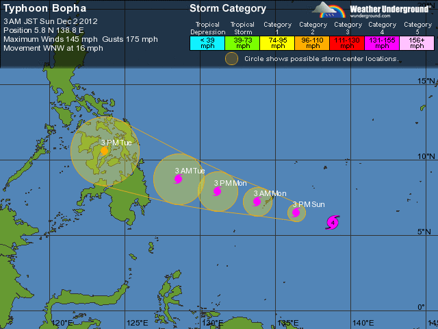
Over the last few days Typhoon Bopha (which is known as Typhoon Pablo in the Philippines) has intensified very rapidly as it tracks westwards. This is an unusual typhoon, in particular in terms of its starting point, which was at about 4 degrees North. Land-falling typhoons in December are also quite unusual (there have only been three since 1978). Usually typhoons start further from the equator than this, because they need a stronger Coriolis force to allow rotation to develop. The typhoon will pass over Palau in the next 24 hours, and then is forecast to track west-northwest to cross the southern part of the Philippines on Tuesday (map from Weather Underground):
.
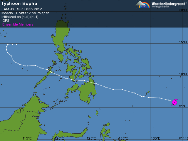
This is will make landfall in the Philippines as a category 3 storm. This is very strong, but not exceptional (the scale goes up to five). However, it is also likely to bring very heavy rainfall, which of course is the potential trigger for landslides, and the Philippines has a long history of devastating landslides from typhoons. The only positive sign is that it does seem to be moving reasonably fast, which typically reduces the rainfall impacts (the biggest problems often arise when the typhoon stalls – i.e. stops moving – which concentrates the rainfall in a smaller area). However, the longer term forecast does seem to show the storm slowing and then stalling to the west of the Philippines, which must be a cause for concern:
.
Last year Tropical Storm Sendong (known locally as Washi) crossed a similar area, also in December, bringing devastation as a result of very serious landslides and floods. Sendong was not as intense as is Bopha, being just a tropical storm as it crossed Mindanao. Whilst there is no way to know what might happen this time, the dangers are very real. There is a very real need to ensure that there is adequate preparation along the potential typhoon track. T


 Dave Petley is the Vice-Chancellor of the University of Hull in the United Kingdom. His blog provides commentary and analysis of landslide events occurring worldwide, including the landslides themselves, latest research, and conferences and meetings.