20 June 2012
Did you see a landslide?
Posted by Dave Petley
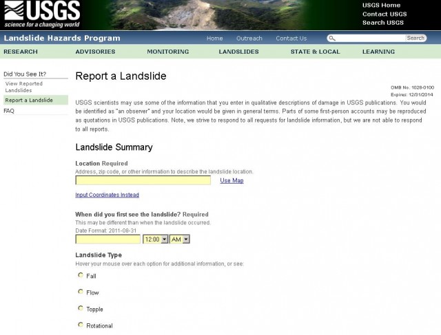
For the last few years seismologists have had considerable success in getting spatial information about earthquakes through web-based initiatives in which users can indicate the magnitude of shaking that they experienced during an event. The two best known examples are the USGS Did you Feel It? and the Geonet (New Zealand) Report an Earthquake initiatives. In landslides there has been some discussion about whether this model could be replicated to start to collect much better information about the spatial distribution of events. It is good to see that the USGS, so often the pioneer in such work, has taken the plunge with the Did You See It? site, in which users can fill in a short form to report a landslide event:
 Inevitably this will take some time to gain momentum, but it is a really great initiative that we should all support if possible.


 Dave Petley is the Vice-Chancellor of the University of Hull in the United Kingdom. His blog provides commentary and analysis of landslide events occurring worldwide, including the landslides themselves, latest research, and conferences and meetings.