2 May 2011
Wildfire at Liathach in Torridon
Posted by Dave Petley
Over the weekend Michele and I popped up to the classic geological area of Torridon in western Scotland to go walking for a few days. We were fortunate to be greeted by glorious weather – the Highlands are hard to beat in such conditions – which was quite wonderful. A remarkable observation was just how dry the ground is at the moment – all of the UK is having a period of exceptionally dry weather that is forecast to persist until late this week at least. Precipitation in the last month has been particularly low, in a month that is typically showery, resulting in very dry conditions underfoot. The consequence in Scotland is that there is a high vulnerability to wildfires as the vegetation dries out. The heather and gorse found in the highlands, and the peat layers that sit below in the valley floors – are quite vulnerable to fires.
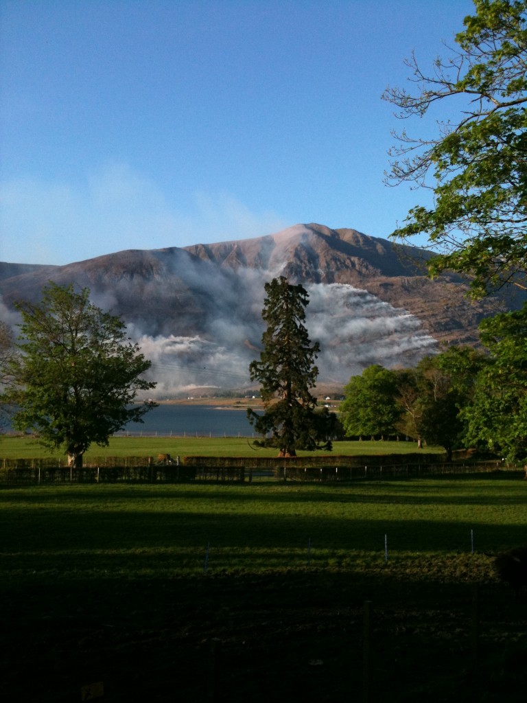
Over the weekend a number of fires broke out across Scotland, and with the weather set fair more are likely over the next few days. In Torridon a large fire started on Saturday on Liathach that quickly swept up the mountain to form two fire fronts burning to the east and the west. I took this image of the fire from the other side of the valley on Saturday evening using my iPhone:
The eastern fire front is on the right side of the image, and the western to the left. At the foot of the slope the village of Torridon is visible – the fire came perilously close but the houses were spared. A day later the fire was still burning and had extended considerably. There are some amazing shots of the fire on Steve Carter’s website. The upshot of this fire will be damage to a large area of vegetation, which is very sad to see.


 Dave Petley is the Vice-Chancellor of the University of Hull in the United Kingdom. His blog provides commentary and analysis of landslide events occurring worldwide, including the landslides themselves, latest research, and conferences and meetings.
The Dundee Satellite Receiving Station (DSRS) has a satellite image of gorse fires in Northern Ireland, and possibly also on the island of Colonsay, dated 1st May. Some of the white features over the north west of Scotland and the Torridon area are clouds but I am unable to decide if there is smoke among them. You might find you need to register for the image which is at
http://www.sat.dundee.ac.uk/gallery/gallery_image.php?id=1195&size=m
The Dundee Satellite Receiving Station (DSRS) has posted an updated satellite image (3rd May) which shows the smoke plumes from the Scottish gorse fires well. Registration needed.
http://www.sat.dundee.ac.uk/gallery/gallery_imagedetails.php?id=1197
Please correct the spelling on your title page! Liathach