7 December 2010
Update on the landslide in Colombia
Posted by Dave Petley
According to the latest report in El Tiempo, the large landslide in La Gabriela, Bello in Colombia is now through to have killed 124 people. Of these victims, the bodies of 36 people have been recovered to date, but rescue operations are being hampered by concerns about the potential for further landslides. The landslide itself is now thought to have had a volume of about 8000 cubic metres and a crown to toe length of about 300 metres. Although not huge, the slide buried 35 poorly constructed houses at 2:30 pm (local time), resulting in the major loss of life.
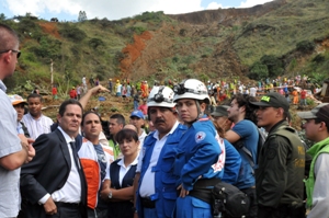
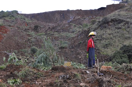
There are few good images of the site that allow interpretation of the process of the slide. The best two that I have seen are these:
Based upon this the landslide looks to have been a moderately deep earthflow type failure, with quite a large run out, suggesting a fairly mobile mass. Unfortunately to date I have not been able to locate the site of the landslide on a map. Has anyone been able to pin this down as yet, as I would like to take a look at the imagery of the topography before the landslide.


 Source
 Source
 Dave Petley is the Vice-Chancellor of the University of Hull in the United Kingdom. His blog provides commentary and analysis of landslide events occurring worldwide, including the landslides themselves, latest research, and conferences and meetings.
The Bello municipal government already has some information on its web page: http://www.municipiodebello.gov.co/ , including contact for the engineers on site. I can’t find where La Gabriela is within Bello via Google Maps, or elsewhere.
Agree with the local office for prevention and emergency of the municipality of Bello (CLOPAD), the movement is an earthflow type landslide, due to the surcharge by bad construction of the heterogeneous fill in the top of the slope, and free flow of waste water from an illegal car wash site. The invernal rains of the last weeks was the trigger.
The land use plan had indicated that this area has a high level of risk for landslides. The link of the information source is http://www.municipiodebello.gov.co/component/content/article/37-noticias-bello/1002-informe-tecnico.html
I’m just speculating, but based on the description in the story, outside of bend on highway from Medellin to Bogata (#60), and barrio La Gabriella in Bello, it looks to be here:
http://maps.google.ca/maps?client=firefox-a&channel=s&hl=en&q=6.322215,-75.545751&ie=UTF8&t=h&z=15
Looks like there are some circular scarps below the highway in the imagery.
some brief aerial views:
http://www.youtube.com/watch?v=Llat1eDyY04&feature=player_embedded#!
some video of the movement from the ground:
http://www.youtube.com/watch?v=PTOg5NUg7ZY&feature=related
[…] the course of the week more information has slowly come to light about the causes and nature of the Bello Landslide in Colombia last weekend. Most helpful is this Youtube video, which provides an […]