
5 March 2010
The Attabad landslide in N. Pakistan – some initial images from my field visit this week
Posted by Dave Petley
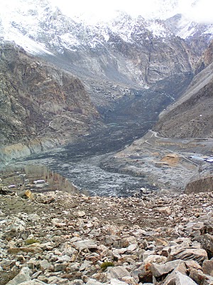
I am now back from my comparatively short but very interesting trip to the Attabad landslide in N. Pakistan. I will make a series of posts about this serious but very interesting landslide over the next few days. As a taster, here a few images of the site. The first image was taken from the top of the 1858 Salmanabad landslide deposit, looking upstream to the Attabad slide. The scar of the landslide is on the left and extends beyond the snowline. The main landslide deposit is on the right, coated with a layer of black clay-silt sediment that was scooped up from the river bed by the slide. In the valley bottom the secondary flow is also visible – this was a mudflow of riverbed sediment that travelled about 1.5 km. Look carefully on the full image (click on the image below to see this) and you will see the ruins of some buildings on the left side of the mudflow, at the junction with the rock cliff. This is the place where the 19 victims of the landslide died, struck by the mudflow:
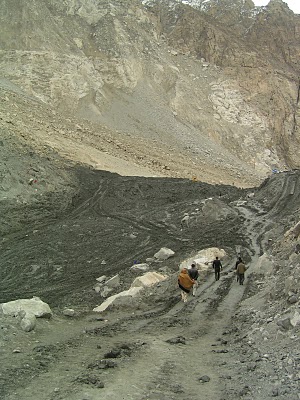
 The image below shows the spillway under construction. At the moment the spillway is still being excavated in the black mudflow deposit, although this will shortly break through to the underlying colluvium. The army are optimistic that the spillway will survive the summer flood – others may have a different opinion…
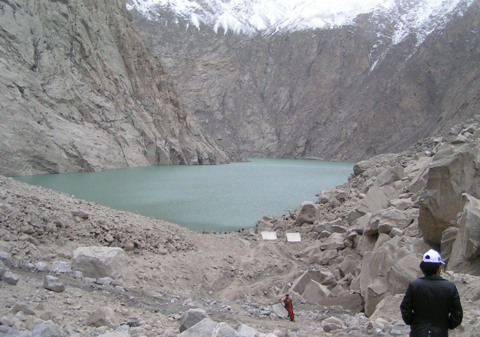
 This final image is a view from the top of the landslide deposit looking upstream. In the foreground is the landslide deposit – note the lack of black clay here. In the background is the lake and, beyond that, the rock walls of the main river valley. If the landslide does survive then a new section of the Karakoram Highway will need to be built through this section. This will take some time.
 More to follow.
 Dave Petley is the Vice-Chancellor of the University of Hull in the United Kingdom. His blog provides commentary and analysis of landslide events occurring worldwide, including the landslides themselves, latest research, and conferences and meetings.
http://www.yoube.com/user/hunzaonlinewww.gbtimes.wordpress.com
Was the original location which you posted in the form of GE images earlier correct? need to put this place on a map.Now since you have visited the site maybe you can help put up info on google.com/mapmaker
can you please confirm the coordinates for this area?