
29 January 2010
New images of the level of destruction in the Cusco area of Peru
Posted by Dave Petley
The Spanish language blog El Caminerito has been covering the magnitude of the rainfall, flood and landslide disaster in Cusco, Peru. They have put together a very helpful map showing the locations of serious damage:
Ver Cusco en Emergencia en un mapa más grande
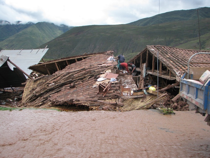
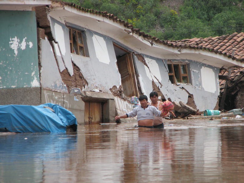
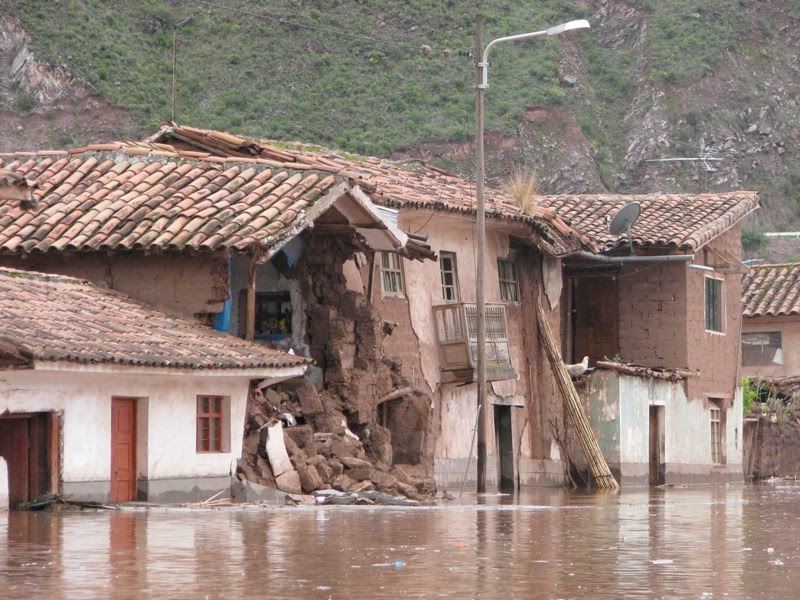
The scale of the disaster, which is still being ignored by the western media in favour of coverage of the tourists at Machu Picchu, is well-illustrated by these images of the Huacarpay region:
Meanwhile, via the Typeboard site, the Spanish language site Peru.com reports that the village of Zurite was severely damaged by a landslide, which sounds to be a debris flow (Google translation):
” the landslide of mud and stones covered the Plaza de Armas, the town’s Church, the main streets of the city and damaged 500 houses. The incident occurred about 3 pm on Thursday after they noticed a crack on a hill and began to take appropriate action, emergency services were able to evacuate the entire population.”
This is the Google Earth imagery of Zurite:
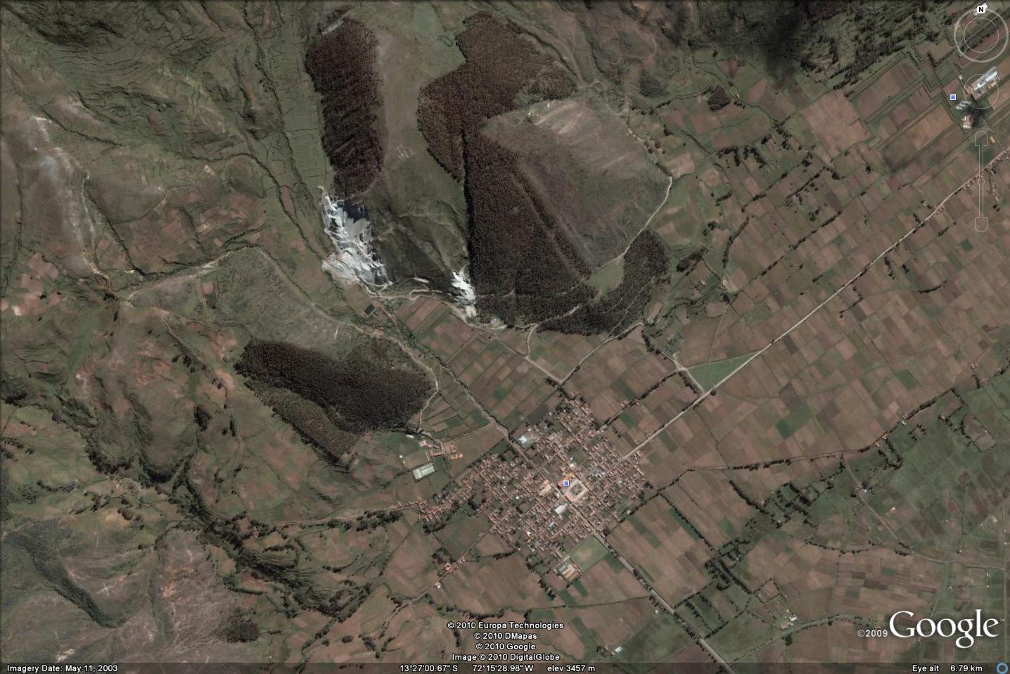
There is no shortage of landslide scars on the hillside above the town, plus the quarries, one of which appears to have excavated out the toe of one of the scars.
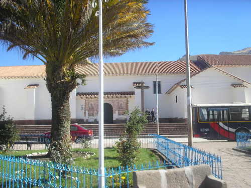
Here is an image of the central square via the Panoramio site:
 Dave Petley is the Vice-Chancellor of the University of Hull in the United Kingdom. His blog provides commentary and analysis of landslide events occurring worldwide, including the landslides themselves, latest research, and conferences and meetings.
Few comments on the event in the Cuzco region based on my field work experiences in the area of Machupicchu. – The level of destruction due to mainly floods is extremely high. Apart from extraordinary flow of the rivers (almost double compare to "normal" rainy season) contributed also high vulnerability of the adobe houses – dried mud bricks which easily absorb water and loose the strength. Adobe houses make no less than 72% of all buildings and in the rural communities (districtos) they make up to 95% of the construction material of the houses. – In some communities (districtos) 22 – 28% (Calca) of all buildings was destroyed and another 45% (Calca district) were damaged. This may represent also lot of buildings which would collapse later.- There are some evidences that the same part of the Urubamba river valley – Calca area, was subject to similar disaster before Spanish arrival causing collapse of local tribes and their overruling by surrounding communities.- Unfortunately, landslides just next to the Machupicchu historical monument claimed two lives showing that placing the tourist camp on old landslide scarp area is not a good idea.- Damage to the railroad bringing tourists to Machupicchu was also much more severe than in preceding rainy season, thus its full operation will claim probably months rather than weeks.If you are interested in some videos of the event go to http://www.sesuvy.cz/?lang=ENG&link;=Aktuality.