
26 September 2008
The Yigong Rock Avalanche, Tibet
Posted by Dave Petley
Occasionally I like to take a look back at a significant landslide. Today I thought I’d write about the amazing Yigong rock avalanche in Tibet. The location of the landslide is shown on Figure 1: it’s location is 30°14′ N, 94°59′ E, located high on the Tibetan Plateau.
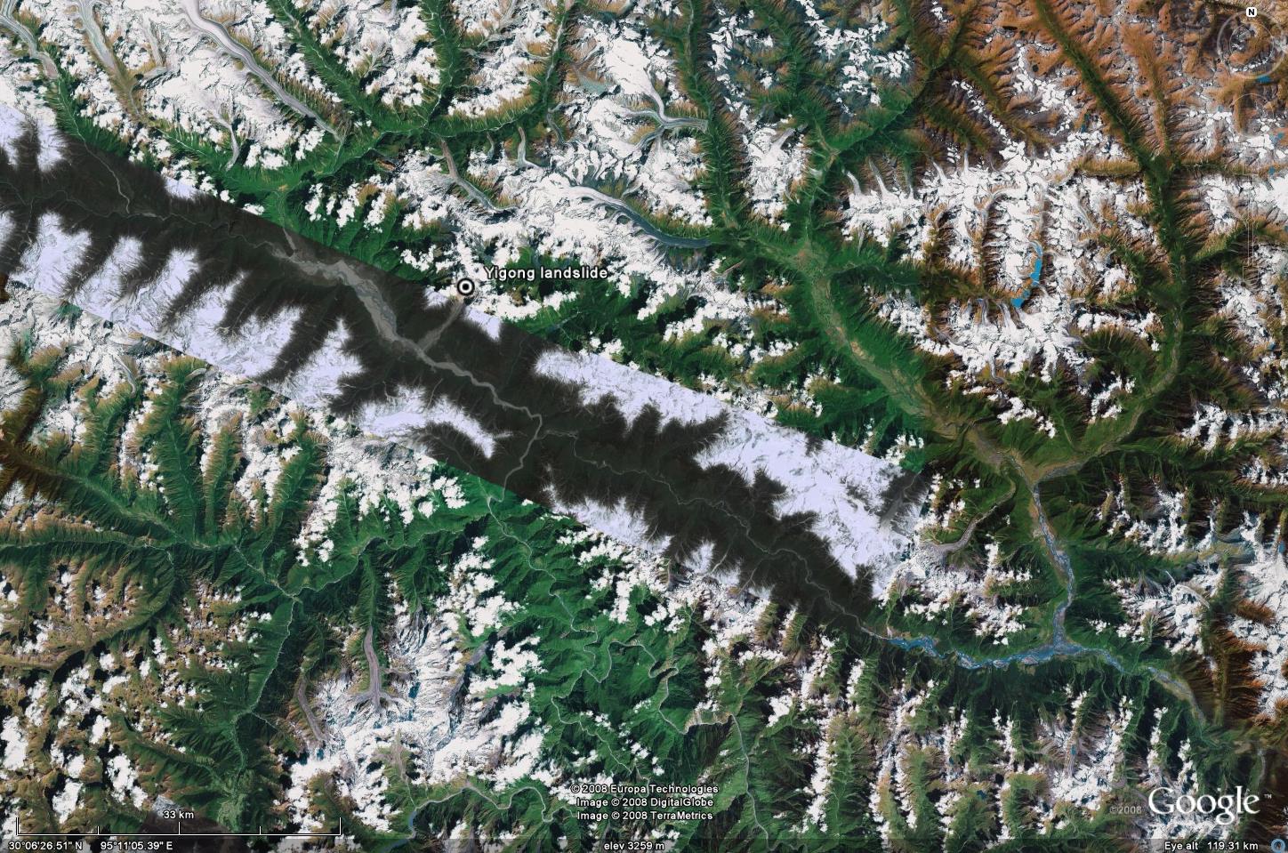 Figure 1: Google Earth image showing the location of the Yigong landslide. Click on the image for a better view.
 The landslide itself occurred at midday (UT) on 9th April 2000, when a wedge failure at about 5,500 m elevation (3,300 m above the valley floor) detached a volume of rock of over 100 million cubic metres.
the landslide occurred in Zhamu Creek. It took only 10 min to travel down a horizontal distance of 8 km through a vertical elevation difference of 3330 m from its source at 5520 m a.s.l. to its sediment fan at 2190 m a.s.l.(Fig. 3). The trigger for the failure is not clear, but no obvious rainfall or seismic event was recorded. The debris travelled down the valley (Fig. 2) at velocities of up to about 14 m/sec (Shang et al. 2003). Over the next 10 minutes the landslide travelled about 10 km, entraining debris, snow and ice as it flowed to generate a deposit with a volume of about 300 million cubic metres. The landslide came to rest on the valley floor at an elevation of 2190 m, blocking the Yigong River to a height of 60 m over a distance of about 1000 m (Fig. 3).
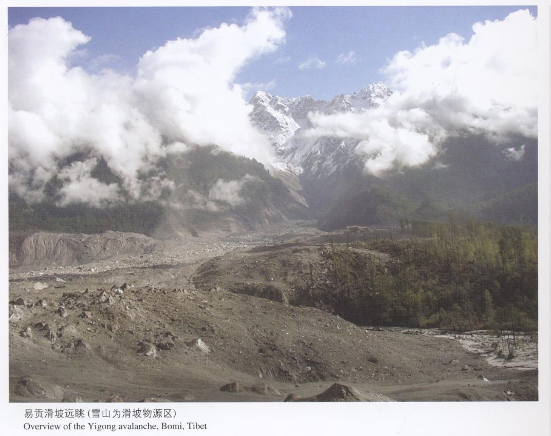 Figure 2: The track of the Yigong landslide. Click on the image for a better view. Image from Yueping, Y. 2008. Landslides in China: selected case studies. China Land Press, Beijing.
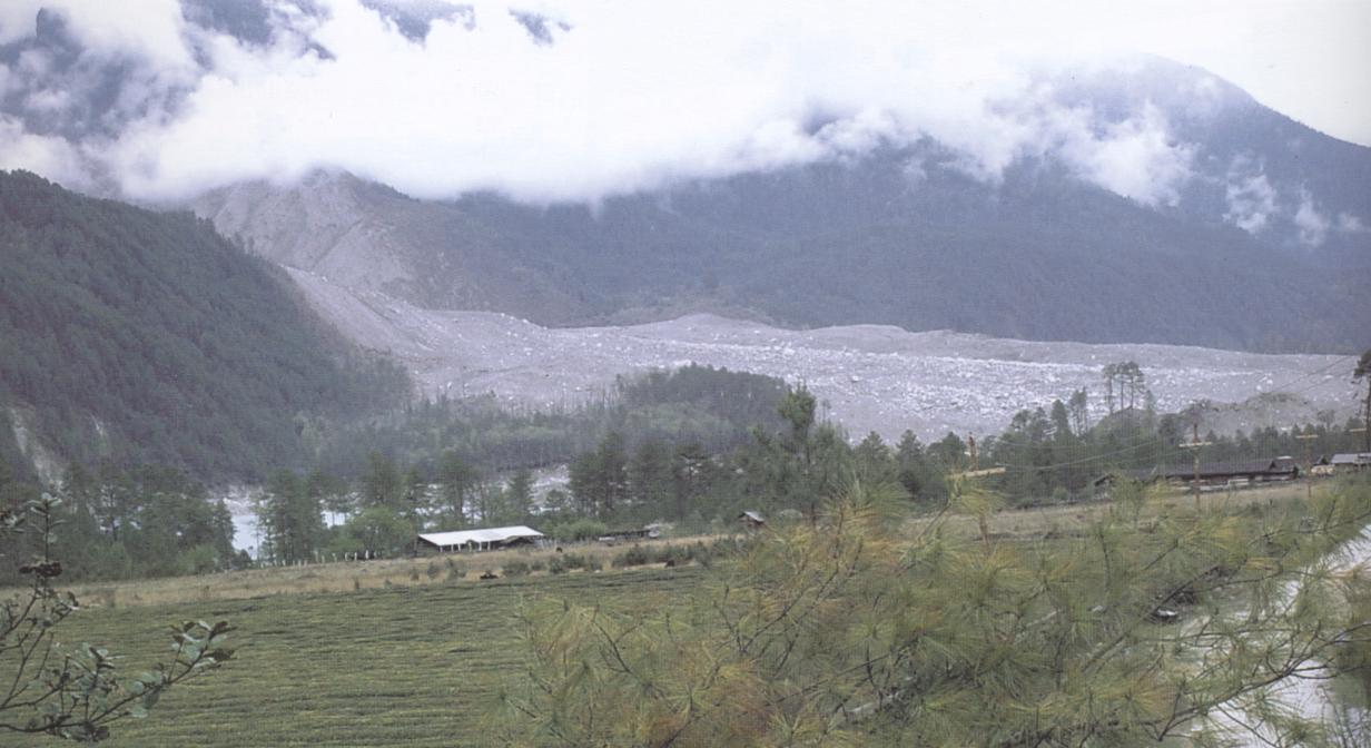 Figure 3: The deposit the Yigong landslide. Click on the image for a better view. Image from Yueping, Y. 2008. Landslides in China: selected case studies. China Land Press, Beijing.
The landslide itself is rather well shown in Google Earth, although unfortunately the source area has a slightly lower resolution than does the track (Figure 4). It is clear that the debris travelled down a comparatively linear tributary valley until the main valley was reached. In the latter stages of the movement the landslide was technically a distal debris flow, essentially meaning that it entrained a large volume of water (from snow and ice). This would have been immensely destructive in an inhabited area, but fortunately the area is sparsely populated.
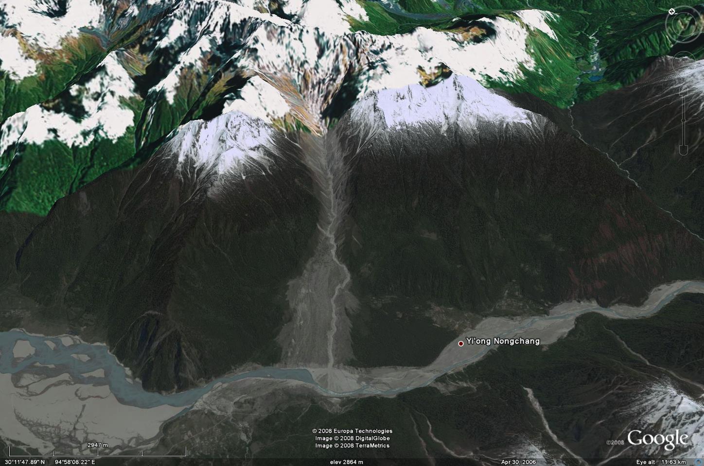 Figure 4: The track the Yigong landslide as shown on Google Earth. Click on the image for a better view.
Of course the landslide did create a major problem in that it blocked the valley. A lake rapidly started to fill, and over the next two months a volume of about 3 billion cubic metres of water accumulated. The authorities sought to mitigate the problem by relocating the 4,000 living in the path of the flood whilst simultaneously constructing a drainage channel across the landslide deposit. This lowered the peak height of the dam to 44 m above the river level. The water broke through the channel on 10th June and the lake drained over a period of two days. 17 km downstream a peak discharge of 120,000 cumecs (cubic metres per second) was recorded, with the river level rising to 32 m above the deck of the bridge across the river. The trimline created by the flood is clearly visible in Fig. 5. The area that had been inundated by the lake is clear on Figure 6.

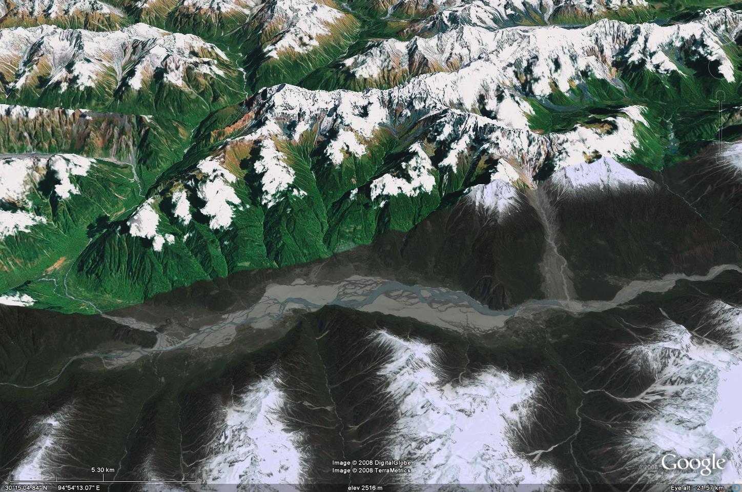 Figure 6: The area inundated by the landslide dammed lake at Yigong shown on Google Earth. Click on the image for a better view.
 The emergency measures were effective in preventing loss of life in Tibet, although there was considerable damage to infrastructure downstream. However, the flood did cause an international incident as the Chinese authorities failed to warn their counterparts in India that the flood was coming. As a result, the people of Arunachal Pradesh were not prepared for the event, leading to about 130 fatalities and 50,000 being rendered homele
ss (Yin and Wang 2005).
Finally, as an aside, the team that successfully built the drainage channel in this case was kept intact after the event and were thus ready to respond to the landslide dams created by the Wenchuan (Sichuan) earthquake this year. Their experience at Yingong was undoubtedly critical in their success in mitigating the major landslide dammed lakes that were created. It appears that their skills continue to be needed.
References:
Shang, Y. et al. 2003. A super-large landslide in Tibet in 2000: background, occurrence, disaster, and origin. Geomorphology. 54 (3-4), 225-243.
Yin, Y. and Wang, S. 2005. Landslide hazard and reduction strategy in China. In: Hungr et al. Landslide Risk Management. Tayor and Francis, 423-6.
Yueping, Y. 2008. Landslides in China: selected case studies. China Land Press, Beijing.
 Dave Petley is the Vice-Chancellor of the University of Hull in the United Kingdom. His blog provides commentary and analysis of landslide events occurring worldwide, including the landslides themselves, latest research, and conferences and meetings.
Hi there
I stumbled across this page while researching this river. I’m currently plotting the course of Frank Kingdon Ward who travelled this area in 1935, one of the first Europeans to do so. He mentions that this river went through a similar event at some point in the 1800s. When I first saw this landslide I thought perhaps this was the one that he mentioned, though in retrospect it looks far too recent on Google Earth, and the story checks out. Just thought you might be curious. Thanks for writing this over 10 years ago…. I imagine you’ll never see this message 😉