
16 May 2008
Updated 16th May (twice): Sichuan Earthquake landslide images
Posted by Dave Petley
I thought a thread showing some news images of landslides triggered by the Sichuan earthquake would be useful. The first image shows vividly the likely impact of landslides in this area.

 AP photo entitled “Buildings are destroyed by landslides following Monday’s powerful magnitude 7.9 earthquake in Beichuan in Mianyang city in southwest China’s Sichuan Province Tuesday, May 13, 2008. A signboard atop the building at left reads: Beichuan Hotel”
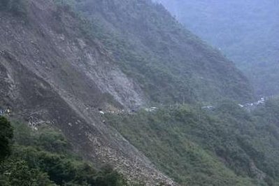
 Xinhua image entitled: An aerial photo taken on May 14 shows the road from Dujiangyan city to Wenchuan County in southwest China’s Sichuan Province is destroyed by landslide caused by Monday’s earthquake. The serious devastation of the road affected the transportation of rescue teams and relief materials to the disaster areas
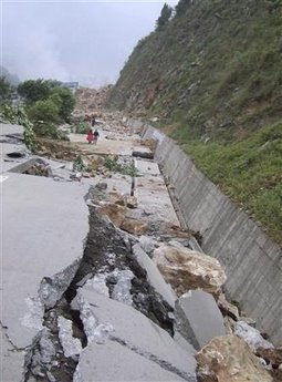 Reuters image entitled: “A damaged highway is seen after an earthquake in Beichuan, Sichuan province May 13, 2008. “
 Xinhua image entitled “An aerial view shows the earthquake-hit town of Yingxiu in Wenchuan County, Sichuan province May 14, 2008”
 Reuters image entitled “Vehicles are stranded on an earthquake-affected highway linking Dujiangyan to Wenchuan, May 15, 2008. China poured more troops into the earthquake-ravaged province of Sichuan on Wednesday to speed up the search for survivors as time ran out for thousands of people buried under rubble and mud.”
 Reuters image entitled “Soldiers use explosives to clear a road leading to an earthquake-hit village in Dujiangyan, Sichuan province, May 14, 2008.”
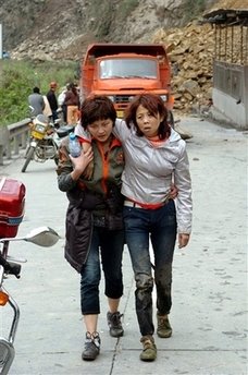 Xinhua image entitled “a volunteer helps a woman walking out of the earthquake-stricken area in Mianzhu city of southwest China’s Sichuan Province, Wednesday, May 14, 2008.”
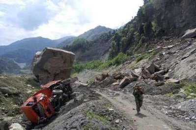 Xinhua image entitled “A soldier from the People’s Liberation Army makes his way to the quake-stricken Yingxiu town of Wenchuan county, Sichuan province, May 14, 2008″
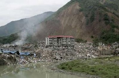 Reuters image entitled: “A genera
l view shows the earthquake-hit Beichuan county, about 160 km (99 miles) northeast of the epicenter of Wenchuan county, Sichuan province, May 14, 2008.”
 Reuters / Stringer image entitled “A local resident walks among the debris of collapsed buildings at the earthquake-hit Beichuan county, about 160 km (99 miles) northeast of the epicentre of Wenchuan county, Sichuan province, May 14, 2008.”
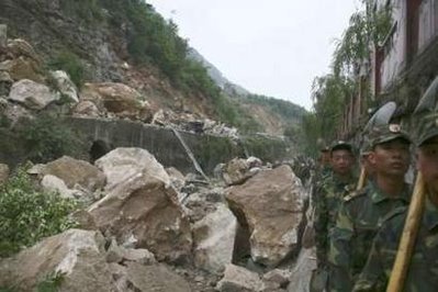 Reuters image entitled “A view of the earthquake-affected Beichuan county, Sichuan province, May 13, 2008.”
 Dave Petley is the Vice-Chancellor of the University of Hull in the United Kingdom. His blog provides commentary and analysis of landslide events occurring worldwide, including the landslides themselves, latest research, and conferences and meetings.
dave,living in one of the most landslide prone areas of the world (Darjeeling hills in India), i shudder when i see these images.these are also visions of hell which is what i have called the savethehills blog on landslides in my part of the world.i hope to hear from u and that we can interact and mutually benefit from each others experienceour blogsitehttp://www.savethehills.blogspot.compraful