October 22, 2021
From Shasta, CA to Adams to Baker, WA to Kokanee, BC to Banff, AB High Glacier Mass Loss in 2021
Posted by Mauri Pelto
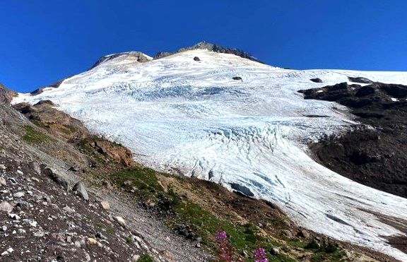
Easton Glacier on Mount Baker in late August 2021, with less than 20% of the glacier retaining snowpack.
The exceptional heat of the summer of 2021 across glaciated mountain ranges of the Pacific Northwest, reduced snowcover extent from Mount Shasta, CA north to Mount Adams and Mount Baker, WA and east to Glacier National Park, MT, Kokanee Glacier, BC and Bonnet Glacier, Alberta. Here we examine late summer images to illustrate the extent of exposed bare ice and firn across glaciers in the region. For a glacier to be in equilibrium requires at least 50% to be in the accumulation zone, snow covered at the end of the summer. At the end of the summer the snowcovered area varied from 0-20% on all of the glaciers reviewed here, the snowcovered area is the accumulation area ratio. Low accumulation area ratios such as this indicate mass loss of at least 2 m w.e. in 2021 on these glaciers. That is the equivalent of losing a 2 m thick slide of ice off the surface of the entire glacier.
When there is a persistent pattern of snowcover loss on the upper part of the glacier this indicates the lack of a consistent accumulation zone indicating the glacier cannot survive (Pelto, 2010). One indicator of this is new bedrock being exposed on the upper glacier as seen on both Easton and Bonnet Glacier here.
As the winter season begins hopefully a La Nina pattern will deliver much needed deep snowpacks.
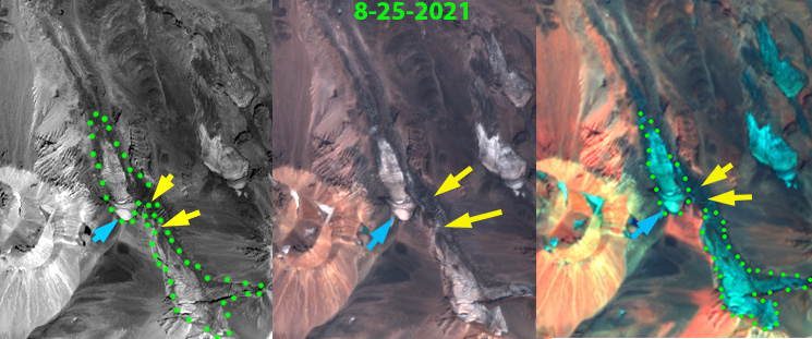
Sentinel 2 False and True Color images from 8-25-2021. Yellow arrows indicate where glacier is separating and blue arrows the small remanent of 2021 snowpack remaining. This remanent will not last to the end of the melt season.
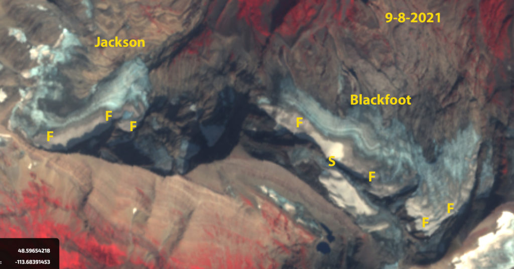
Jackson and Blackfoot Glacier in early September Sentinel 2 false color images. Point A indicates exposed ice showing annual layers. Point B indicates exposed firn that had been retained through previous summers. The gray color of the firn indicates how dirty it is and that its albedo would enhance melting.
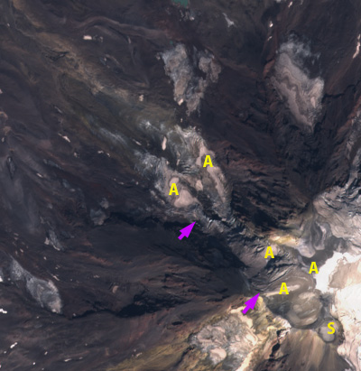
Adams Glacier on Mount Adams in Sentinel 2 True Color image from 8-30-2021. Pink arrows indicate icefall top and bottom. S=summit area, A=Areas where limited pockets of 2021 snowpack has been retained through August.
 The upper reaches of Kokanee Glacier to Cond Peak (2800 m) with no retained snow in 2021. Bare ice is exposed on the lower half of the image, and firn, or multi-year snow above. Picture taken during fieldwork by Ben Pelto.

Bonnet Glacier in Sentinel 2 images indicating the emergence of bedrock due to thinning in the former accumulation zone, Point A. Note the lack of retained snowcover in both years with at least a month left in the melt season.


 Dean of Academic Affairs at Nichols College and Professor of Environmental Science at Nichols College in Massachusetts since 1989. Glaciologist directing the North Cascade Glacier Climate Project since 1984. This project monitors the mass balance and behavior of more glaciers than any other in North America.