September 7, 2021
Adams Glacier, Washington 50% area loss since 1998, No retained Snow in 2021
Posted by Mauri Pelto
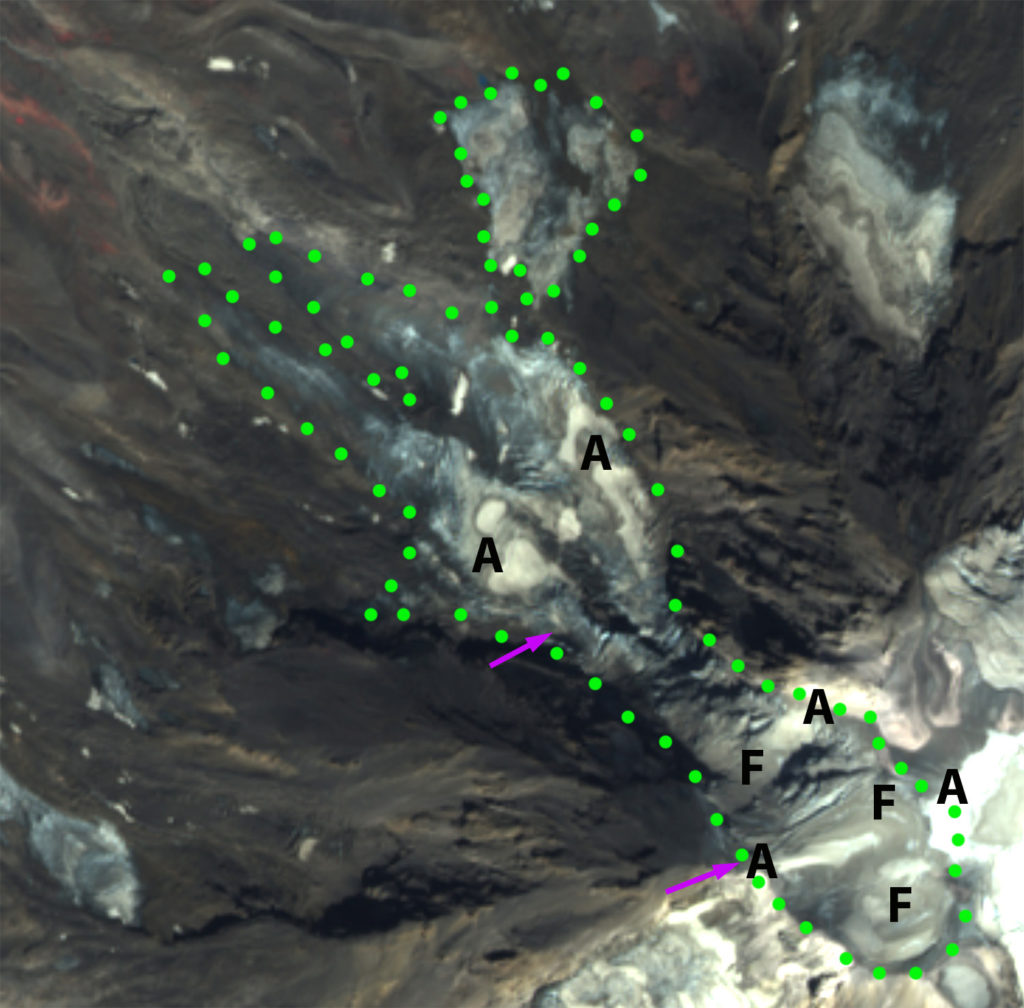
Adams Glacier in Sentinel 2 False Color image from 8-30-2021. Green dots indicate margin of the Adams Glacier and the now separated Adams Outlier section. The pink arrows indicate the top and bottom of the icefall. F=regions of exposed firn, A=areas of perennial retained accumulation.
Adams Glacier descends the north side of Mount Adams a 3743 m stratovolcano in the Cascade Range of Washington. The glacier begins from the summit plateau between 3600 m and 3700 m, before descending a steep icefall down to 2750 m and then diverging on lower slopes terminating at 2225 m. Sittts et al (2010) mapped the area change of Mount Adams glaciers from 1904 to 2006. The area was 6.93 km2 in 1904 declining to 5.16 km2 by 1969, 4.62 km2 by 1998, and 3.68 km2 in 2006. This decline since 1969 has been due largely to increased summer temperatures (Sittts et al 2010) . Here we examine the impact of the particularly warm summer of 2021 on snowpack, glacier volume and reassess the area of the glacier. The winter of 2021 had above average snowfall with 157% of the mean peak winter snowpack in April at the nearest Snotel site at Potato Hill ( 1375 m), the snowpack loss date after a dry May was the same as usual, see figure below. The mean June-August temperature at the Mount Adams Ranger Station (600 m) was the second warmest for the 1984-2021 period to 2015.
Snowpack loss from June 21 to August 25 in Sentinel images. AO=Adams Outlier, T=Terminsu Zone, I=Icefall, S= bergshrunds on upper glacier.
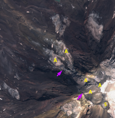
On June 21, 2021 nearly the entire glacier is snowcovered, which is typical. By July 1, 2021 areas of the glacier below the icefall are rapidly losing snowcover. By August 15, 50% of the glacier has retained 2021 snowcover. This rapidly diminishes to ~10% by Aug. 25, 2021. On Aug. 30, 2021 there are large areas above 10000 feet that typically retain snowcover to the end of the summer that have lost all snowcover and are particularly dirty firn, snow that fell in recent years but has not been converted to glacier ice. The retained snowcover is in five patches, the lower three are all avalanche runout zones and the upper two regions, above the icefall, of wind drift redeposition.
Adams Glacier in Sentinel 2 True Color image from 8-30-2021. Pink arrows indicate icefall top and bottom. S=summit area, A=Areas where limited pockets of 2021 snowpack has been retained through August.
Similar to Whitney Glacier on Mount Shasta , Adams Glacier will not retain snowcover in 2021. The early exposure of bare firn and ice, which melt at a faster rate than snow is causing rapid mass losses on the upper glacier this summer, as we have reported from Easton Glacier on Mount Baker. The current area of the main glacier is 1.9 km2, with the outlier have an area of 0.3 km2. The combined area of 2.2 km2 is less than 50% of the 1998 total. The loss of snowpack from the Adams Glacier is greater than in any year since 1984, exceeding 2015. The winter of 2015 had less snowfall and the mean summer temperature was warmer. The key difference is likely the excessive melt of the late June 2021 heat wave that is particularly impactful early in summer. Finn et al (2017) noted that the upper reaches of Adams Glacier ranged from ~25 to 60 m thick, while lower down on the volcano are the glacier is less than<~30m thick. This summer mass losses will be in the 2-3 m range on Adams Glacier, based on the duration of exposed ice and percentage of the glacier in the accumulation zone. This will represent a 5-10% volume loss for this glacier in 2021.
Snowpack at Potato Hill (1375 m) a Snotel site. The 2021 winter had above average peak snowpack (black line), but typical melt out date.


 Dean of Academic Affairs at Nichols College and Professor of Environmental Science at Nichols College in Massachusetts since 1989. Glaciologist directing the North Cascade Glacier Climate Project since 1984. This project monitors the mass balance and behavior of more glaciers than any other in North America.
I live in goldendale and have been very concerned of the snow and ice melt on Mt Adams i look at it everyday and all the brown up there now is alarming are we looking at a eruption soon
The volcano is not active so nothing alarming. The snow melt this summer exposed considerably more bare ice and rock than normal.