
3 July 2014
Bell Canyon’s Permian submarine landslide
Posted by Callan Bentley
What are these Border to Beltway students up to?…
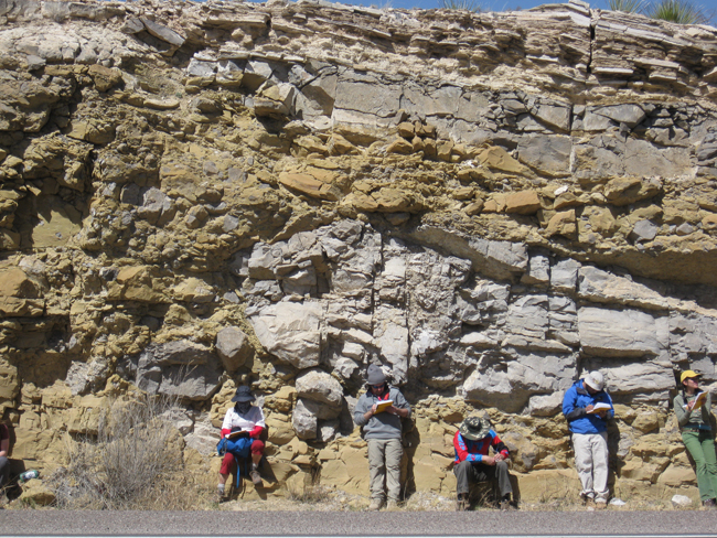
Clearly, they are all immersed in their field notebooks, sketching away. This was in March, in west Texas.
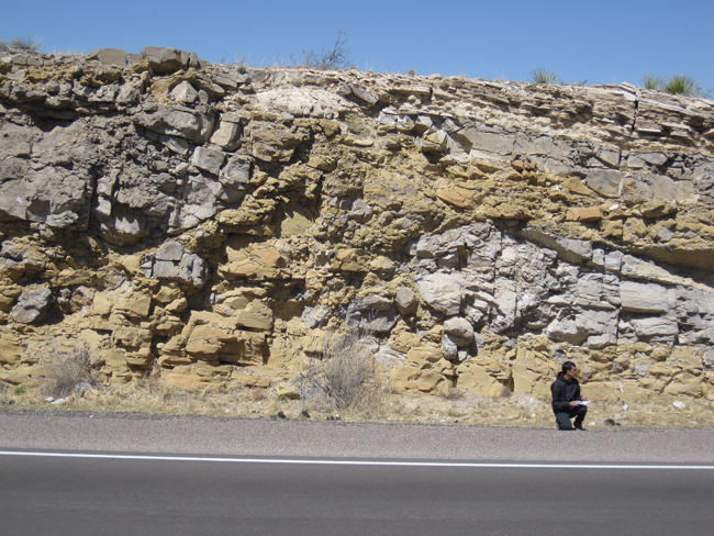
There must be something worth drawing at this road cut…
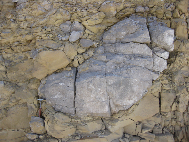
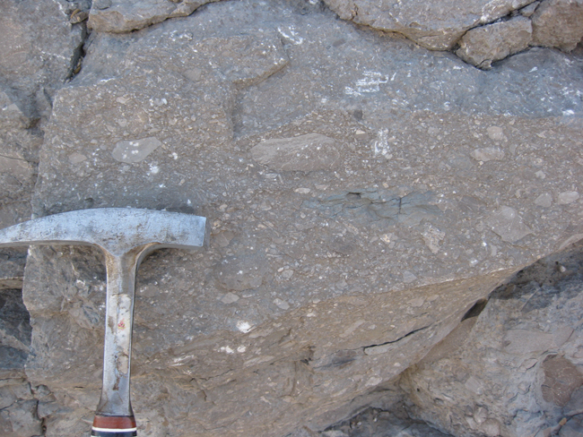
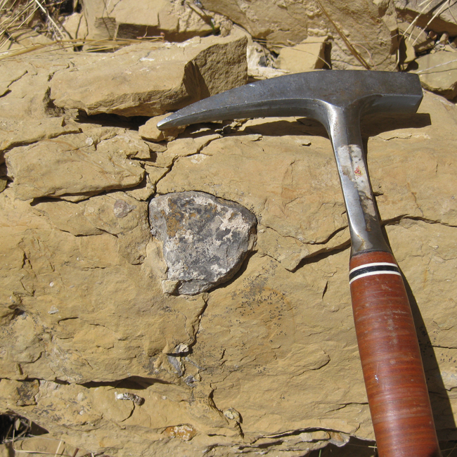
A clue can be seen on the wall of rock behind them. There, you can find features such as this:
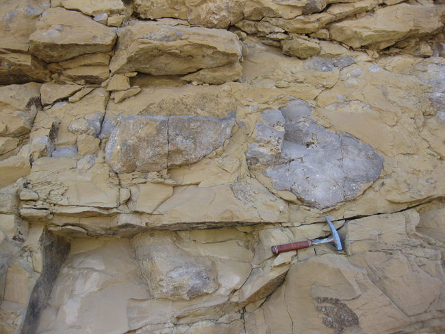
And this:
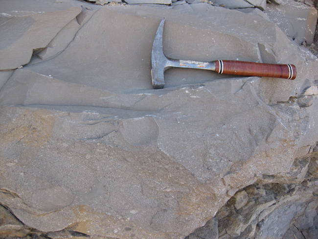
And this:
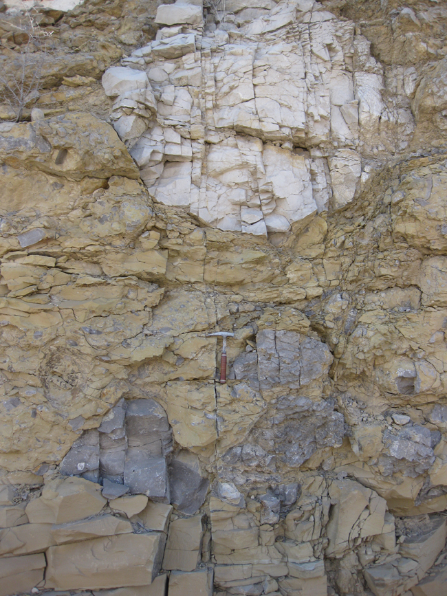
Those are outsized clasts of gray limestone in fine-grained tan limestone. …An interesting mixture! How could such a mixing occur? Perhaps the outcrop has some more clues to share, something to inform our thinking before we rendered an interpretation…
So we asked the students to sketch out what they observed, at several scales, before we began to discuss it.
The clast-rich unit was overlain by a graded bed of limestone “breccia”…
Which fined upward…
And got finer and finer, but still part of one massive bed…
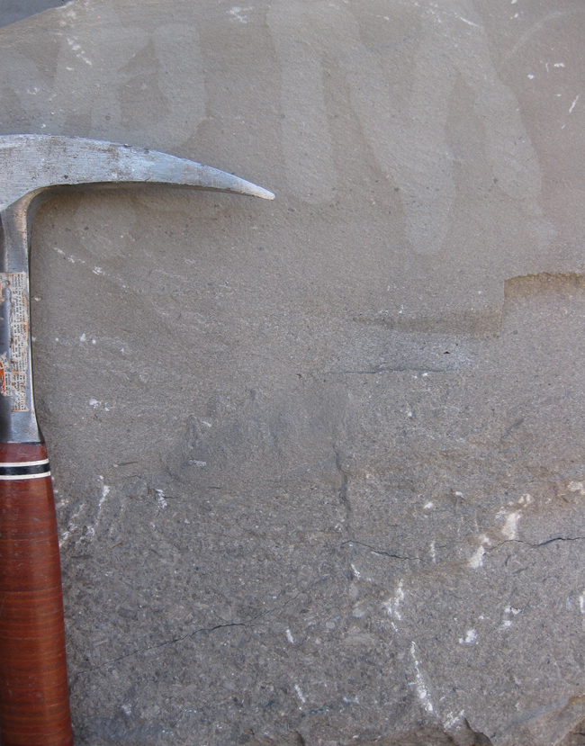
And then that massive bed was overlain by alternating layers of shaly limestone and ~2″ thick limestone beds:
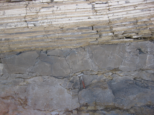
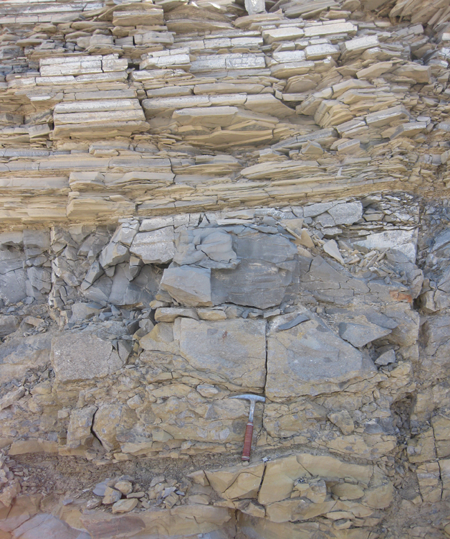
We interpreted this ensemble, which was in the deep water basin seaward of the forereef of the Permian reef complex which sees expression in the Guadalupe Mountains a few miles to the north, as a massive submarine landslide, bringing big blocks of reef material avalanching down into the deep, where the big chunks were included in unlithified carbonate mud.
Thus, something as innocent looking as this…
…can imply a massive, chaotic, underwater catastrophe in the ancient past.
This is why I love geology – acquiring the ability to read the clues allows one to deduce fascinating stories about the otherwise inaccessible past.
 Callan Bentley is Associate Professor of Geology at Piedmont Virginia Community College in Charlottesville, Virginia. He is a Fellow of the Geological Society of America. For his work on this blog, the National Association of Geoscience Teachers recognized him with the James Shea Award. He has also won the Outstanding Faculty Award from the State Council on Higher Education in Virginia, and the Biggs Award for Excellence in Geoscience Teaching from the Geoscience Education Division of the Geological Society of America. In previous years, Callan served as a contributing editor at EARTH magazine, President of the Geological Society of Washington and President the Geo2YC division of NAGT.