22 February 2014
Mount La Perouse: Sunday’s rock avalanche in Alaska has been found
Posted by Dave Petley
The Mount La Perouse Rock avalanche: background
Earlier this week I posted the initial results of the tool developed by Goran Ekstrom and Colin Stark, which indicated that a rock avalanche had occurred in Alaska on Sunday. We were waiting for Landsat 8 to collect imagery today in the hope of locating it. However, yesterday pilot Drake Olson found it on the flank of Mount La Perouse. Marten Geertsema has generously acted as the conduit of information about the landslide, and Drake has very kindly provided some photographs of the landslide too. Two satellite passes are due this weekend, so hopefully we’ll get some images from that source too.
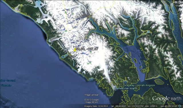
The approximate location from the seismic data
The seismic data indicated that the landslide was located somewhere is the region of coordinates 58.68, -137.37,which is this area of Alaska. Interestingly, this is within 10 km of the Mount Lituya rock avalanche of two years ago:
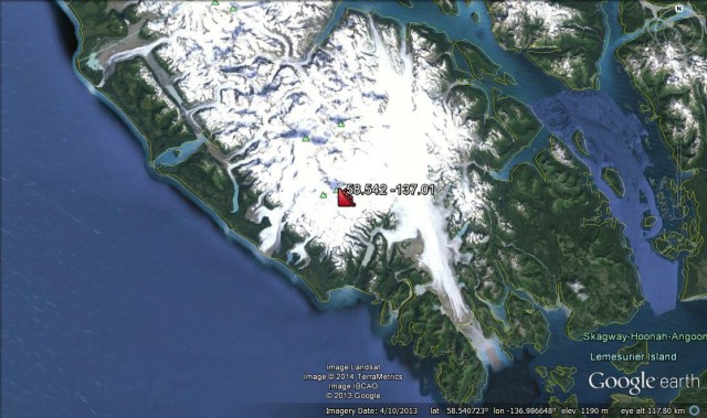
Drake Olson and the location of the Mount La Perouse landslide
Today helicopter pilot Drake Olson spotted the landslide. It is on the flank of Mount La Perouse at about 58.542 -137.01:
..
First information and images of the Mount La Perouse rock avalanche
This is a big landslide. It appears that a near vertical wall of the mountain has collapsed and then turned into a rock avalanche that has entrained snow and ice. The run out distance is about 4.8 km. The collapse occurred at about 3000 m elevation; unfortunately this is above the snow line, so the landslide has already started to be covered by snow. With thanks to Drake Olson, this is the source:
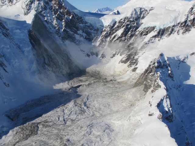
Copyright Drake Olson
..
So it is clear that a near-vertical wall on the flank of the mountain collapsed. Note the clear runup on the other side of the corrie, after which the landslide has flowed downslope. The initial part of the track has a quite low gradient, after which it has flowed down a steeper slope. This is the track:
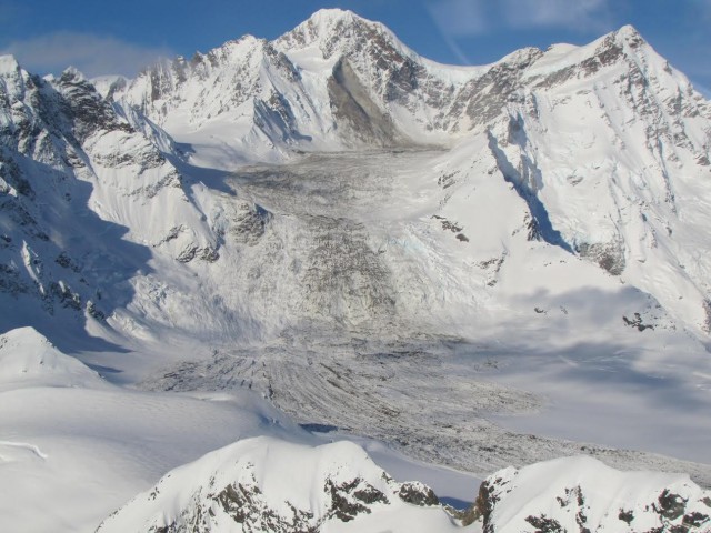
Copyright Drake Olson – used with permission
..
At the toe the landslide has spread out. This image shows the toe of the landslide with some quite beautiful flow lines:
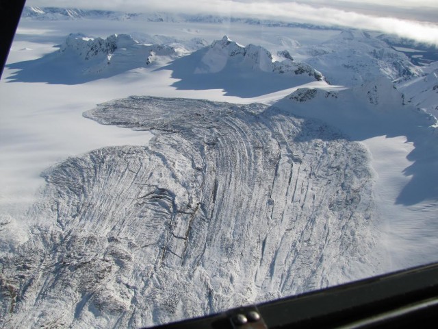
Copyright Drake Olson. Used with permission.
..
These wonderful images perhaps don’t give a feel for the thickness of the deposit, which is up to about 13 m. Drake even landed at the toe of the landslide to get a feel for the constituent materials. This image shows that they consist of ice and rock, suggesting that the landslide has entrained a large amount of snow and ice as it travelled downslope:
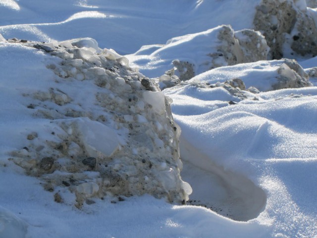
Copyright Drake Olson – used with permission
..
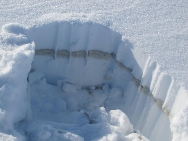
Unfortuantely the landslide will disappear beneath snow very quickly. Already there is a few centimetres of fresh snow on it – this is the dust layer generated by the landslide, with fresh snow on the surface:
Copyright Drake Olson – used with permission
..
I must thank Drake Olson for both locating the landslide and for providing the images; Marten Geertsema for forwarding the information to me; and Colin Stark, Goran Ekstrom and Clément Hibert for spotting this in the first place and for allowing me to break the news about it.


 Dave Petley is the Vice-Chancellor of the University of Hull in the United Kingdom. His blog provides commentary and analysis of landslide events occurring worldwide, including the landslides themselves, latest research, and conferences and meetings.